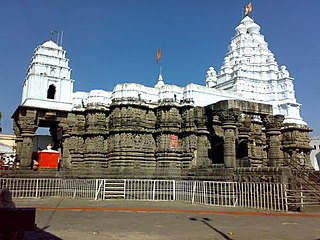
Hingoli district is an administrative district in the state of Maharashtra in India. The district is headquartered at Hingoli. The district occupies an area of 4,526 km2 and has a population of 11,77,345 of which 15.60% were urban. Hingoli was actually known as the Nizams military base as it was bordered with Vidharbha. In that era military troops, hospitals, veterinary hospital were in operation from Hingoli. Being a military base the city was one of the important and famous places of the Hyderabad state. One of the twelve Jyotirlinga shrines, the Aundha Nagnath is located in Hingoli district about 25 km south-west from district headquarter.

Osmanabad District officially known as Dharashiv District is an administrative district in the Marathwada region in the Indian state of Maharashtra. The district headquarter is located at Osmanabad. The District of Osmanabad derives its name from the last ruler of Hyderabad, the 7th Nizam, Mir Osman Ali Khan, of which the region was a part till 1947. This region was earlier part of The Hyderabad State until Independence.This primarily rural district occupies an area of 7,569 km2 (2,922 sq mi) of which 241.4 km2 (93.2 sq mi) is urban and has a population of 1,657,576 of which 16.96% were urban.
Malshiras is a town and the headquarters of Malshiras taluka in Solapur district of Maharashtra state in western India. Its governing body is promoted to Nagar Panchayat from a Gram Panchayat in 2017. There are many popular towns in Malshiras taluka such as Akluj, Natepute, Mahalung, Malinagar, Velapur and popular Villages like Rajapur (Islampur) Goradwadi, Bhamburdi, Medad and Palasmandal. Rajapur (Islampur) is adjacent to Malshiras which has good literacy rate and having historic samadhi mandir of Veer Santaji Ghorpade.

Sangli district is a district of Maharashtra state in India. Sangli city is the district headquarters. It is bordered by Satara district, Solapur district to the North, Karnataka state to the South-East, by Kolhapur district to South-West and by narrow portion on the East side to Ratnagiri district. It is present on the southern tip of Maharashtra.
Akkalkot is a City and a municipal council in Solapur district in the Indian state of Maharashtra. It is situated 38 km southeast of Solapur and close to the border of Karnataka state.

Solapur District is a district in Maharashtra state of India. The city of Solapur is the district headquarters. It is located on the south east edge of the state and lies entirely in the Bhima and Seena basins. The entire district is drained by the Bhima River.
Khatav is a town and taluka located in the Man-Khatav subdivision of the Satara district, India.
Kalamb is one of eight tehsils in the Osmanabad district in the state of Maharashtra, India. Headquarters for the tehsil is the town of Kalamb. There are ninety-one panchayat villages in the Kalamb Tehsil.
Madha is a city in the municipal council of Madha Taluka, in Solapur district in the Indian state of Maharashtra. It belongs to Solapur Division. It is located 70 km towards North-West from district headquarters Solapur. Madha is also known for the Madheshawari temple, situated near Mankarna river. The historic temple of Lord Vitthal is in Madha City. Madha Fort built by Raje Nimbalkar is a big attraction in the city.
Maharashtra State Highway 151, commonly referred to as SH 151, is a state highway that runs south through Solapur district in the state of Maharashtra. This state highway touches the cities of Barshi – Vairag – Solapur – Akkalkot and then proceeds south towards Maharashtra-Karnataka state border.
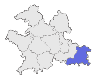
Solapur South Taluka is one of the 11 tehsils of Solapur District in the Indian state of Maharashtra. This tehsil is located in the southeastern side of district and is bordered by Osmanabad District to the northeast, North Solapur and Mohol Taluka to the north, Akkalkot Taluka to the southeast, Karnataka's Kalaburagi district to the south, and Mangalvedhe Taluka to the west. The tehsil headquarters is located at Solapur, which is also the district headquarters and its largest city. Mandrup, Kumbhari, Valasang, Musti and Boramani are the biggest villages in south Solapur.
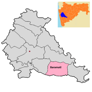
Baramati taluka is a taluka in Baramati subdivision of Pune district of state of Maharashtra in India.

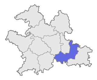
Barshi Taluka is one of the 11 tehsils of Solapur District in the Indian state of Maharashtra. This tehsil occupies the Northeast corner of the district and is bordered by Osmanabad District to the north and east, Madha Taluka to the west, Mohol Taluka to the southwest and North Solapur Taluka to the south. The tehsil headquarters is located at Barshi, which is also the largest city in the tehsil.
Madha Taluka is one of the 11 tehsils of Solapur District in the Indian state of Maharashtra.

Karmala Taluka is one of the 11 talukas of Solapur district in the Indian state of Maharashtra. Parts of the movie Sairat were shot in this taluka. Its headquarters are in the town of Karmala.
Sangola is one of the 288 Vidhan Sabha constituencies of Maharashtra state, western India. This constituency is located in Solapur district. The constituency is not reserved constituency. It is a part of Madha Lok Sabha constituency along with five other Vidhan Sabha segments, namely Madha, Karmala and Malshiras in Solapur district and Phaltan and Man in Satara district.
Solapur South Assembly constituency (251) is one of the 288 Vidhan Sabha constituencies of Maharashtra state, western India. This constituency is located in Solapur district.
Solapur City Central Assembly constituency (249) is one of the 288 Vidhan Sabha constituencies of Maharashtra state, western India. This constituency is located in Solapur district, of which Solapur city is the district headquarters, and is part of Solapur.