Northaven, Tennessee

Last updated
Northaven sign Northaven Shelby County TN 002.jpg
Northaven sign

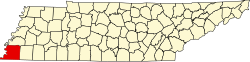
Northaven is an unincorporated community located in north Shelby County, Tennessee, United States, that is a part of the Memphis metropolitan area. Tennessee State Route 388 connects Northaven with Frayser and Shelby Forest. The Mississippi River Trail runs through the neighborhood.[ citation needed ]

Contents

Geography

Northaven boundaries are the Mississippi River in the west, Millington and Memphis in the north, Raleigh in the east, the Wolf River and Frayser in the south.

Education

Northaven Elementary School, which is part of the Shelby County School System serves the community. [1]

Notable people

Related Research Articles

<span class="mw-page-title-main">Shelby County, Tennessee</span> County in Tennessee, United States

Shelby County is the westernmost county in the U.S. state of Tennessee. As of the 2020 census, the population was 929,744. It is the largest of the state's 95 counties, both in terms of population and geographic area. Its county seat is Memphis, a port on the Mississippi River and the second most populous city in Tennessee. The county was named for Governor Isaac Shelby (1750–1826) of Kentucky. It is one of only two remaining counties in Tennessee with a majority African American population, along with Haywood County.

<span class="mw-page-title-main">Hardin County, Tennessee</span> County in Tennessee, United States

Hardin County is a county located in the U.S. state of Tennessee. As of the 2020 census, the population was 26,831. The county seat is Savannah. Hardin County is located north of and along the borders of Mississippi and Alabama. The county was founded in November 1819 and named posthumously for Col. Joseph Hardin, a Revolutionary War soldier and a legislative representative for the Province of North Carolina; the State of Franklin; and the Southwest Territory. Hardin County was the site of the Battle of Shiloh during the Civil War.

<span class="mw-page-title-main">Fayette County, Tennessee</span> County in Tennessee, United States

Fayette County is a county located in the U.S. state of Tennessee. As of the 2020 census, the population was 41,990. Its county seat is Somerville. The county was named after the Marquis de la Fayette, French hero of the American Revolution. A part of the Memphis, TN-MS-AR Metropolitan Statistical Area, Fayette County is culturally alike to the Mississippi Delta and was a major area of cotton plantations dependent on slave labor in the nineteenth century.

<span class="mw-page-title-main">Atoka, Tennessee</span> Town

Atoka is a local government area with a town charter in Tipton County, Tennessee, United States. In 1888, Atoka was a stop on the Newport News & Mississippi Valley Railroad. Today the City of New Orleans Amtrak passenger train makes its daily route between New Orleans and Chicago, through Atoka. The population was 10,008 at the 2020 census, making the Town of Atoka the largest municipality in Tipton County.

<span class="mw-page-title-main">Wolf River (Tennessee)</span> Water course in Mississippi and Tennessee, United States

The Wolf River is a 105-mile-long (169 km) alluvial river in western Tennessee and northern Mississippi, whose confluence with the Mississippi River was the site of various Chickasaw, French, Spanish and American communities that eventually became Memphis, Tennessee. It is estimated to be about 12,000 years old, formed by Midwestern glacier runoff carving into the region's soft alluvial soil. It should not be confused with The Wolf River which flows primarily in Middle Tennessee and southern Kentucky. The Wolf River rises in the Holly Springs National Forest at Baker's Pond in Benton County, Mississippi, and flows northwest into Tennessee, before entering the Mississippi River north of downtown Memphis.

Southwest Tennessee Community College is a public community college in Memphis, Tennessee. As the product of a merger between two colleges in 2000, the school has two campuses in Memphis and several satellite centers. It is operated by the Tennessee Board of Regents.

<span class="mw-page-title-main">Loosahatchie River</span> River in Tennessee, United States

The Loosahatchie River is a 64.0-mile-long (103.0 km) stream in southwestern Tennessee. Except for a few miles near its head, its mouth, and near the middle of its length, it has been entirely channelized, as have its major tributaries, for agriculture purposes. Its drainage basin was once the site of extensive cotton plantings, which have been greatly diminished in recent decades by extensive urbanization of the area.

<span class="mw-page-title-main">Downtown Memphis, Tennessee</span>

Downtown Memphis, Tennessee is the central business district of Memphis, Tennessee and is located along the Mississippi River between Interstate 40 to the north, Interstate 55 to the south and I-240 to the east, where it abuts Midtown Memphis.

<span class="mw-page-title-main">Frayser, Memphis</span> Neighborhood in Memphis, Tennessee, United States

Frayser is a neighborhood on the northside of Memphis, Tennessee, United States. It is named after Memphis physician Dr. J Frayser, who owned a summer home near the railroad. Frayser's boundaries are the Wolf River to the south, the Mississippi River to the west, the Loosahatchie River to the north, and ICRR tracks to the east. The population of Frayser is 45,000.

Raleigh is a community in north-central Memphis, Tennessee, United States, named for a formerly incorporated town that used to be at its center. Raleigh is bordered on the west by the community of Frayser, on the east by the incorporated suburb of Bartlett, on the south by the Wolf River and Interstate 40, and on the north by the Memphis city limits. The former town of Raleigh was the first county seat of Shelby County, Tennessee.

<span class="mw-page-title-main">North Memphis, Memphis, Tennessee</span> Place in Tennessee, United States

North Memphis is one of the five defined districts of Memphis, Tennessee. It includes smaller neighborhoods such as Klondike, New Chicago, Douglass, Hyde Park, Hollywood, Nutbush, Binghampton, Smokey City, Scutterfeld, Frayser, and Raleigh.

<span class="mw-page-title-main">Geography of Memphis, Tennessee</span>

The City of Memphis is located on the eastern bank of the Mississippi River in the southwest corner of the U.S. state of Tennessee. It is the regional hub for a tri-state area of Arkansas, Mississippi and Tennessee.

<span class="mw-page-title-main">Cordova, Tennessee</span> Community in Tennessee, United States

Cordova is a community in Shelby County, Tennessee, United States. Cordova lies east of Memphis, north of Germantown, south of Bartlett, and northwest of Collierville at an elevation of 361 feet.

Shelby Forest is an unincorporated community in Shelby County, Tennessee, United States. The area is located roughly twelve miles north of Downtown Memphis, just west of the Millington area and eight miles (13 km) north of Frayser. The area includes the former communities of Benjestown, Locke, Cuba, and Woodstock each previously maintaining their own post office.

<span class="mw-page-title-main">History of Randolph, Tennessee</span> Aspect of history

Randolph is an unincorporated rural community in Tipton County, Tennessee, United States, located on the banks of the Mississippi River. The lands of the Mississippi River Basin were inhabited by Paleo-Indians and later Native American tribes of the Mississippian culture for thousands of years. The Tipton phase people and the Chickasaw Indian tribe populated the Mississippi River valley near Randolph during the Mississippian period. In 1541, Spanish explorer Hernando de Soto crossed the Mississippi River at or near Randolph. French explorer Cavelier de La Salle built the first French fortification at or near Randolph on his 1682 canoe expedition of the Mississippi River.

<span class="mw-page-title-main">Fort Assumption</span> 18th century French military base in present day Tennessee

Fort Assumption was a French fortification constructed in 1739 on the fourth Chickasaw Bluff on the Mississippi River in Shelby County, present day Memphis, Tennessee. The fort was used as a base against the Chickasaw in the unsuccessful Indian-removal Campaign of 1739.

<span class="mw-page-title-main">Tennessee State Route 388</span> State highway in Tennessee, United States

State Route 388 (SR 388) is a four-lane divided highway in Shelby County, Tennessee. The route connects the Frayser neighborhood of Memphis with Northaven and Shelby Forest. The entire route is known locally as North Watkins Street.

Westwood is a neighborhood in southern Memphis, Tennessee, United States, west of Whitehaven. The neighborhood is home to recreational facilities, businesses, schools and churches; including the more than 4,000 member Mt. Vernon Baptist Church. Westwood, Charles Powell Community Center, Westwood Shopping Center, Freedom Preparatory Academy-Westwood Elementary and Westwood High School are focal-points of the community. Double Tree Montessori School is west of Weaver Road and south of Western Park Drive.

<span class="mw-page-title-main">Mississippi River Trail</span> Long-distance bicycle route

The Mississippi River Trail is a designated bicycle and pedestrian trail that traverses the shores of the Mississippi River in the United States. The trail extends from the headwaters at Lake Itasca in Minnesota to near the mouth of the river in Venice, Louisiana. Much of the trail’s 3,000 miles (4,800 km) follows roadways used by motor vehicles, although some of the route is on multi-use trails. The segment in Minnesota has been designated as U.S. Bicycle Route 45, part of the U.S. Bicycle Route System.

Memphis, Tennessee serves as the Southern headquarters for Tennessee based street organizations in the Southern United States. In 2021, there were approximately 102 gangs with 13,400 gang members in the city.

References

  1. "Northaven Elementary / Homepage". 20 December 2019. Retrieved 2021-05-05.

35°16′01″N90°02′53″W / 35.26694°N 90.04806°W / 35.26694; -90.04806