Northwest, Spokane

Last updated
Northwest
Northwest Spokane Street Scene.png
Residential street scene in Northwest
Northwestcropped.png
Location of Northwest in Spokane
Coordinates: 47°42′30″N117°27′46″W / 47.70833°N 117.46278°W / 47.70833; -117.46278
CountryUnited States
State Washington
County Spokane
City Spokane
Population
 (2017 [1] )
  Total13,367
Demographics 2017 [1]
   White 89.9%
  Latinx4.6%
  Asian/Native Hawaiian/Pacific Islander1.6%
  American Indian/Alaska Native1.5%
  Black1.4%
Time zone UTC-8 (PST)
  Summer (DST) UTC-7 (PDT)
ZIP Codes
99205, 99208
Area code 509

Northwest is a neighborhood in Spokane, Washington, located in the northwestern portion of the city. Largely single-family residential, Northwest is also home to Spokane's VA Medical Center, the Dwight Merkel Sports complex, a large public sports facility, and portions of Riverside State Park along the Spokane River. The neighborhood contains developments that span from the post-World War II housing boom in the east to more contemporary, suburban-style developments in the west. It was also home to Joe Albi Stadium from 1950 until 2022, which served as the Spokane region's main high school sports stadium over its seven decades of use.

Contents

History

The Spokane people have lived in what is now Northwest for hundreds of years. [2] They camped and fished along the banks of the Spokane River and gathered edible plants, roots and berries which grew throughout the neighborhood. A trail which gave its name to the South Indian Trail and North Indian Trail neighborhoods to the north passed through the area, connecting the Spokane Falls to the southeast with the Little Spokane River to the north. [3]

With the arrival of European settlers in the 1800s, the trail became an important arterial for the trappers and pioneers who came to the Spokane area. The trail was renamed Pioneer Road and was part of a route that connected the Columbia River to Spokane House, roughly 7.5 miles to the northwest of the current neighborhood. From Spokane House, the trail and subsequent Pioneer Road passed through what is now Northwest into the nascent city of Spokane. [4]

Spokane VA Medical Center in Northwest Spokane VA Medical Center.png
Spokane VA Medical Center in Northwest

The bulk of Northwest was annexed into the city of Spokane between 1907 and 1910. [5] By 1923, towards the end of Spokane's streetcar era, a streetcar line stretched into Northwest along Driscoll Boulevard to near Rowan Avenue. [6]

Growth in the neighborhood took off in the 1940s. During World War II the U.S. Army built Baxter General Hospital on the grounds of what is now the VA Medical Center. [3] In the post-war housing boom that followed, residential development spread across the north side of Spokane, including in the Northwest neighborhood. [7] Joe Albi Stadium, originally named Memorial Stadium, was opened to the west of the VA Medical Center in 1950. The stadium served as the city's municipal stadium for 70 years. [3]

The neighborhood expanded in 1986 by annexing a tract of land to the northwest of the former border at Francis and again in 2006 by annexing the eastern banks of the Spokane River. [5]

Geography

Dwight Merkel Sports Complex Dwight Merkel Sports Complex.png
Dwight Merkel Sports Complex

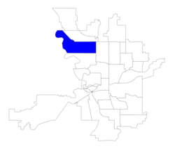
As the name suggests, Northwest is located in the northwestern portion of Spokane. It is bounded by the Spokane River on the west, Wellesley Avenue on the South, Ash Street on the east and Francis Avenue and Nine Mile Road in the north. The Balboa/South Indian Trail lies to the north. North Hill is located to the east. Audubon/Downriver is located to the south. Unincorporated Spokane County sits to the west, beyond the Spokane River; The Spokane River and portions of Riverside State Park are located within the neighborhood, but extend north, south and west from the neighborhood. [3]

The eastern half of Northwest is largely flat, especially west of A Street. There is a hillside that runs southeast–northwest along Driscoll Boulevard that climbs approximately 100 feet over two to three city blocks. Another, steeper bluff falls more than 100 feet just northwest of the intersection of Francis and Nine Mile Road, where the northwesternmost portion of the neighborhood lies closer to the elevation of the Spokane River. The western, flat portions of the neighborhood are around 2,000 feet above sea level while the river on the western edge is around 1,600 feet. [8]

Driscoll Boulevard Parkway Driscoll Boulevard NW Spokane.png
Driscoll Boulevard Parkway

Riverside State Park extends into Northwest along its western boundary on the Spokane River. The parkland here protects some of the last intact Okanagan dry forests ecoregion, part of the broader temperate coniferous forest biome. The Okanagan dry forests extend from just south of Spokane northwest through the Okanagan to the Thompson Plateau in British Columbia. Tall ponderosa pine trees in the neighborhood are remnants of the ecoregion's presence prior to human development. [9]

Assembly Street runs north–south through the middle of the neighborhood. To the east are largely single-family residential zones with a few neighborhood retail areas. To the west of Assembly are the campuses of the VA Medical Center, Dwight Merkel Sports Complex, Pauline Flett Middle School and Fairmount Memorial Park, as well as the portions of Riverside State Park within the neighborhood. [10] [11] [3] There is also an area of suburban development in the northwest of the neighborhood to the west of Nine Mile Road made up of multiple subdivision style developments. [8]

Demographics

As of 2017, there were 13,367 residents in the neighborhood across 5,513 households, of which 28.2% had children. 22.8% of households were rented, compared to 45.3% citywide. 24.6% of the residents were aged 19 or younger, compared to 21.9% citywide. Those over 65 made up 23.5% of the population, compared to 14.5% citywide. The median household income was $55,709, compared to $44,768 citywide. 23.2% of the population has a bachelor's degree or higher, while 27.5% have at most a high school diploma. The unemployment rate was 5.6% compared to 6.5% citywide. 51.8% of students qualify for free or reduced lunch, compared to 54.5% citywide. 96.4% of residents were born in the United States or one of its territories. Of those born elsewhere, 24.3% were from Germany, 15.1% from Ireland, with 20.8% from "other" and 20.3% from "unclassified." [1]

Education

Northwest is served by Spokane Public Schools, and is home to Westview Elementary and Browne Elementary Schools. Those two schools, as well as Indian Trail Elementary in neighboring Balboa/South Indian Trail and Ridgeview in neighboring North Hill, serve Northwest. Westview Elementary serves Northwest from Francis Avenue in the north to Rowan Avenue in the south, and Assembly Street in the west to Belt Street in the east. Browne Elementary serves the neighborhood south of Rowan Avenue and west of Belt Street. Indian Trail Elementary serves the northwestern portion of the neighborhood along Nine Mile Road and Ridgeview Elementary serves Northwest east of Belt Street. All four schools feed into Pauline Flett Middle School. located in the Northwest neighborhood. [12] From Pauline Flett Middle School, all four elementary districts also feed into Shadle Park High School, located just south of Northwest in the adjacent Audubon/Downriver neighborhood. [13]

Transportation

Highway

WA-291.svg - State Route 291 - to Tumtum (north) and Spokane (south)

State Route 291 passes east–west as the northern boundary of Northwest along Francis Avenue and then as Nine Mile Road; it connects to U.S. Route 2 and U.S. Route 395 at its southern terminus at Division Street in the neighboring North Hill neighborhood to the east. [8]

Surface streets

The easternmost portions of Northwest are aligned to the city's street grid, though it breaks down as one moves west and the terrain becomes less flat. East of Assembly Street, even where the streets do not follow the grid pattern they do connect with one another. West of Assembly, however, streets take on more of a suburban pattern with winding roads, cul-de-sacs, and non-connecting roads common. [14]

Ash, Assembly, Francis, Nine Mile and Wellesley are classified by the city as principal arterials, the city's top classification for a surface street. Alberta, Driscoll and Rowan are classified as minor arterials by the city. The Aubrey L. White Parkway, passing through Riverside State Park and paralleling the Spokane River, as well as A and Belt Streets, are classified as major collectors by the city. The rest of the streets in Northwest are classified as local-access roadways. [14]

Dedicated bike lanes run along Assembly, Driscoll and Rowan, while shared-roadway bike routes run along A, Belt and Bismark Streets and Nine Mile Road. A non-motorized path connects Northwest to Riverside State Park to the Dwight Merkel Sports Complex in the northwest of the neighborhood. [15]

Public transit

Northwest is served by the Spokane Transit Authority, like the rest of the Spokane metropolitan area, with three fixed-route bus lines passing through the neighborhood. [16]

RouteTerminiService operation and notesStreets traveled
33
Wellesley
West Hills
Spokane Falls Community College
Chief Garry Park
Spokane Community College
High-frequency routeWellesley
22
Northwest Boulevard
Downtown Spokane
STA Plaza
Balboa/South Indian Trail
Five Mile Park & Ride
Basic-frequency routeWellesley, Assembly, Rowan, G, Francis
23
Maple/Ash
Downtown Spokane
STA Plaza
North Indian Trail
Meadowglen Park
Basic-frequency routeMaple/Ash couplet, Rowan, Alberta, Francis,

Related Research Articles

<span class="mw-page-title-main">Hillyard, Spokane</span> Neighborhood of Spokane in Spokane County, Washington, United States

Hillyard is a neighborhood in Spokane, Washington which existed as a separate town between 1892 and 1924.

<span class="mw-page-title-main">West Central, Spokane</span> Neighborhood in Spokane, Washington, U.S.

West Central is a neighborhood in Spokane, Washington. As the name suggests it is located centrally on the west side of the city. Downtown Spokane is immediately east of the neighborhood, and spreads into West Central along Monroe Street in the Kendall Yards area. The neighborhood is diverse, with single and multi-family residential zones dating back to the early days of Spokane, a new mixed use development on the site of a former rail yard, the Spokane County Courthouse campus and associated government buildings and a few commercial districts. The Spokane River gorge winds around the southern and western edge of the neighborhood. It is home to Nettleton's Addition Historic District, which was added to the National Register of Historic Places in March 2006, and is also the largest historic district on the Washington State Heritage Register.

<span class="mw-page-title-main">Bemiss, Spokane</span> Neighborhood in Spokane, Washington, United States

Bemiss is a neighborhood in Spokane, Washington. It is located within City Council District 1, which covers the northeastern section of the city. The neighborhood is bounded by Wellesley Avenue to the north, Market Street to the east, Illinois Avenue and the Spokane River to the south, and Perry Street and Napa Street to the west. It is located to the southeast of the Hillyard neighborhood and is often grouped into greater Hillyard.

<span class="mw-page-title-main">Chief Garry Park, Spokane</span> Neighborhood in Spokane, Washington, United States

Chief Garry Park is a neighborhood in Spokane, Washington. It is located immediately south of the Spokane River. It is named for Spokane Garry and a park that has taken his name. The neighborhood was first established in 1912 but it wasn't until 1932 that it was officially named for Chief Garry.

<span class="mw-page-title-main">Logan, Spokane</span> Spokane Neighborhood in Washington, United States

Logan is a neighborhood in Spokane, Washington. It is located immediately northeast of Downtown Spokane and is home to Gonzaga University. The Spokane River runs along its eastern and southern edge. Due to its proximity to the city center, Logan is home to some of the oldest and densest areas in the city. It is known for its tree-lined streets, historic buildings and population of college students. In addition to numerous individual properties, there are two historic districts listed on the National Register of Historic Places located within Logan: the Desmet Avenue Warehouse Historic District and the Mission Avenue Historic District.

<span class="mw-page-title-main">Browne's Addition, Spokane</span> Spokane Neighborhood in Washington, United States

Browne's Addition, often referred to shorthand as just Browne's, is a neighborhood in Spokane, Washington. It is located directly west of Downtown Spokane and is one of the oldest and densest neighborhoods in the city. The area is known for its numerous historic mansions, many of which have been converted into multi-family apartments. The terrain is flat in the neighborhood despite the degree of topographical relief in the immediate surrounding area. Latah Creek cuts a deep valley to the west, separating Browne's Addition from the Sunset Hill portion of the West Hills neighborhood and the Spokane River gorge drops off dramatically to the north into the Peaceful Valley neighborhood. The South Hill area of Spokane rises to the southwest.

<span class="mw-page-title-main">Cliff/Cannon, Spokane</span> Neighborhood in Spokane, Washington, United States

Cliff/Cannon is a neighborhood in Spokane, Washington. It is located immediately south of Downtown, Spokane, and on the lower reaches of the broader South Hill. The neighborhood is home to a medical district with Sacred Heart and Deaconess both having their main hospital campuses along Cliff/Cannon's denser northern edge. To the south the neighborhood becomes more residential. City parks break up the residential zoning of the southern half of Cliff/Cannon. It is adjacent to the Cannon Hill area of the neighboring but separate Manito/Cannon Hill neighborhood. The Marycliff-Cliff Park Historic District, a National Historic District listed on the National Register of Historic Places, is located within the neighborhood.

<span class="mw-page-title-main">Latah/Hangman, Spokane</span> Spokane Neighborhood in Washington, United States

Latah/Hangman is a neighborhood in Spokane, Washington.

<span class="mw-page-title-main">Emerson/Garfield, Spokane</span> Spokane Neighborhood in Washington, United States

Emerson/Garfield is a neighborhood in Spokane, Washington. It is located immediately north of Downtown Spokane's North Bank and extends out into the inner northwestern portion of the city. Emerson/Garfield is a diverse neighborhood with residential, commercial and civic zones all bordering one another, with density ranging from single-family homes to multi-use buildings. Due to its location in the central area of Spokane, Emerson/Garfield is criss-crossed by numerous arterials and thoroughfares. Along those main roads are numerous commercial and retail districts of importance to both the neighborhood and city as a whole.

<span class="mw-page-title-main">Lincoln Heights, Spokane</span> Spokane Neighborhood in Washington, United States

Lincoln Heights is a neighborhood in Spokane, Washington. It is located in the southeastern portion of the city in a broader area commonly known as the South Hill. As the name suggests, Lincoln Heights lies on the slopes and atop the crest of the South Hill area. Lincoln Heights is home to a mix of single-family residential, multi-family residential, and commercial areas and a significant amount of park land. The Lincoln Heights Shopping Center and surrounding area is one of the largest and most important commercial and retail districts on the entire south side of Spokane.

<span class="mw-page-title-main">Comstock, Spokane</span> Spokane Neighborhood in Washington, United States

Comstock is a neighborhood in Spokane, Washington. It is located on the south side of the city in a broader area commonly known as the South Hill. The neighborhood is primarily single-family residential, and a mix of homes built during the streetcar era and then built during the post-World War II housing boom. The neighborhood is also home to a few commercial districts, including the regionally important Manito Shopping Center, two schools, the eponymous Comstock Park, sports fields and a golf course.

<span class="mw-page-title-main">Southgate, Spokane</span> Spokane Neighborhood in Washington, United States

Southgate is a neighborhood in Spokane, Washington. It is located in the southwestern corner of the City of Spokane and part of the broader area known locally as the South Hill. Southgate is one of the newer neighborhoods in the city, with development first taking hold in the post-World War II housing boom and continuing into the present day. It is a mix of single-family residential, multi-family residential and commercial districts. The neighborhood has grown as Spokane has expanded southward, with multiple annexations expanding Southgate and the city since 2000 and as recently as 2016.

<span class="mw-page-title-main">North Hill, Spokane</span> Spokane Neighborhood in Washington, United States

North Hill is a neighborhood in Spokane, Washington. As the name suggests, it is atop a hill on the north side of Spokane, within which it is centrally located and crossed by numerous major thoroughfares. It is home to parks, commercial districts and single family residential areas. The historic Garland Theater is located in North Hill, and the city's main north–south arterial, Division Street, is home to a major commercial district along the eastern edge of the neighborhood.

<span class="mw-page-title-main">West Hills, Spokane</span> Spokane Neighborhood in Washington, United States

West Hills is a neighborhood in Spokane, Washington. As the name suggests, the neighborhood is located on hillsides to the west of downtown Spokane. The neighborhood also extends far to the west along the West Plains to incorporate the Spokane International Airport and surrounding land. As the city has grown over the decades, the West Hills neighborhood has expanded uphill and onto the plains to the west. That history of incremental growth, combined with the hilly topography of the area cut by numerous watercourses, has broken up the neighborhood into multiple, distinct areas with swaths of undeveloped land mixed in between.

<span class="mw-page-title-main">North Indian Trail, Spokane</span> Spokane neighborhood in Washington, United States

North Indian Trail is a neighborhood in the northwesternmost corner of Spokane, Washington. It extends to the northwest of the rest of Spokane along a tableland east of the Spokane River, west of the Five Mile Prairie. Its terrain isolates the neighborhood somewhat, and it was only extensively developed starting in the second half of the 20th century.

<span class="mw-page-title-main">Balboa/South Indian Trail, Spokane</span> Spokane Neighborhood in Washington, United States

Balboa/South Indian Trail is a neighborhood in Spokane, Washington located on the northwestern side of the city. The neighborhood is largely composed of single-family residential areas that were developed after being annexed into the city in the 1950s. The neighborhood is situated on tableland above a steep bluff rising from the Spokane River to the west, that then rises up a more developed bluff towards Five Mile Prairie which is located above the neighborhood to the north and east.

<span class="mw-page-title-main">Audubon/Downriver, Spokane</span> Spokane Neighborhood in Washington, United States

Audubon/Downriver is a neighborhood in Spokane, Washington, located on the northwest side of the city. There is a diversity of land use in the neighborhood, with single-family residential areas dating from the early 20th century through the Post–World War II economic expansion era, regionally important commercial districts, smaller neighborhood retail areas, numerous schools, large parks, a golf course, conservation areas and part of Riverside State Park along the Spokane River. The neighborhood is the site of the corporate offices for Rosauers Supermarkets, a regional grocery store chain with stores located across the Northwestern United States.

<span class="mw-page-title-main">Nevada Heights, Spokane</span> Spokane Neighborhood in Washington, United States

Nevada Heights is a neighborhood in Spokane, Washington, located on the north side of the city. Its southern border is atop a bluff that runs east–west across the north side of the city, which gives the neighborhood its name. Nevada Street, a major north–south arterial, runs through the neighborhood. The neighborhood is largely residential, but also home to large retail districts, medical facilities, schools and parks. Being surrounded by the city of Spokane on all sides, the neighborhood is well integrated into urban area.

<span class="mw-page-title-main">Shiloh Hills, Spokane</span> Spokane Neighborhood in Washington, United States

Shiloh Hills is a neighborhood in Spokane, Washington, located on the far northeastern side of the city. It is one of the newer areas of the city, initially annexed in the late 1960s with growth continuing into the 21st century. The neighborhood is home to residential, commercial and industrial districts as well as multiple regionally important transportation corridors such as the Division Street "Y".

<span class="mw-page-title-main">Whitman, Spokane</span> Spokane Neighborhood in Washington, United States

Whitman is a neighborhood located on the northeast side of Spokane, Washington. It is named for pioneer missionaries Marcus and Narcissa Whitman.

References

  1. 1 2 3 "Northwest Neighborhood Snapshot" (PDF). spokanecity.org. City of Spokane. Retrieved 17 June 2022.
  2. "History - Spokane Tribe of Indians". spokanetribe.com. Spokane Tribe of Indians. Retrieved 12 June 2022.
  3. 1 2 3 4 5 "Northwest Neighborhood Profile" (PDF). spokanecity.org. City of Spokane. Retrieved 19 June 2022.
  4. "North Indian Trail Neighborhood Profile" (PDF). spokanecity.org. City of Spokane. Archived (PDF) from the original on 8 May 2021. Retrieved 18 June 2022.
  5. 1 2 "Annexation History". data-spokane.opendata.arcgis.com. City of Spokane. Retrieved 19 June 2022.
  6. Deshais, Nicholas (17 December 2014). "Do you live along an old streetcar route?". The Spokesman-Review. Retrieved 19 June 2022.
  7. Camden, Jim (11 August 1995). "Victory And Beyond Gis Detonated Housing Boom They All Wanted A Piece Of The American Dream". The Spokesman-Review. Retrieved 19 June 2022.
  8. 1 2 3 "Spokane NW Quadrangle". usgs.gov. U.S. Geological Survey. Retrieved 19 June 2022.
  9. "Terrestrial Ecoregions of the World". databasin.org. Conservation Biology Institute. Retrieved 14 June 2022.
  10. "Future Schools & Improvements". spokaneschools.org. Spokane Public Schools. Retrieved 19 June 2022.
  11. Boyd, R. (3 November 2021). "City of Spokane, Washington Current Zoning" (Map). spokanecity.org. City of Spokane. Retrieved 19 June 2022.
  12. "Elementary School Boundary Map" (PDF). spokaneschools.org. Spokane Public Schools. Retrieved 18 June 2022.
  13. "High School Boundary Map" (PDF). spokaneschools.org. Spokane Public Schools. Retrieved 18 June 2022.
  14. 1 2 "Official Arterial Street Map" (PDF). spokanecity.org. City of Spokane. Retrieved 18 June 2022.
  15. "Spokane Regional Bike Map". srtc.maps.arcgis.com. Spokane Regional Transportation Council. Retrieved 27 May 2022.
  16. "STA System Map" (PDF). spokanetransit.com. Spokane Transit Authority. Retrieved 13 June 2022.