West Hills, Spokane

Last updated
West Hills
Sunset hill spokane.png
Sunset Hill from Browne's Addition
West Hillscropped.png
Location within the city of Spokane
Coordinates: 47°38′38.5″N117°27′44.1″W / 47.644028°N 117.462250°W / 47.644028; -117.462250
CountryUnited States
StateWashington
County Spokane
CitySpokane
Population
 (2017 [1] )
  Total3,690
Demographics 2017 [1]
   White 84.2%
  Latinx6.1%
  Asian4.1%
  Black or African American2.7%
  American Indian/Alaska Native2.6%
Time zone UTC-8 (PST)
  Summer (DST) UTC-7 (PDT)
ZIP Codes
99224
Area code 509

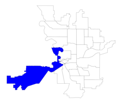
West Hills is a neighborhood in Spokane, Washington. As the name suggests, the neighborhood is located on hillsides to the west of downtown Spokane. The neighborhood also extends far to the west along the West Plains to incorporate the Spokane International Airport and surrounding land. As the city has grown over the decades, the West Hills neighborhood has expanded uphill and onto the plains to the west. That history of incremental growth, combined with the hilly topography of the area cut by numerous watercourses, has broken up the neighborhood into multiple, distinct areas with swaths of undeveloped land mixed in between.

Contents

History

Historic buildings on the former campus of Fort George Wright Fort George Wright HD NRHP 76001918 Spokane County, WA.jpg
Historic buildings on the former campus of Fort George Wright

The Spokane people inhabited the area that is now West Hills for centuries before European settlers arrived. [2] The land along the banks of Garden Springs Creek and Indian Canyon Creek were used as campsites and water sources for the Spokane. Chief Spokane Garry lived in Indian Canyon late in his life, until his death there in 1892. In the 1880s, Chinese immigrants replaced the Spokane along the banks of Garden Springs Creek in what is now Finch Arboretum, where they tended to vegetable gardens. [3] [4]

In 1891 the area west of H Street was incorporated into the City of Spokane. Just outside the municipal limit at the time, along a bend in the Spokane River, construction began on Fort George Wright in 1897 and was completed in 1899. Streetcars soon followed, connecting Fort George Wright through West Hills along Government Way, and climbing Sunset Boulevard to the crest of the hill. When the Olmsted Brothers came to Spokane in 1913 to design the city's park system they praised Indian Canyon Park for its beauty, and the land that would become the Finch Arboretum was purchased that same year. [3]

New Wynne Motel between 1930 and 1945 New Wynne Motel -- Spokane, Washington (89790).jpg
New Wynne Motel between 1930 and 1945

West Hills became a regional transportation hub with the construction of the first automobile bridge over the deep Latah Creek gorge in 1911, when the Sunset Boulevard Bridge was built. It connected Downtown Spokane with agricultural areas to the west via West Hills along Sunset Boulevard. [5] In 1926, the Sunset Boulevard Bridge was chosen to carry U.S. Route 10, one of the first major east–west highways across the northern tier of the country. Numerous motels and campgrounds were developed in the area just west of the bridge at the base of Sunset Hill. A tourist camp was established at what is now High Bridge Park [6] and along Sunset Boulevard itself motels were developed. Many stand to this day, though few remain operational. [5] [7] The area's importance in transportation waned in the 1960s as Interstate 90 was constructed roughly parallel to the Sunset Highway. U.S. Route 10 replaced by the limited-access freeway, which passes next to but does not have off or on ramps connecting directly to the motel district. In the decades since, hotels and motels have been developed at the top of the hill, on the western edge of the neighborhood, where there are ramps connecting West Hills to the interstate. [8]

Spokane Falls Community College was opened on the property of Fort George Wright in 1967. [9] In 1990, also on the property of Fort George Wright, the U.S. Campus of Mukogawa Women's University was opened. Many of the historic buildings from Fort Wright remain in use on the Mukogawa campus. [10]

From 1891 when parts of West Hills were first incorporated into the city until 1948 the western border of the city through the area was delineated by a north–south line running roughly along H Street. Westward expansion of the city took off during the post-World War II housing boom. In 1948 a couple of blocks just west of H Street by Whittier Park was annexed, and by the mid-1960s most of the area in the southern portion of the neighborhood from H Street west to the crest of Sunset Hill had been annexed. Fort George Wright in the north was annexed in 1966. A pair of areas were annexed in the 1990s, bringing the western portion of the neighborhood to its current size. The bounds of the neighborhood grew substantially in 2012 when the airport and surrounding areas were annexed into the city and named part of West Hills. [11]

Geography

Aerial of the flat West Plains to the west of Spokane with Fairchild AFB (left) and Spokane International (right) Fairchild AFB and Spokane.jpg
Aerial of the flat West Plains to the west of Spokane with Fairchild AFB (left) and Spokane International (right)

West Hills is located to the west of Spokane's city center, about a mile from the downtown core. It is somewhat cut off from the rest of the city by the deep valleys cut by Latah Creek and the Spokane River along its eastern edge. Furthermore, the neighborhood is bisected small streams like Garden Springs Creek, which cuts a valley through which Interstate 90 and the Sunset Highway pass, and Indian Canyon Creek, which cuts a rugged valley just to the north. These streams are fed by numerous wetlands which are located atop the crest of the neighborhood's eponymous hill. [12]

The easternmost portion of the neighborhood lies roughly at the same elevation as much of the rest of the city of Spokane to the east, being located on a bench above Latah Creek and the Spokane River. From there, as one travels to the west, the elevation rises from between 1,800 and 1,900 feet to 2,300 feet. The elevated portions of the neighborhood are at the level of the surrounding Columbia Plateau which stretches to the west into Central Washington. There is much exposed Basalt rock in the neighborhood along the bluffs and canyons of West Hills. The slopes themselves are heavily forested, even adjacent and into residential areas. While on the West Plains atop the hill the area begins to open up into the Channeled Scablands with wetlands and meadows interspersed large basalt outcroppings trending in a northeast–southwest direction. [12] [3]

West Hills straddles the boundary between two ecoregions as defined by the World Wildlife Fund. The lower and easternmost portions of the neighborhood, like almost all of the rest of the city, lie within the Okanagan dry forests ecoregion, which stretches from just south of Spokane northwest through the Okanagan and into the Thompson Plateau of British Columbia. Tall ponderosa pine trees are a remnant of the pre-development nature of the ecoregion. Beyond the crest of the hill the Okanagan dry forests transition into the Palouse grasslands. [13]

Garden Springs Creek in Finch Arboretum John A. Finch Arboretum - IMG 6931.JPG
Garden Springs Creek in Finch Arboretum

In the north of the neighborhood, surrounded on three sides by a bend of the Spokane River, is the site of Fort George Wright. The former army base is now home to Spokane Falls Community College and the Mukogawa Women's University's U.S. Campus. Just to the south of the campuses is the River Run residential area, with both single-family and apartment homes, which has been developed over the first decades of the 21st century. [14]

A cluster of large cemeteries separates the northern portion of the neighborhood with the older residential areas in the south. [15]

The southern portion of the neighborhood, from I-90 on the south to the cemeteries in the north, is commonly known as Sunset Hill. [16] There is a commercial district along Sunset Boulevard here, as well as single-family residential neighborhoods and abundant parkland. Whittier Park, a neighborhood park with a playground and sports facilities, is located in this part of West Hills, as are the much larger John A. Finch Arboretum along Garden Springs Creek and the public Indian Canyon Golf Course.

Demographics

Apartments at the top of Sunset Hill West Hills Crest.png
Apartments at the top of Sunset Hill

As of 2017, West Hills was home to 3,690 people across 1,708 households, of which 18.1% had children. 58.8% of households in the neighborhood were rentals, compared with 45.3% citywide. Persons aged 19 or younger made up 20.4% of the population, compared to 21.9% citywide, and persons aged 65 and above made up 10.9% of the population, compared to 14.5% citywide. $46,458 was the median household income, compared to $44,768 citywide. 28.7% of students qualified for free or reduced lunch, below the citywide average of 54.5%. Persons of color made up 17.9% of the population, compared to 15.1% citywide.

89.4% of residents were born in the United States or its territories. Of those who weren't, 13.9% were from Mexico, 13.4% from Iraq, 9.6% from Saudi Arabia and 5.9% from Canada. [1]

Education

SFCC's Science building and planetarium SFCCBuilding28.jpg
SFCC's Science building and planetarium

The West Hills neighborhood is home to Spokane Falls Community College (SFCC), a public higher education institution, and the U.S. Campus of Mukogawa Women's University, a private university with its main campus located in Spokane's sister city of Nishinomiya, Japan. There are no primary or secondary schools located within the neighborhood.

Areas south of Indian Canyon Creek are part of the Hutton Elementary School district, located in the Rockwood neighborhood. Areas to the north are part of the Finch Elementary School district, located in the Audubon/Downriver neighborhood. The Finch district in West Hills is contiguous with the rest of the Finch district, though separated from it by the Spokane River, though the Hutton district in the neighborhood does not touch any of the rest of the Hutton district. Through the 2022 school year, the Hutton district areas of the neighborhood fed into Sacajawea Middle School, like the rest of the Hutton district, but starting in the 2022-23 year they will feed instead to the new Carla Peperzak Middle School being constructed on the southern edge of Spokane, and from there into Lewis and Clark High School. The Finch district feeds into Glover Middle School and North Central High School. [17] [18] [19]

Areas that were part of the 2012 annexation, such as the airport and West Plains, are not part of the Spokane Public Schools district but rather the Cheney School District. [20]

Transport

Interstate 90 looking northeast to Spokane with the West Hills to the left Downtown Spokane - panoramio.jpg
Interstate 90 looking northeast to Spokane with the West Hills to the left

Interstate

Highway

Surface Streets

Sunset Highway is classified as a principal arterial by the city, as is Airport Drive (which serves the airport). In the north, Whistalks Way is also classified as a principal arterial. U.S. 2 is a limited-access roadway through the eastern portion of the neighborhood, sharing a roadway with Interstate 90 in this area. From just past the Airport off-ramp heading westbound, however, U.S. 2 becomes a surface street and is considered to be a principal arterial in this section. Geiger Boulevard and Government Way are considered minor arterials. [21]

The southeastern portion of West Hills, on the shelf above the Spokane River and Latah Creek, is part of the city street grid. Southwest of H Street and Hartson Avenue the streets bend around the bluffs and cliffs as they climb Sunset Hill. Due to the terrain and waterways, even the part of the neighborhood on the street grid is relatively disconnected from the rest of the city. Only Whistalks Way, Riverside at Government Way, and Sunset Boulevard provide surface access directly into the rest of the city. [12] [21]

Non-motorized vehicles and pedestrians have access to the Fish Lake Trail, which as of 2022 has its northern terminus in West Hills one block from the major intersection of Government Way and Sunset Boulevard. It connects south through the Grandview/Thorpe neighborhood and is planned to extend roughly 10 miles to Fish Lake south of Marshall, where it would meet the Columbia Plateau Trail. Also as of 2022, there are plans in the works to extend the trail north through West Hills to connect it to the Spokane River Centennial Trail. [22]

Public Transit

West Hills, like the rest of the Spokane urban area, is served by the Spokane Transit Authority. There are five scheduled-service bus lines serving the neighborhood.

RouteTerminiService operation and notesStreets traveled
20
SFCC
Downtown Spokane
STA Plaza
Spokane Falls Community College
Spokane Falls Station
High-frequency routeGovernment Way, Whistalks Way
33
Wellesley
Spokane Community College
SCC Transit Center
Spokane Falls Community College
Spokane Falls Station
High-frequency routeWhistalks Way
60
Airport via Browne's Addition
Downtown Spokane
STA Plaza
Spokane International Airport Basic-frequency routeSunset Boulevard, Sunset Highway/Highway 2, Airport Way
61
Hwy 2 via Browne's Addition
Downtown Spokane
STA Plaza
Fairchild Air Force Base
Basic-frequency routeSunset Boulevard, Sunset Highway/Highway 2
63
Airway Heights/West Plains
West Plains
West Plains Transit Center
Airway Heights
Basic-frequency routeElectric Avenue, Flightline Boulevard, Spotted Road, Airport Way, Flint Road, Sunset Highway/Highway 2

Related Research Articles

<span class="mw-page-title-main">Neighborhoods in Spokane, Washington</span>

Neighborhoods in Spokane, Washington are officially grouped by the Spokane City Council into three main city council districts: 1, 2, and 3. Each city council district contains multiple, official neighborhoods that are recognized with a neighborhood council. Informally, neighborhoods are colloquially grouped by local geographical, geological, cultural, or historical features The list of neighborhoods below is organized based on the official designations by the City of Spokane. Unofficial neighborhoods and districts are listed within the official neighborhood in which they are located.

<span class="mw-page-title-main">High Bridge Park</span> Park in Spokane, Washington, United States of America

High Bridge Park is a 200 acres (810,000 m2) public park located at Riverside Ave. and A St. in Latah/Hangman, Spokane, Washington. It is open daily, without charge.

<span class="mw-page-title-main">West Central, Spokane</span> Neighborhood in Spokane, Washington, U.S.

West Central is a neighborhood in Spokane, Washington. As the name suggests it is located centrally on the west side of the city. Downtown Spokane is immediately east of the neighborhood, and spreads into West Central along Monroe Street in the Kendall Yards area. The neighborhood is diverse, with single and multi-family residential zones dating back to the early days of Spokane, a new mixed use development on the site of a former rail yard, the Spokane County Courthouse campus and associated government buildings and a few commercial districts. The Spokane River gorge winds around the southern and western edge of the neighborhood. It is home to Nettleton's Addition Historic District, which was added to the National Register of Historic Places in March 2006, and is also the largest historic district on the Washington State Heritage Register.

<span class="mw-page-title-main">Logan, Spokane</span> Spokane Neighborhood in Washington, United States

Logan is a neighborhood in Spokane, Washington. It is located immediately northeast of Downtown Spokane and is home to Gonzaga University. The Spokane River runs along its eastern and southern edge. Due to its proximity to the city center, Logan is home to some of the oldest and densest areas in the city. It is known for its tree-lined streets, historic buildings and population of college students. In addition to numerous individual properties, there are two historic districts listed on the National Register of Historic Places located within Logan: the Desmet Avenue Warehouse Historic District and the Mission Avenue Historic District.

<span class="mw-page-title-main">East Central, Spokane</span> Spokane Neighborhood in Washington, United States

East Central is a neighborhood in Spokane, Washington. As the name suggests, it is on the east side of Spokane and centrally located. The official neighborhood is expansive and covers multiple areas considered by locals to be independent neighborhoods, such as the Sprague Union District on East Sprague Avenue, the South Perry District, the Underhill Park area and the University District on the eastern fringe of Downtown Spokane.

<span class="mw-page-title-main">Browne's Addition, Spokane</span> Spokane Neighborhood in Washington, United States

Browne's Addition, often referred to shorthand as just Browne's, is a neighborhood in Spokane, Washington. It is located directly west of Downtown Spokane and is one of the oldest and densest neighborhoods in the city. The area is known for its numerous historic mansions, many of which have been converted into multi-family apartments. The terrain is flat in the neighborhood despite the degree of topographical relief in the immediate surrounding area. Latah Creek cuts a deep valley to the west, separating Browne's Addition from the Sunset Hill portion of the West Hills neighborhood and the Spokane River gorge drops off dramatically to the north into the Peaceful Valley neighborhood. The South Hill area of Spokane rises to the southwest.

<span class="mw-page-title-main">Peaceful Valley, Spokane</span> Spokane Neighborhood in Washington, United States

Peaceful Valley is a neighborhood in Spokane, Washington. It sits directly below Downtown Spokane on the Spokane River under its falls. The neighborhood snakes along the thin floodplain on the valley floor of the Spokane River Gorge. It is the smallest neighborhood in the city by both area and population, but due to its central location and unique character it is quite notable. The neighborhood has a working class and bohemian culture.

<span class="mw-page-title-main">Manito/Cannon Hill, Spokane</span> Neighborhood in Spokane, Washington, United States

Manito/Cannon Hill is a neighborhood on the South Hill of Spokane, Washington. It is named after the two public parks that dominate its setting: Manito Park and Cannon Hill Park. Manito/Cannon Hill is a predominantly residential neighborhood made up mostly by single-family homes and city park land.

<span class="mw-page-title-main">Cliff/Cannon, Spokane</span> Neighborhood in Spokane, Washington, United States

Cliff/Cannon is a neighborhood in Spokane, Washington. It is located immediately south of Downtown, Spokane, and on the lower reaches of the broader South Hill. The neighborhood is home to a medical district with Sacred Heart and Deaconess both having their main hospital campuses along Cliff/Cannon's denser northern edge. To the south the neighborhood becomes more residential. City parks break up the residential zoning of the southern half of Cliff/Cannon. It is adjacent to the Cannon Hill area of the neighboring but separate Manito/Cannon Hill neighborhood. The Marycliff-Cliff Park Historic District, a National Historic District listed on the National Register of Historic Places, is located within the neighborhood.

<span class="mw-page-title-main">Latah/Hangman, Spokane</span> Spokane Neighborhood in Washington, United States

Latah/Hangman is a neighborhood in Spokane, Washington.

<span class="mw-page-title-main">Emerson/Garfield, Spokane</span> Spokane Neighborhood in Washington, United States

Emerson/Garfield is a neighborhood in Spokane, Washington. It is located immediately north of Downtown Spokane's North Bank and extends out into the inner northwestern portion of the city. Emerson/Garfield is a diverse neighborhood with residential, commercial and civic zones all bordering one another, with density ranging from single-family homes to multi-use buildings. Due to its location in the central area of Spokane, Emerson/Garfield is criss-crossed by numerous arterials and thoroughfares. Along those main roads are numerous commercial and retail districts of importance to both the neighborhood and city as a whole.

<span class="mw-page-title-main">Lincoln Heights, Spokane</span> Spokane Neighborhood in Washington, United States

Lincoln Heights is a neighborhood in Spokane, Washington. It is located in the southeastern portion of the city in a broader area commonly known as the South Hill. As the name suggests, Lincoln Heights lies on the slopes and atop the crest of the South Hill area. Lincoln Heights is home to a mix of single-family residential, multi-family residential, and commercial areas and a significant amount of park land. The Lincoln Heights Shopping Center and surrounding area is one of the largest and most important commercial and retail districts on the entire south side of Spokane.

<span class="mw-page-title-main">Comstock, Spokane</span> Spokane Neighborhood in Washington, United States

Comstock is a neighborhood in Spokane, Washington. It is located on the south side of the city in a broader area commonly known as the South Hill. The neighborhood is primarily single-family residential, and a mix of homes built during the streetcar era and then built during the post-World War II housing boom. The neighborhood is also home to a few commercial districts, including the regionally important Manito Shopping Center, two schools, the eponymous Comstock Park, sports fields and a golf course.

<span class="mw-page-title-main">Southgate, Spokane</span> Spokane Neighborhood in Washington, United States

Southgate is a neighborhood in Spokane, Washington. It is located in the southwestern corner of the City of Spokane and part of the broader area known locally as the South Hill. Southgate is one of the newer neighborhoods in the city, with development first taking hold in the post-World War II housing boom and continuing into the present day. It is a mix of single-family residential, multi-family residential and commercial districts. The neighborhood has grown as Spokane has expanded southward, with multiple annexations expanding Southgate and the city since 2000 and as recently as 2016.

<span class="mw-page-title-main">Grandview/Thorpe, Spokane</span> Spokane Neighborhood in Washington, United States

Grandview/Thorpe is a neighborhood in Spokane, Washington. Located in southwestern Spokane, the neighborhood takes its name from two roads that pass through. Grandview Boulevard, so named because of its location at the top of a ridge from which large swaths of Spokane, the Spokane Valley and surrounding mountains to the north and east such as Mount Spokane, can be seen, is located in the northern part of the neighborhood. Thorpe Road traverses a gully in the central and southern portion of the neighborhood.

<span class="mw-page-title-main">Audubon/Downriver, Spokane</span> Spokane Neighborhood in Washington, United States

Audubon/Downriver is a neighborhood in Spokane, Washington, located on the northwest side of the city. There is a diversity of land use in the neighborhood, with single-family residential areas dating from the early 20th century through the Post–World War II economic expansion era, regionally important commercial districts, smaller neighborhood retail areas, numerous schools, large parks, a golf course, conservation areas and part of Riverside State Park along the Spokane River. The neighborhood is the site of the corporate offices for Rosauers Supermarkets, a regional grocery store chain with stores located across the Northwestern United States.

<span class="mw-page-title-main">Nevada Heights, Spokane</span> Spokane Neighborhood in Washington, United States

Nevada Heights is a neighborhood in Spokane, Washington, located on the north side of the city. Its southern border is atop a bluff that runs east–west across the north side of the city, which gives the neighborhood its name. Nevada Street, a major north–south arterial, runs through the neighborhood. The neighborhood is largely residential, but also home to large retail districts, medical facilities, schools and parks. Being surrounded by the city of Spokane on all sides, the neighborhood is well integrated into urban area.

<span class="mw-page-title-main">Northwest, Spokane</span> Spokane Neighborhood in Washington, United States

Northwest is a neighborhood in Spokane, Washington, located in the northwestern portion of the city. Largely single-family residential, Northwest is also home to Spokane's VA Medical Center, the Dwight Merkel Sports complex, a large public sports facility, and portions of Riverside State Park along the Spokane River. The neighborhood contains developments that span from the post-World War II housing boom in the east to more contemporary, suburban-style developments in the west. It was also home to Joe Albi Stadium from 1950 until 2022, which served as the Spokane region's main high school sports stadium over its seven decades of use.

<span class="mw-page-title-main">Whitman, Spokane</span> Spokane Neighborhood in Washington, United States

Whitman is a neighborhood located on the northeast side of Spokane, Washington. It is named for pioneer missionaries Marcus and Narcissa Whitman.

<span class="mw-page-title-main">Sunset Boulevard Bridge</span> Bridge in Washington, U.S.

The Sunset Boulevard Bridge, also known as the Latah Creek Bridge, is a deck arch bridge in the northwestern United States that spans Latah Creek in Spokane, Washington. The bridge connects the neighborhoods of Browne's Addition on the east, and Downtown Spokane just beyond that, with West Hills to the west. Latah Creek, which passes under the bridge, separates the two neighborhoods. It was built 112 years ago in 1911 by the city of Spokane, and was designed by Morton McCartney & J.F. Cunningham, with J.F. Greene serving as the construction engineer.

References

  1. 1 2 3 "West Hills Neighborhood Snapshot" (PDF). spokanecity.org. City of Spokane. Retrieved 2 June 2022.
  2. "History - Spokane Tribe of Indians". spokanetribe.com. Spokane Tribe of Indians. Retrieved 3 June 2022.
  3. 1 2 3 "West Hills Neighborhood Profile" (PDF). spokanecity.org. City of Spokane. Retrieved 2 June 2022.
  4. Rebstock, Tracy L. "John A. Finch Arboretum". spokanehistorical.org. Eastern Washington University. Retrieved 4 June 2022.
  5. 1 2 Roberts, Jesse. "Sunset Bridge". spokanehistorical.org. Eastern Washington University. Retrieved 4 June 2022.
  6. Rebstock, Tracy L. "Tourist Camp at High Bridge Park". spokanehistorical.org. Eastern Washington University. Retrieved 4 June 2022.
  7. Shanks, Adam (27 July 2021). "Catholic Charities eyes Boulevard Motel as shelter for homeless families". The Spokesman-Review. Retrieved 4 June 2022.
  8. Lind, Treva (26 March 2016). "New Red Lion opens atop Sunset Hill". The Spokesman-Review. Retrieved 4 June 2022.
  9. "History". sfcc.spokane.edu. Community Colleges of Spokane. Retrieved 4 June 2022.
  10. "About — Mukogawa U.S. Campus". mfwi.edu. Mukogawa U.S. Campus. Retrieved 4 June 2022.
  11. "Annexation History | City of Spokane". /data-spokane.opendata.arcgis.com. City of Spokane. Retrieved 2 June 2022.
  12. 1 2 3 "Spokane NW Quadrangle". usgs.gov. U.S. Geological Survey. Retrieved 4 June 2022.
  13. "Terrestrial Ecoregions of the World". databasin.org. Conservation Biology Institute. Retrieved 14 June 2022.
  14. McLean, Mike (23 May 2013). "Roughly $25 million in construction planned at River Run". Spokane Journal of Business. Retrieved 4 June 2022.
  15. Russell, Julie Y. "A History of Greenwood Cemetery". spokanehistorical.org. Eastern Washington University. Retrieved 4 June 2022.
  16. Deshais, Nicholas (10 December 2018). "Getting There: Near completion but yet unfinished, two major street projects go to rest for the winter". The Spokesman-Review. Retrieved 4 June 2022.
  17. "High School Boundary Map" (PDF). spokaneschools.org. Spokane Public Schools. Retrieved 5 June 2022.
  18. "Elementary School Boundary Map" (PDF). spokaneschools.org. Spokane Public Schools. Retrieved 5 June 2022.
  19. Nelson, Madeline (26 May 2021). "Denny Yashuara, Pauline Flett and Carla Peperzak: SPS chooses names for 3 new middle schools". KREM-TV. Retrieved 5 June 2022.
  20. "Spokane County School Districts". spokanecounty.org. Spokane County. Retrieved 5 June 2022.
  21. 1 2 "Official Arterial Street Map" (PDF). spokanecity.org. City of Spokane. Retrieved 4 June 2022.
  22. Shanks, Adam (8 November 2021). "City moving forward Fish Lake Trail connection". The Spokesman-Review. Retrieved 5 June 2022.