
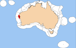
The Northwest Shelf Transition, also known as Bonaparte Coast, [1] is a biogeographic region of Australia's continental shelf. It adjoins the Kimberley region of Western Australia and the adjacent coast of the Northern Territory.
The Northwest Shelf Transition, also known as Bonaparte Coast, [1] is a biogeographic region of Australia's continental shelf. It adjoins the Kimberley region of Western Australia and the adjacent coast of the Northern Territory.
The Northwest Shelf Transition includes the coastal waters and continental shelf of northeastern Western Australia and the northwestern Northern Territory, between Cape Leveque and the Tiwi Islands. It has an area of 305,463 km2, extending from the shore to 330 metres depth. Most of the region ranges from 10 to 100 metres depth. [2]
The Northwest Shelf Province lies to the west, and the Northern Shelf Province to the east. The continental slope and deep ocean waters of the Timor Sea lie to the north.
The waters are tropical. Surface waters are generally from the Indonesian Throughflow. The shoreline is complex, with rocky headlands, embayments, beaches, estuaries, and offshore islands. The seafloor is also complex, with submerged terraces, carbonate banks, pinnacles, reefs, and sand banks. [2]
Sea life is typical of the tropical Central Indo-Pacific marine realm. Habitats include soft-bottom (sand and mud) and harder (rock) substrates. [2] Coral reefs are uncommon. [3]
The carbonate banks and pinnacles of the Joseph Bonaparte Gulf form habitats distinct from others in the region, and support high diversity of marine species including sponge gardens and octocorals. The carbonate banks are home to Olive ridley turtles, olive sea snake (Aipysurus laevis) and turtle-headed sea snake (Emydocephalus annulatus), and attract large fish like mackerel, red snapper (Lutjanus erythropterus), and goldband snapper (Pristipomoides multidens). [3]
The Western Australian population of humpback whales (Megaptera novaeangliae) mate and give birth in the bays along the Kimberley coast during the winter months, before migrating south along the Western Australian coast to their summer feeding grounds in the Southern Ocean. [2]
The Integrated Marine and Coastal Regionalisation of Australia (IMCRA) identifies six distinct meso-scale bioregions that make up the province. [4]
The Integrated Marine and Coastal Regionalisation of Australia (IMCRA), formerly the Interim Marine and Coastal Regionalisation for Australia, is a biogeographic regionalisation of the oceanic waters of Australia's exclusive economic zone (EEZ). As of 2008, the most recent version is IMCRA Version 4.0.

The Bass Strait Shelf Province is a biogeographic region of Australia's coastal and continental shelf waters. It covers the central Bass Strait between Tasmania and the southern Australian mainland. It is a provincial level bioregion in the Integrated Marine and Coastal Regionalisation of Australia (IMCRA) system. The Bassian and adjacent Tasmanian Shelf provinces correspond to the Bassian marine ecoregion in the WWF's Marine Ecoregions of the World system.

Tweed–Moreton, also known as the Central Eastern Shelf Transition, is a marine biogeographic region of eastern Australia.
The Central Western Shelf Province, also known as the Shark Bay marine ecoregion, is a biogeographic region of Australia's continental shelf and coastal waters. It includes the subtropical coastal waters of Western Australia.

The Northeast Shelf Province is a biogeographic region of Australia's coastal and continental shelf waters. It includes the tropical coastal waters of the central and southern Great Barrier Reef in northeastern Australia. It is a provincial level bioregion in the Integrated Marine and Coastal Regionalisation of Australia (IMCRA) system. It corresponds to the Central and Southern Great Barrier Reef marine ecoregion in the WWF's Marine Ecoregions of the World system.
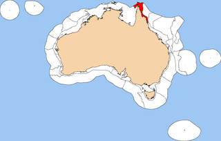
The Northeast Shelf Transition is a biogeographic region of Australia's coastal and continental shelf waters. It includes the tropical coastal waters of the northern Great Barrier Reef and the Torres Strait in northeastern-most Australia. It is a provincial level bioregion in the Integrated Marine and Coastal Regionalisation of Australia (IMCRA) system. It corresponds to the Torres Strait and Northern Great Barrier Reef marine ecoregion in the WWF's Marine Ecoregions of the World system.

The Northern Shelf Province, also known as Arnhem Coast to Gulf of Carpentaria, is a biogeographic region of Australia's continental shelf. It includes the coastal waters of Arnhem Land and the Gulf of Carpentaria in Northern Australia.

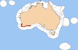
The Northwest Shelf Province, also known as Exmouth to Broome, is a biogeographic region of Australia's continental shelf.
The Southwest Shelf Province, also known as the Leeuwin marine ecoregion, is a biogeographic region of Australia's continental shelf. It includes the temperate coastal waters of Southwest Australia.

The Southwest Shelf Transition, also known as the Houtman marine ecoregion, is a biogeographic region of Australia's continental shelf and coastal waters. It includes the subtropical coastal waters of Southwest Australia.
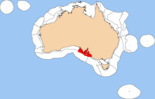
The Spencer Gulf Shelf Province, also known as the South Australian Gulfs marine ecoregion, is a biogeographic region of Australia's continental shelf and coastal waters. It includes the warm temperate coastal waters of South Australia's central coast. It is a provincial bioregion in the Integrated Marine and Coastal Regionalisation of Australia (IMCRA) system.

The Tasmanian Shelf Province is a biogeographic region of Tasmania's coastal and continental shelf waters. It covers the western, eastern, and southern coasts of Tasmania. It is a provincial level bioregion in the Integrated Marine and Coastal Regionalisation of Australia (IMCRA) system. The Tasmanian Shelf and adjacent Bass Strait Shelf provinces correspond to the Bassian marine ecoregion in the WWF's Marine Ecoregions of the World system.

The Western Bass Strait Shelf Transition is a biogeographic region of Australia's coastal and continental shelf waters. It is a transitional region between the cold-temperate Bass Strait Shelf and Tasmanian Shelf provinces and the warm-temperate Spencer Gulf Shelf Province. It is a provincial bioregion in the Integrated Marine and Coastal Regionalisation of Australia (IMCRA) system. It is the southern portion of the Western Bassian marine ecoregion in the World Wildlife Fund's (WWF) Marine Ecoregions of the World system.

The South-west Corner Marine Park is a marine protected area on the lower south west and southern coast of Western Australia, one of 14 in the South-west Marine Parks Network.

Lindsay Boyd Collins was an Australian marine geologist and sedimentologist, a faculty member in the department of applied geology at Curtin University in Western Australia. He was interested in studying the continental shelf of Western Australia and coral reefs. Collins was a prominent scholar, he has completed projects on continental shelf mapping of Australian shelves, microbialites and seagrass banks at Shark Bay, and coral reef studies at the Abrolhos, Ningaloo, Scott Reef, the Rowley Shoals and the Kimberley.
The Oceanic Shoals Marine Park is an Australian marine park offshore of the Northern Territory, near of Darwin. The marine park covers an area of 71,743 km2 (27,700 sq mi) and is assigned IUCN category VI. It is the largest of the 8 parks managed under the North Marine Parks Network.
The Kimberley Marine Park, formerly known as the Kimberley Commonwealth Marine Reserve and also known as the Great Kimberley Marine Park, is an Australian marine park offshore of Western Australia, near the Kimberley region. Proclaimed under the EPBC Act in 2013, the marine park covers an area of 74,469 km2 (28,753 sq mi) and is assigned IUCN category VI. It is one of the 13 parks managed under the North-west Marine Parks Network. It covers a number of state-managed marine parks.

The marine ecoregions of the South African exclusive economic zone are a set of geographically delineated regions of similar ecological characteristics on a fairly broad scale, covering the exclusive economic zone along the South African coast.
The East African coral coast is a marine ecoregion along the eastern coast of Africa. It extends along the coasts of Kenya, Tanzania, and northern Mozambique, from Lamu in Kenya to Angoche in Mozambique. It adjoins the Northern Monsoon Current Coast ecoregion to the north, and the Bight of Sofala/Swamp Coast ecoregion to the south.
The Bassian ecoregon is a biogeographic region of Australia's coastal and continental shelf waters. It includes the cold-temperate waters surrounding Tasmania, including the central Bass Strait between Tasmania and the southern Australian mainland. This ecoregion, designated in the Marine Ecoregions of the World system by the World Wildlife Fund (WWF), includes both the Bass Strait Shelf and Tasmanian Shelf provincial level bioregions from the Integrated Marine and Coastal Regionalisation of Australia (IMCRA) system.