The Botlek originally was the name of a stretch of the Nieuwe Maas river, part of the Rhine-Meuse delta near the Dutch cities of Vlaardingen and Spijkenisse in the province of Zuid-Holland. Specifically, it was the name of the strait that separated the island of Rozenburg from the sand bar of Welplaat. The strait itself was merely the continuation of the Nieuwe Maas, and the stretch of the river south of Rozenburg continued to be called Nieuwe Maas until the confluence with het Scheur formed the Brielse Maas estuary.
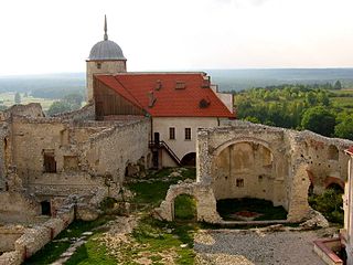
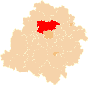
Janowiec is a village in Puławy County, Lublin Voivodeship, in eastern Poland. It is the seat of the gmina called Gmina Janowiec. It lies approximately 12 kilometres (7 mi) south-west of Puławy and 49 km (30 mi) west of the regional capital Lublin. The village has a population of 1,000.

Kobylniki is a village in the administrative district of Gmina Środa Śląska, within Środa Śląska County, Lower Silesian Voivodeship, in south-western Poland. Prior to 1945 it was in Germany. It lies approximately 11 kilometres (7 mi) north-east of Środa Śląska and 28 km (17 mi) north-west of the regional capital Wrocław.
Kępa-Kolonia is a village in the administrative district of Gmina Borzechów, within Lublin County, Lublin Voivodeship, in eastern Poland.
Osieki is a village in the administrative district of Gmina Borzytuchom, within Bytów County, Pomeranian Voivodeship, in northern Poland. It lies approximately 4 kilometres (2 mi) north-east of Borzytuchom, 13 km (8 mi) north-west of Bytów, and 82 km (51 mi) west of the regional capital Gdańsk.
Łęczyska is a village in the administrative district of Gmina Sulmierzyce, within Pajęczno County, Łódź Voivodeship, in central Poland.
Kolonia Bujnice is a settlement in the administrative district of Gmina Gorzkowice, within Piotrków County, Łódź Voivodeship, in central Poland.
Maksymów is a village in the administrative district of Gmina Ujazd, within Tomaszów Mazowiecki County, Łódź Voivodeship, in central Poland. It lies approximately 4 kilometres (2 mi) south-west of Ujazd, 12 km (7 mi) north-west of Tomaszów Mazowiecki, and 37 km (23 mi) south-east of the regional capital Łódź.
Olewin is a village in the administrative district of Gmina Wieluń, within Wieluń County, Łódź Voivodeship, in central Poland. It lies approximately 5 kilometres (3 mi) east of Wieluń and 84 km (52 mi) south-west of the regional capital Łódź.
Milejów is a village in the administrative district of Gmina Milejów, within Łęczna County, Lublin Voivodeship, in eastern Poland. It lies approximately 9 kilometres (6 mi) south of Łęczna and 25 km (16 mi) east of the regional capital Lublin. The parish church is the Church of Assumption of Blessed Virgin and St Anthony of Padua.
Mieczysławówka is a village in the administrative district of Gmina Grójec, within Grójec County, Masovian Voivodeship, in east-central Poland.
Wyborów is a village in the administrative district of Gmina Grabów nad Pilicą, within Kozienice County, Masovian Voivodeship, in east-central Poland. It lies approximately 2 kilometres (1 mi) north of Grabów nad Pilicą, 30 km (19 mi) north-west of Kozienice, and 56 km (35 mi) south of Warsaw.
Wiktorów is a village in the administrative district of Gmina Radzymin, within Wołomin County, Masovian Voivodeship, in east-central Poland. It lies approximately 4 kilometres (2 mi) east of Radzymin, 8 km (5 mi) north of Wołomin, and 27 km (17 mi) north-east of Warsaw.
Józefów Ochelski is a village in the administrative district of Gmina Pogorzela, within Gostyń County, Greater Poland Voivodeship, in west-central Poland.
Łąkie is a village in the administrative district of Gmina Rakoniewice, within Grodzisk Wielkopolski County, Greater Poland Voivodeship, in west-central Poland. It lies approximately 6 kilometres (4 mi) south-west of Rakoniewice, 18 km (11 mi) south-west of Grodzisk Wielkopolski, and 58 km (36 mi) south-west of the regional capital Poznań.
Kuszyn is a village in the administrative district of Gmina Mycielin, within Kalisz County, Greater Poland Voivodeship, in west-central Poland.
Czysta Woda is a settlement in the administrative district of Gmina Stężyca, within Kartuzy County, Pomeranian Voivodeship, in northern Poland. It lies approximately 5 kilometres (3 mi) west of Stężyca, 26 km (16 mi) south-west of Kartuzy, and 52 km (32 mi) west of the regional capital Gdańsk.
Cyganka is a village in the administrative district of Gmina Nowy Dwór Gdański, within Nowy Dwór Gdański County, Pomeranian Voivodeship, in northern Poland. It lies approximately 2 kilometres (1 mi) north of Nowy Dwór Gdański and 36 km (22 mi) south-east of the regional capital Gdańsk.
Gyűrűs is a village in Zala County, Hungary.
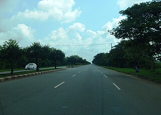
National Highway 1 (NR1), literally "The Road to Mandalay ") is an important south-north flowing highway of central Burma and the busiest road in the country. It connects Yangon to Meiktila where it joins the National Highway 4 going east and then NR1 continues north to Mandalay.