Bospop is an annual rock festival, happening in Weert, Netherlands.

The European route E 22 is one of the longest European routes. It has a length of about 5,320 km (3,310 mi). Many of the E-roads have been extended into Asia since the year 2000; the E 22 was extended on 24 June 2002.

Plantation Key is an island in Monroe County, Florida, United States. It is located in the upper Florida Keys on U.S. 1, between Key Largo and Windley Key.
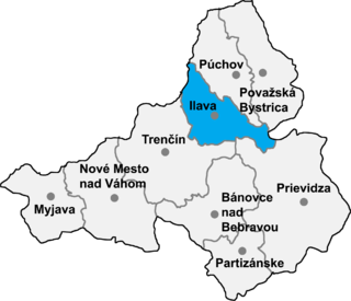
Ladce is a village and municipality in Ilava District in the Trenčín Region of north-western Slovakia.

Ysgol Gyfun Llangefni is a bilingual community comprehensive school for pupils aged 11 to 18 years old located in Llangefni, Anglesey. Pupils come from the town of Llangefni and the surrounding villages and rural areas. The school opened around 1953 and currently has 702 students on roll.
HD 125612 is a yellow main sequence star located approximately 188 light years away in the constellation Virgo. It is rich in heavy elements and has three known planets in orbit around it. A red dwarf companion star was detected in 2009 at a projected separation of 4750 AU. The possibility of a much closer companion to the primary star was also suggested, though this will need more observation to better define.
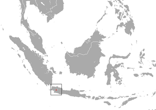
The Oriental shrew is a species of mammal in the family Soricidae. It is endemic to Indonesia. It is threatened by habitat loss.
In mathematical physics, the Degasperis–Procesi equation
Ceccia is an archaeological site in Corsica. It is located in the commune of Porto-Vecchio.

Jiangmen East railway station, formerly Jiangmen railway station, is an elevated station on the Guangzhou-Zhuhai Intercity Mass Rapid Transit Jiangmen Spur Line.
The Royton Branch was a mile-long Lancashire & Yorkshire Railway built double track branch railway line in Greater Manchester, England, that ran from Royton Junction on the Oldham Loop Line to Royton.
Yattafène is a town and commune in Tizi Ouzou Province in northern Algeria.
Anekäbrud is an island belonging to the country of Estonia. Anekäbrud is referenced in a book titled Islands of Estonia.
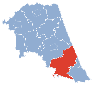
Haig is a community in the city of St. Catharines, Ontario, Canada. Its borders are Regional Road 83 to the north, Regional Road 77 to the south, Regional Road 44 to the east, and the Twelve Mile Creek to the west.
Kınık, Kazan is a village in the District of Kazan, Ankara Province, Turkey.
The Town of Newtown was a local government area in the Darling Downs region of Queensland, Australia, loosely based on the current Newtown, a suburb of Toowoomba. It existed between 1913 and 1917.
St. Laurentiusbukta is a bay in Albert I Land at Spitsbergen, Svalbard. The bay is located on Reuschhalvøya, east of Scheibukta, at the southern side of Bjørnfjorden. It is named after the saint Laurentius.

Jiangxia Bridge East Station is a metro station on Line 1 of the Ningbo Rail Transit that started operations on 30 May 2014. It is situated under Zhongshan East Road in the Yinzhou District of Ningbo City, Zhejiang Province, eastern China.
Lycée Charles de Gaulle is a French international school in Damascus, Syria. The school serves the levels maternelle (preschool) through lycée.
The International Gartenbauausstellung 73 was a garden festival held in Hamburg, Germany, which was recognized by the Bureau International des Expositions. The exposition was the 6th edition of the international horticultural exposition organised under the auspices of the Association of International Horticultural Producers (AIPH) and the second held at Planten un Blomen park in Hamburg. The exhibition took place on the same site where IGA 63 was held a decade earlier. There were some changes to the site location, such as the vaulting of the Marseillerstrasse so that visitors throughout the area without crossing could visit. Instead of a cable car, a park trail was constructed on the site to provide for visitors. The line had four stations and took 30 minutes to complete a lap.