Tołkacze

Last updated
Tołkacze
Village
Country Flag of Poland.svg  Poland
Voivodeship Podlaskie
County Sokółka
Gmina Szudziałowo

Tołkacze [tɔu̯ˈkat͡ʂɛ] is a village in the administrative district of Gmina Szudziałowo, within Sokółka County, Podlaskie Voivodeship, in north-eastern Poland, close to the border with Belarus. [1]

Village Small clustered human settlement smaller than a town

A village is a clustered human settlement or community, larger than a hamlet but smaller than a town, with a population ranging from a few hundred to a few thousand. Though villages are often located in rural areas, the term urban village is also applied to certain urban neighborhoods. Villages are normally permanent, with fixed dwellings; however, transient villages can occur. Further, the dwellings of a village are fairly close to one another, not scattered broadly over the landscape, as a dispersed settlement.
Gmina Szudziałowo Gmina in Podlaskie, Poland

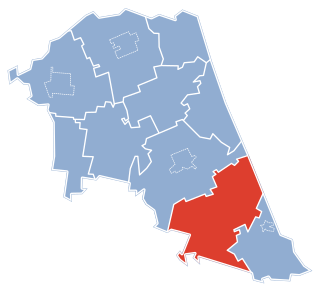
Gmina Szudziałowo is a rural gmina in Sokółka County, Podlaskie Voivodeship, in north-eastern Poland, on the border with Belarus. Its seat is the village of Szudziałowo, which lies approximately 16 kilometres (10 mi) south-east of Sokółka and 40 km (25 mi) north-east of the regional capital Białystok.
Sokółka County County in Podlaskie, Poland

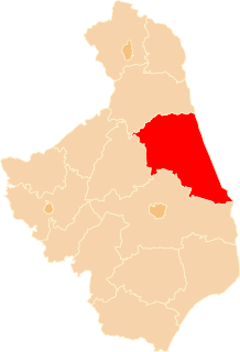
Sokółka County is a unit of territorial administration and local government (powiat) in Podlaskie Voivodeship, north-eastern Poland, on the border with Belarus. It was created on 1 January 1999 as a result of the Polish local government reforms passed in 1998. Its administrative seat and largest town is Sokółka, which lies 39 kilometres (24 mi) north-east of the regional capital Białystok. The county also contains the towns of Dąbrowa Białostocka, lying 30 km (19 mi) north of Sokółka, Krynki, lying 24 km (15 mi) south-east of Sokółka, and Suchowola, 33 km (21 mi) north-west of Sokółka.

Related Research Articles

National Assembly (São Tomé and Príncipe)

The unicameral National Assembly is São Tomé and Príncipe's legislative body.

Französische Straße (Berlin U-Bahn) Berlin U-Bahn station

Französische Straße is a Berlin U-Bahn underground station of the U 6 located under the road Friedrichstraße in central Berlin.

Liboc neighborhood of Prague 6

Liboc is a district of the city of Prague, the capital of the Czech Republic. It is part of Prague 6, located near Divoká Šárka.

Machtlfinger Straße (Munich U-Bahn) metro station in Munich, Germany

Machtlfinger Straße is an U-Bahn station in Munich on the U3.

Omas District District in Lima, Peru

Omas District is one of thirty-three districts of the province Yauyos in Peru.

Kolonia Łódź is a village in the administrative district of Gmina Lubraniec, within Włocławek County, Kuyavian-Pomeranian Voivodeship, in north-central Poland.

Chylin, Lublin Voivodeship Village in Lublin, Poland

Chylin is a village in the administrative district of Gmina Wierzbica, within Chełm County, Lublin Voivodeship, in eastern Poland. It lies approximately 3 kilometres (2 mi) north of Wierzbica, 19 km (12 mi) north-west of Chełm, and 54 km (34 mi) east of the regional capital Lublin.

Ruda Rzeczka is a village in the administrative district of Gmina Czarna Białostocka, within Białystok County, Podlaskie Voivodeship, in north-eastern Poland.

Podłubianka is a village in the administrative district of Gmina Janów, within Sokółka County, Podlaskie Voivodeship, in north-eastern Poland.

Keytikh Place in Absheron, Azerbaijan

Keytikh is a village in the Absheron Rayon of Azerbaijan.

Madagiz Place in Tartar, Azerbaijan

Madagiz is a village in the Tartar district of Azerbaijan. It is located 30 kilometers north-west of the left bank of the river Tartar. The village is currently occupied by Armenian forces as a result of the Nagorno-Karabakh War. It was also one of the sites of the military clashes in April 2016.

Załęże is a village in the administrative district of Gmina Wieczfnia Kościelna, within Mława County, Masovian Voivodeship, in east-central Poland.

Antonia is a village in the administrative district of Gmina Łyse, within Ostrołęka County, Masovian Voivodeship, in east-central Poland.

Rawica-Kolonia is a village in the administrative district of Gmina Tczów, within Zwoleń County, Masovian Voivodeship, in east-central Poland.

Nowa Wieś, Gmina Kaźmierz Village in Greater Poland, Poland

Nowa Wieś used to be a village in the administrative district of Gmina Kaźmierz, within Szamotuły County, Greater Poland Voivodeship, in west-central Poland. It is a part of Kaźmierz at now. It lies approximately 10 kilometres (6 mi) south of Szamotuły and 27 km (17 mi) north-west of the regional capital Poznań.

Strużka, Chojnice County Settlement in Pomeranian, Poland

Strużka is a settlement in the administrative district of Gmina Chojnice, within Chojnice County, Pomeranian Voivodeship, in northern Poland. It lies approximately 12 kilometres (7 mi) north of Chojnice and 96 km (60 mi) south-west of the regional capital Gdańsk.

Borki, Nowe Miasto County Settlement in Warmian-Masurian, Poland

Borki is a settlement in the administrative district of Gmina Biskupiec, within Nowe Miasto County, Warmian-Masurian Voivodeship, in northern Poland.

Tân Hòa, Bà Rịa–Vũng Tàu Commune and village in Bà Rịa–Vũng Tàu, Vietnam

Tân Hoà is a commune () and village in Tân Thành District, Bà Rịa–Vũng Tàu Province, in Vietnam.

Hosszúvölgy is a village in Zala County, Hungary.

Hrushawka (Minsk Metro) Minsk Metro Station

Hrushawka is a Minsk Metro station. It was opened on November 7, 2012 along with the metro stations of Mikhalova and Pyatrowshchyna.

References


Coordinates: 53°19′53″N23°30′53″E / 53.33139°N 23.51472°E / 53.33139; 23.51472

Geographic coordinate system Coordinate system

A geographic coordinate system is a coordinate system that enables every location on Earth to be specified by a set of numbers, letters or symbols. The coordinates are often chosen such that one of the numbers represents a vertical position and two or three of the numbers represent a horizontal position; alternatively, a geographic position may be expressed in a combined three-dimensional Cartesian vector. A common choice of coordinates is latitude, longitude and elevation. To specify a location on a plane requires a map projection.