
Ostrowo is a village in the administrative district of Gmina Cekcyn, within Tuchola County, Kuyavian-Pomeranian Voivodeship, in north-central Poland. It lies approximately 4 kilometres (2 mi) east of Cekcyn, 15 km (9 mi) east of Tuchola, and 51 km (32 mi) north of Bydgoszcz.
Jasiel is a former village in the administrative district of Gmina Komańcza, within Sanok County, Subcarpathian Voivodeship, in south-eastern Poland, close to the border with Slovakia. It lies approximately 10 kilometres (6 mi) north-west of Komańcza, 30 km (19 mi) south-west of Sanok, and 75 km (47 mi) south of the regional capital Rzeszów.
Falejówka is a village in the administrative district of Gmina Sanok, within Sanok County, Subcarpathian Voivodeship, in south-eastern Poland. It lies approximately 10 kilometres (6 mi) north of Sanok and 46 km (29 mi) south of the regional capital Rzeszów.
Raczkowa is a village in the administrative district of Gmina Sanok, within Sanok County, Subcarpathian Voivodeship, in south-eastern Poland. It lies approximately 12 kilometres (7 mi) north of Sanok and 45 km (28 mi) south of the regional capital Rzeszów.
Tarnawa Górna is a village in the administrative district of Gmina Zagórz, within Sanok County, Subcarpathian Voivodeship, in south-eastern Poland. It lies approximately 6 kilometres (4 mi) south of Zagórz, 10 km (6 mi) south of Sanok, and 66 km (41 mi) south of the regional capital Rzeszów.
Bażanówka is a village in the administrative district of Gmina Zarszyn, within Sanok County, Subcarpathian Voivodeship, in south-eastern Poland. It lies approximately 4 kilometres (2 mi) north-east of Zarszyn, 14 km (9 mi) north-west of Sanok, and 49 km (30 mi) south of the regional capital Rzeszów.

Długie is a village in the administrative district of Gmina Zarszyn, within Sanok County, Subcarpathian Voivodeship, in south-eastern Poland. It lies approximately 3 kilometres (2 mi) east of Zarszyn, 13 km (8 mi) west of Sanok, and 51 km (32 mi) south of the regional capital Rzeszów.
Granicznik is a village in the administrative district of Gmina Zarszyn, within Sanok County, Subcarpathian Voivodeship, in south-eastern Poland. It lies approximately 4 kilometres (2 mi) north-east of Zarszyn, 15 km (9 mi) north-west of Sanok, and 47 km (29 mi) south of the regional capital Rzeszów.

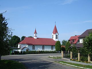
Jaćmierz is a village in the administrative district of Gmina Zarszyn, within Sanok County, Subcarpathian Voivodeship, in south-eastern Poland. It lies approximately 4 kilometres (2 mi) north of Zarszyn, 17 km (11 mi) north-west of Sanok, and 47 km (29 mi) south of the regional capital Rzeszów.
Koszary is a settlement in the administrative district of Gmina Zarszyn, within Sanok County, Subcarpathian Voivodeship, in south-eastern Poland. It lies approximately 3 kilometres (2 mi) north-east of Zarszyn, 14 km (9 mi) west of Sanok, and 49 km (30 mi) south of the regional capital Rzeszów.
Mroczkówki is a settlement in the administrative district of Gmina Zarszyn, within Sanok County, Subcarpathian Voivodeship, in south-eastern Poland. It lies approximately 6 kilometres (4 mi) south of Zarszyn, 15 km (9 mi) west of Sanok, and 56 km (35 mi) south of the regional capital Rzeszów.

Odrzechowa is a village in the administrative district of Gmina Zarszyn, within Sanok County, Subcarpathian Voivodeship, in south-eastern Poland. It lies approximately 4 kilometres (2 mi) south-west of Zarszyn, 17 km (11 mi) west of Sanok, and 52 km (32 mi) south of the regional capital Rzeszów.

Pielnia is a village in the administrative district of Gmina Zarszyn, within Sanok County, Subcarpathian Voivodeship, in south-eastern Poland. It lies approximately 6 kilometres (4 mi) south-east of Zarszyn, 11 km (7 mi) west of Sanok, and 54 km (34 mi) south of the regional capital Rzeszów.
Posada Zarszyńska is a village in the administrative district of Gmina Zarszyn, within Sanok County, Subcarpathian Voivodeship, in south-eastern Poland. It lies close to Zarszyn, approximately 15 km (9 mi) west of Sanok and 50 km (31 mi) south of the regional capital Rzeszów.

Zarszyn is a village in Sanok County, Subcarpathian Voivodeship, in south-eastern Poland. It is the seat of the gmina called Gmina Zarszyn. It lies approximately 15 kilometres (9 mi) west of Sanok and 50 km (31 mi) south of the regional capital Rzeszów.
Leszczowate is a village in the administrative district of Gmina Ustrzyki Dolne, within Bieszczady County, Subcarpathian Voivodeship, in south-eastern Poland. It lies approximately 8 kilometres (5 mi) north of Ustrzyki Dolne and 72 km (45 mi) south-east of the regional capital Rzeszów.
Wydrne is a village in the administrative district of Gmina Czarna, within Bieszczady County, Subcarpathian Voivodeship, in south-eastern Poland, close to the border with Ukraine. It lies approximately 8 kilometres (5 mi) west of Czarna, 14 km (9 mi) south of Ustrzyki Dolne, and 90 km (56 mi) south-east of the regional capital Rzeszów.
Murowanka is a village in the administrative district of Gmina Pokrzywnica, within Pułtusk County, Masovian Voivodeship, in east-central Poland. It lies approximately 7 kilometres (4 mi) south-east of Pokrzywnica, 15 km (9 mi) south of Pułtusk, and 40 km (25 mi) north of Warsaw.
Kózki is a village in the administrative district of Gmina Biała Piska, within Pisz County, Warmian-Masurian Voivodeship, in northern Poland. It lies approximately 6 kilometres (4 mi) south of Biała Piska, 19 km (12 mi) east of Pisz, and 107 km (66 mi) east of the regional capital Olsztyn.


