Nueva Palmira

Last updated
Nueva Palmira
City
OdacirAr 128.JPG
Uruguay location map.svg
Red pog.svg
Nueva Palmira
Coordinates: 33°53′0″S58°25′0″W / 33.88333°S 58.41667°W / -33.88333; -58.41667
CountryFlag of Uruguay.svg  Uruguay
Department Flag of Colonia Department.svg  Colonia
Founded1831
Founded byFelipe Santiago Torres Leiva
Population
 (2011 Census)
  Total9,857
Time zone UTC -3
Postal code
70101
Dial plan +598 4544 (+4 digits)

Nueva Palmira is a city in Colonia Department in south-western Uruguay.

Contents

Geography

It is located on the east bank of Uruguay River, about 86 kilometres (53 mi) northwest of the departmental capital Colonia del Sacramento.

History

A "Pueblo" (village) named "Higueritas" was founded here on 26 October 1831 by Felipe Santiago Torres Leiva. Its status was elevated to "Villa" (town) by the Act of Ley Nº 7.257 on 17 August 1920 and then to "Ciudad" (city) by the Act of Ley Nº 11961 on 1 July 1953. [1] The city got its name from the ancient city of Palmira in Syria (Aramaic for City of Date Trees). [2]

Population

In 2011 Nueva Palmira had a population of 9,857. [3]

YearPopulation
19084,191
19636,307
19757,146
19857,151
19968,339
20049,230
20119,857

Source: Instituto Nacional de Estadística de Uruguay [1]

Features

Nueva Palmira is considered the second most important commercial port in Uruguay after the Port of Montevideo and offers docking facility for yachts. There are several beaches along its shore, like Playa Higuerita, Playa Eolo, Playa Corbacho and Playa Los Vascos, while the northern end of the city, along the shore, is a resort called Balneario Brisas del Uruguay.[ citation needed ]

Main streets and squares

The main streets are General J.G. Artigas and fellipe Fontana, both running SE to NW, converge at the southeastern end of town and join with Ruta 21 towards Carmelo. The other main street, Chile, runs SW to NE and extends to Ruta 21 towards Dolores and Mercedes of Soriano Department.[ citation needed ]

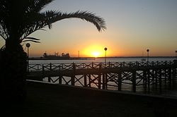
The main squares of the city are Plaza de los 33 Patriotas, which takes up two blocks and extends to the Muelle Viejo (Old Dock) at the waterfront, and Plaza Artigas, featuring a monument to José Gervasio Artigas and the main church of the city. There is also Plaza de Deportes which offers open doors sports facilities. The city has also a zoological garden in its northern part.[ citation needed ]

Places of worship

Government

The city mayor as of July 2010 is Andrés Passarino. [4]

Notable people

See also

Related Research Articles

The transport network in Uruguay consists of 1,673 km of rail network, 7,743 km of paved roads, 1,600 km of navigable waterways, and 11 airports with paved roads.

<span class="mw-page-title-main">Colonia del Sacramento</span> Capital city in Colonia, Uruguay

Colonia del Sacramento is a city in southwestern Uruguay, by the Río de la Plata, facing Buenos Aires, Argentina. It is one of the oldest towns in Uruguay and capital of the Colonia Department. It has a population of around 27,000.

<span class="mw-page-title-main">Fray Bentos</span> Capital city in Río Negro Department, Uruguay

Fray Bentos is the capital city of the Río Negro Department, in south-western Uruguay, at the Argentina-Uruguay border, near the Argentine city of Gualeguaychú. Its port on the Uruguay River is one of the nation's most important harbours. The city hosts the first campus of the Technological University, beside the historically relevant industrial complex Anglo, a World Heritage site.

<span class="mw-page-title-main">Minas, Uruguay</span> Capital city in Lavalleja, Uruguay

Minas is the capital of the Lavalleja Department in Uruguay. As of the census of 2011, it is the twelfth-most populated city in the country.

<span class="mw-page-title-main">Salto, Uruguay</span> Department capital city in Salto, Uruguay

Salto is the capital city of the Salto Department in northwestern Uruguay. As of the 2011 census it had a population of 104,028 and is the third most populated city in Uruguay, after Montevideo and Ciudad de la Costa.

Salto Department is a department of the northwestern region of Uruguay. It has an area of 14,163 km2 (5,468 sq mi) and a population of 124,878. Its capital is the city of Salto. It borders Artigas Department to its north, Paysandú Department to its south, the departments of Rivera and Tacuarembó to its east and has the Río Uruguay flowing at its west, separating it from Argentina.

<span class="mw-page-title-main">Piriápolis</span> City & Municipality in Maldonado, Uruguay

Piriápolis is a city in the Maldonado Department of Uruguay. It is an important summer resort in the country, predating the larger and better known resort town of Punta del Este. Because it is mainly used as a resort, it has a relatively small permanent population for a city of its size.

<span class="mw-page-title-main">Montevideo Department</span> Department of Uruguay

Montevideo is a department (departamento) of Uruguay. It is by far the smallest department in area, but also by far the most populated. Its capital is the city of Montevideo, which is also the national capital. While most of the department is covered by the capital city, there are still smaller towns within its limits.

<span class="mw-page-title-main">Carmelo, Uruguay</span> City in Colonia, Uruguay

Carmelo is a city located in the department of Colonia of western Uruguay, noted for its wineries.

<span class="mw-page-title-main">Chuy</span> City in Rocha, Uruguay

Chuy is a city in the extreme east of Uruguay, in the Rocha Department, 340 kilometres (211 mi) northeast of Montevideo. It lies on the border with Brazil, separated from its Brazilian sister town of Chuí only by a shared avenue that serves as the border, and by the Arroyo Chuy (stream) to the east. Chuy's population is currently 9,675 residents as of 2011.

<span class="mw-page-title-main">Colonia Palma</span> Village in Artigas Department, Uruguay

Colonia Palma is a village in the Artigas Department of northern Uruguay.

<span class="mw-page-title-main">Rail transport in Uruguay</span>

The Uruguayan railway network has about 2900 km (1802 mi) of lines, all of 1,435 mm gauge, diesel traction with only 11 km (7 mi) of double track. Only half of the network is currently active. All the Uruguayan lines start from Montevideo, connecting the cities of Paysandú, Salto, Rivera and Río Branco. The rest of the lines (closed) connected the capital city with Fray Bentos, Cuareim, Artigas, Km. 329, Melo, La Paloma and Colonia del Sacramento.

<span class="mw-page-title-main">Atlántida, Uruguay</span> City in Canelones, Uruguay

Atlántida is a resort town of the Costa de Oro in Canelones Department of Uruguay, 45 kilometres (28 mi) east of Montevideo.

<span class="mw-page-title-main">Rosario, Uruguay</span> City in Colonia, Uruguay

Rosario, also known as Rosario Oriental, Villa del Rosario, or Rosario del Colla, is a small city located within the Colonia Department, in southern Uruguay. It is home to about 10,000 people.

Cardona is a city in the Soriano Department, in southwestern Uruguay. The main square of the city is Plaza Artigas, featuring a monument to General Artigas.

Juan Lacaze, or Juan L. Lacaze, is a city located in southwestern Uruguay, within the Colonia Department.

<span class="mw-page-title-main">Barros Blancos</span> City in Canelones, Uruguay

Barros Blancos is a city in the Canelones Department of southern Uruguay. In 1976, it had been renamed to Juan Antonio Artigas, after commanding officer Juan Antonio Artigas, grandfather of the national hero José Gervasio Artigas, but the old name was reinstated in 2007.

Ombúes de Lavalle is a small city located in the north of Colonia Department in southwestern Uruguay. It is named after the Argentine General Juan Lavalle. The term «Ombúes» is the Spanish plural for «Ombú», a tree originary of the Pampas region, in southern South America, and a national symbol of both Argentina and Uruguay.

<span class="mw-page-title-main">Route 3 (Uruguay)</span> Road in Uruguay

Route 3 is a national route of Uruguay. In 1975, it was assigned the name General José Artigas, the foremost national hero of Uruguay. It is one of the most important highways in the country along with Route 5, connecting the south coast near Rafael Perazza with Bella Unión in the extreme northwest. The road is approximately 592 kilometres (368 mi) in length.

References

  1. 1 2 "Statistics of urban localities (1908–2004)" (PDF). INE. 2012. Retrieved 3 September 2012.
  2. "La importancia de Nueva Palmira". El Pais. 2007-01-31. Archived from the original on 14 March 2011. Retrieved 3 September 2012.
  3. "Censos 2011 Cuadros Colonia". INE. 2012. Retrieved 25 August 2012.
  4. "MUNICIPIOS DE URUGUAY" at the Intendents' Congress website Archived 2012-03-08 at the Wayback Machine (in Spanish)