Nádasd

Last updated
Nádasd
Nadasd1.jpg
HUN Nadasd COA.jpg
Coat of arms
Hungary location map.svg
Red pog.svg
Nádasd
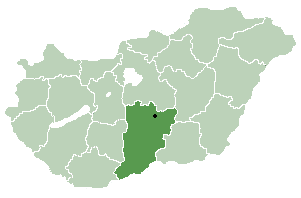
Location of Nádasd in Hungary
Coordinates: 46°57′55″N16°36′26″E / 46.96528°N 16.60722°E / 46.96528; 16.60722
Country Hungary
Region Western Transdanubia
County Vas
Subregion Körmendi
RankVillage
Area
[1]
  Total 35.60 km2 (13.75 sq mi)
Population
(1 January 2008) [2]
  Total1,342
  Density38/km2 (98/sq mi)
Time zone UTC+1 (CET)
  Summer (DST) UTC+2 (CEST)
Postal code
9915
Area code +36 94
KSH code 06716 [3]
Website www.nadasd.hu

Nádasd is a village in Vas county, Hungary.

Related Research Articles

Szalkszentmárton Place in Bács-Kiskun, Hungary

Szalkszentmárton is a village and municipality in Bács-Kiskun county, in the Southern Great Plain region of southern Hungary.

Géderlak Place in Bács-Kiskun, Hungary

Géderlak is a village in Bács-Kiskun county, in the Southern Great Plain region of southern Hungary.

Petőfiszállás Place in Bács-Kiskun, Hungary

Petőfiszállás is a village in Bács-Kiskun county, in the Southern Great Plain region of southern Hungary.

Telekgerendás Place in Békés, Hungary

Telekgerendás is a small village in Békés County, in the Southern Great Plain region of south-east Hungary.

Szabadkígyós Place in Békés, Hungary

Szabadkígyós is a village in Békés County, in the Southern Great Plain region of south-east Hungary.

Körösladány Town in Békés, Hungary

Körösladány is a town in Békés County, in the Southern Great Plain region of south-east Hungary.

Körösújfalu Place in Békés, Hungary

Körösújfalu is a village in Békés County, in the Southern Great Plain region of south-east Hungary.

Királyhegyes Place in Csongrád, Hungary

Királyhegyes is a village in Csongrád county, in the Southern Great Plain region of southern Hungary.

Nagyszekeres Place in Szabolcs-Szatmár-Bereg, Hungary

Nagyszekeres is a village in Szabolcs-Szatmár-Bereg county, in the Northern Great Plain region of eastern Hungary.

Nemescsó Place in Western Transdanubia, Hungary

Nemescsó is a village in Vas county, Hungary.

Rátót Place in Western Transdanubia, Hungary

Rátót is a village in Vas county, Hungary.

Vasszentmihály Place in Western Transdanubia, Hungary

Vasszentmihály is a village in Vas county, Hungary.

Bölcske Place in Southern Transdanubia, Hungary

Bölcske is a village in Tolna County, Hungary.

Értény Place in Southern Transdanubia, Hungary

Értény is a village in Tolna County, Hungary.

Gősfa is a village in Zala County, Hungary.

Iklódbördőce is a village in Zala County, Hungary.

Ortaháza is a village in Zala County, Hungary.

Rédics Village in Western Transdanubia, Hungary

Rédics is a village in Zala County, Hungary.

Szentpéterfölde is a village in Zala County, Hungary.

Zalabér is a village in Zala County, Hungary.

References

Coordinates: 46°58′N16°37′E / 46.967°N 16.617°E / 46.967; 16.617

Geographic coordinate system Coordinate system

A geographic coordinate system is a coordinate system that enables every location on Earth to be specified by a set of numbers, letters or symbols. The coordinates are often chosen such that one of the numbers represents a vertical position and two or three of the numbers represent a horizontal position; alternatively, a geographic position may be expressed in a combined three-dimensional Cartesian vector. A common choice of coordinates is latitude, longitude and elevation. To specify a location on a plane requires a map projection.