
Dodge County is a county located in the U.S. state of Wisconsin. As of the 2020 census, the population was 89,396. Its county seat is Juneau. The county was created from the Wisconsin Territory in 1836 and organized in 1844.
Mathis is a city in San Patricio County, Texas, United States. The population was 4,333 at the 2020 census.

Cassville is a village in Grant County, Wisconsin, United States. The population was 777 at the 2020 census. The village is located along the Mississippi River, opposite from the mouth of the Turkey River. It is surrounded by the Town of Cassville.

The Wisconsin River is a tributary of the Mississippi River in the U.S. state of Wisconsin. At approximately 430 miles long, it is the state's longest river. The river's name was first recorded in 1673 by Jacques Marquette as "Meskousing" from his Indian guides - most likely Miami for "river running through a red place."
Lake Koshkonong is a reservoir in southern Wisconsin, which was transformed from its original marshland by the construction of the Indianford Dam in 1932. The lake lies along the Rock River, with the river acting as both the primary inflow and the primary outflow for the lake. Lake Koshkonong begins 5.5 mi (8.9 km) downriver from Fort Atkinson, with the large majority of the lake located in southwestern Jefferson County. Small portions of the lake extend into southeastern Dane and northern Rock counties.

Table Rock Lake is an artificial lake or reservoir in the Ozarks of southwestern Missouri and northwestern Arkansas in the United States. Designed, built and operated by the U.S. Army Corps of Engineers, the lake is impounded by Table Rock Dam, which was constructed from 1954 to 1958 on the White River.
Lake Anna is one of the largest freshwater inland reservoirs in Virginia, covering an area of 13,000 acres (53 km2), and located 72 miles (116 km) south of Washington, D.C., in Louisa and Spotsylvania counties. The lake is easily accessible from Fredericksburg, Richmond, Charlottesville, Northern Virginia, and Washington, D.C., and is one of the most popular recreational lakes in the state.
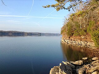
Watts Bar Lake is a reservoir on the Tennessee River created by Watts Bar Dam as part of the Tennessee Valley Authority system.

Tainter Lake is a small reservoir in north central Dunn County, Wisconsin, on the Red Cedar River at its confluence with the Hay River. The lake was created by a hydroelectric dam (about 3 miles downstream on the Red Cedar at Cedar Falls. The lake, a popular resort and fishing spot, has a surface area of approximately 2 square miles.

The Door Peninsula is a peninsula in eastern Wisconsin, separating the southern part of the Green Bay from Lake Michigan. The peninsula includes northern Kewaunee County, northeastern Brown County, and the mainland portion of Door County. It is on the western side of the Niagara Escarpment. Well known for its cherry and apple orchards, the Door Peninsula is a popular tourism destination. With the 1881 completion of the Sturgeon Bay Ship Canal, the northern half of the peninsula became an island.

The Black River is a river in west-central Wisconsin and tributary of the Mississippi River. The river is approximately 190 miles (310 km) long. During the 19th century, pine logs were rafted down the Black, heading for sawmills at La Crosse and points beyond.

Lake Dardanelle is a major reservoir on the Arkansas River in Arkansas, USA. and is an integral part of the McClellan-Kerr Arkansas River Navigation System (MKARNS), which allows barge transportation from the Mississippi River to the Tulsa Port of Catoosa in northeastern Oklahoma. MKARNS went into service along its full length in 1971.

General Zebulon Pike Lock and Dam No. 11 is a lock and dam located between Dubuque, Iowa, and rural Grant County, Wisconsin, on the Upper Mississippi River.

The Flambeau River is a tributary of the Chippewa River in northern Wisconsin, United States. The Chippewa is in turn a tributary of the upper Mississippi River. The Flambeau drains an area of 1,860 square miles (4,800 km2) and descends from an elevation of approximately 1,570 feet (480 m) to 1,060 feet (320 m) above sea level. The Flambeau is an important recreational destination in the region. It is notable among canoeists in the Midwest for outstanding canoe camping, including excellent scenery, fishing and whitewater. The river and its forks have a variety of possible trip lengths from short day outings, to overnight camping, to voyages of a week or more.

Lake Onalaska is a reservoir located on the Black River and Mississippi River between Wisconsin, and Minnesota. It is approximately 4 miles (6.4 km) across, and is the widest point on the Mississippi River. Located in La Crosse County in the state of Wisconsin, its latitude and longitude are 43°52′01″N091°18′26″W. The lake is 7,688 acres (31.11 km2) and is shored by the city from which its name came from: Onalaska, Wisconsin. It sits at an altitude of 633 feet and is 43 feet (13 m) deep at its deepest.
The Bay-Lakes Council is the Boy Scouts of America (BSA) council serving eastern Wisconsin and the Upper Peninsula of Michigan. Headquartered in Appleton, Wisconsin, it is geographically one of the largest local BSA councils. Bay-Lakes Council #635 was formed on July 1, 1973, the product of a merger between six east Wisconsin councils. The council is served by Kon Wapos Lodge of the Order of the Arrow.

Lake Petenwell is an artificial lake on the Wisconsin River in central Wisconsin. It is located in Adams, Juneau, and Wood counties next to Castle Rock Lake. It covers over 23,000 acres (93 km2) and is 42 feet (13 m) deep.
Dexterville is an unincorporated community in the town of Dexter, Wood County, Wisconsin, United States. It is located at the intersection of Wisconsin Highway 80 and Wisconsin Highway 54.

The Mondeaux Dam Recreation Area is a public park in the forest in the town of Westboro, Wisconsin, United States. The Civilian Conservation Corps (CCC) and Work Projects Administration (WPA) created the lake and facilities during the Great Depression.

Puckaway Lake also referred to as Lake Puckaway is a lake in Green Lake County and Marquette County, Wisconsin. The lake has a surface area of 5,013 acres (20.29 km2) and a max depth of 5 ft (1.5 m). Most of the lake has a muck bottom and is shallow with an average depth of 3 ft (0.91 m).
