
The Balkans, corresponding partially with the Balkan Peninsula, is a geographical area in southeastern Europe with various geographical and historical definitions. The region takes its name from the Balkan Mountains that stretch throughout the whole of Bulgaria. The Balkan Peninsula is bordered by the Adriatic Sea in the northwest, the Ionian Sea in the southwest, the Aegean Sea in the south, the Turkish straits in the east, and the Black Sea in the northeast. The northern border of the peninsula is variously defined. The highest point of the Balkans is Musala, 2,925 metres (9,596 ft), in the Rila mountain range, Bulgaria.

Croatia, officially the Republic of Croatia, is a country in Central and Southeast Europe, on the coast of the Adriatic Sea. It borders Slovenia to the northwest, Hungary to the northeast, Serbia to the east, Bosnia and Herzegovina and Montenegro to the southeast, and shares a maritime border with Italy to the west. Its capital and largest city, Zagreb, forms one of the country's primary subdivisions, with twenty counties. Other major urban centers include Split, Rijeka and Osijek. The country spans 56,594 square kilometres, and has a population of nearly 3.9 million.

The geography of Croatia is defined by its location—it is described as located at the crossroads of Central Europe and Southeast Europe, or within the wider region of Southern Europe. Croatia's territory covers 56,594 km2 (21,851 sq mi), making it the 127th largest country in the world. Bordered by Slovenia in the northwest, Hungary in the northeast, Bosnia and Herzegovina and Serbia in the east, Montenegro in the southeast and the Adriatic Sea in the south, it lies mostly between latitudes 42° and 47° N and longitudes 13° and 20° E. Croatia's territorial waters encompass 18,981 square kilometres (7,329 sq mi) in a 12 nautical miles wide zone, and its internal waters located within the baseline cover an additional 12,498 square kilometres (4,826 sq mi).

Dalmatia is one of the four historical regions of Croatia, alongside Central Croatia, Slavonia, and Istria, located on the east shore of the Adriatic Sea in Croatia.

The Dinaric Alps, also Dinarides, are a mountain range in Southern and Southcentral Europe, separating the continental Balkan Peninsula from the Adriatic Sea. They stretch from Italy in the northwest through Slovenia, Croatia, Bosnia and Herzegovina, Serbia, Montenegro, and Kosovo to Albania in the southeast.

Southern Europe is the southern region of Europe. It is also known as Mediterranean Europe, as its geography is marked by the Mediterranean Sea. Definitions of southern Europe include some or all of these countries and regions: Albania, Andorra, Bosnia and Herzegovina, Bulgaria, Croatia, Cyprus, Gibraltar, Greece, southern Italy, Malta, Monaco, Montenegro, North Macedonia, Portugal, San Marino, Serbia, Slovenia, southern France, Spain, Turkey, and Vatican City.

Split-Dalmatia County is a central-southern Dalmatian county in Croatia. The administrative center is Split. The population of the county is 455,242 (2011). The land area is 4.540 km2, the total area is 14.106,40 km2. Split-Dalmatia County is Croatia's most rapidly urbanising and developing region, as economic opportunities and living standards are among the highest alongside capital Zagreb and Istria County.

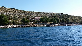
Cres is an Adriatic island in Croatia. It is one of the northern islands in the Kvarner Gulf and can be reached via ferry from Rijeka, Krk island or from the Istrian peninsula.

The Učka is a mountain range in western Croatia. It rises behind the Opatija riviera, on the eastern side of the Istrian peninsula.

Croatian cuisine is heterogeneous and is known as a cuisine of the regions, since every region of Croatia has its own distinct culinary tradition. Its roots date back to ancient times. The differences in the selection of foodstuffs and forms of cooking are most notable between those in mainland and those in coastal regions. Mainland cuisine is more characterized by the earlier Slavic and the more recent contacts with Hungarian, German and Turkish cuisine, using lard for cooking, and spices such as black pepper, paprika, and garlic. The coastal region bears the influences of Greek and Roman cuisine, as well as of the later Mediterranean cuisine, in particular Italian. Coastal cuisines use olive oil, herbs and spices such as rosemary, sage, bay leaf, oregano, marjoram, cinnamon, clove, nutmeg, and lemon and orange rind. Peasant cooking traditions are based on imaginative variations of several basic ingredients and cooking procedures, while bourgeois cuisine involves more complicated procedures and use of selected herbs and spices. Charcuterie is part of the Croatian culinary tradition in all regions. Food and recipes from other former Yugoslav countries are also popular in Croatia.

The Pannonian Basin or Carpathian Basin is a large sedimentary basin situated in southeast Central Europe. After the Treaty of Trianon following World War I, the geomorphological term Pannonian Plain became more widely used for roughly the same region, referring to the lowlands in the area occupied by the Pannonian Sea during the Pliocene Epoch.

Medvednica is a mountain in central Croatia, just north of Zagreb, and marking the southern border of the historic region of Zagorje. The highest peak, at 1,035 m (3,396 ft) is Sljeme. Most of the area of Medvednica is a nature park, a type of preservation lesser than a national park. During Miocene and Pliocene, the mountain was an island within the Pannonian Sea.

Croatian Littoral is a historical name for the region of Croatia comprising mostly the coastal areas between traditional Dalmatia to the south, Mountainous Croatia to the north, Istria and the Kvarner Gulf of the Adriatic Sea to the west. The term "Croatian Littoral" developed in the 18th and 19th centuries, reflecting the complex development of Croatia in historical and geographical terms.

Army Group E was a German Army Group active during World War II.

Posavina is a geographical region that stretches along the Sava river, encompassing only the inner areas of the Sava river basin, that are adjacent or near to the Sava river itself, namely catch region spanning from the Julian Alps in the northwest to the confluence with the Danube in the southeast. It passes through several countries of former Yugoslavia, namely Slovenia, Croatia, Bosnia and Herzegovina and Serbia. In Slovene, the term Posavina is not used to describe the parts of Slovenia that lie by the Sava river. Instead, the terms Posavje, Zasavje and Zgornjesavska dolina are used.
Topography of Croatia is defined through three major geomorphological parts of the country. Those are the Pannonian Basin, the Dinaric Alps, and the Adriatic Basin. The largest part of Croatia consists of lowlands, with elevations of less than 200 metres above sea level recorded in 53.42% of the country. Bulk of the lowlands are found in the northern regions of the country, especially in Slavonia, itself a part of the Pannonian Basin plain. The plains are interspersed by the horst and graben structures, believed to break the Pannonian Sea surface as islands. The greatest concentration of ground at relatively high elevations is found in Lika and Gorski Kotar areas in the Dinaric Alps, but such areas are found in all regions of Croatia to some extent. The Dinaric Alps contain the highest mountain in Croatia—1,831-metre (6,007 ft) Dinara, as well as all other mountains in Croatia higher than 1,500 metres. Croatia's Adriatic Sea mainland coast is 1,777.3 kilometres long, while its 1,246 islands and islets encompass further 4,058 kilometres of coastline—the most indented coastline in the Mediterranean. Karst topography makes up about half of Croatia and is especially prominent in the Dinaric Alps, as well as throughout the coastal areas and the islands.
Sit is an uninhabited Croatian island in the Adriatic Sea located between Žut and Pašman. Its area is 1.77 km2 (0.68 sq mi).

"Lighthouse" is a song by Croatian singer Nina Kraljić released on March 9, 2016. It represented Croatia in the Eurovision Song Contest 2016.

The geology of Croatia has some Precambrian rocks mostly covered by younger sedimentary rocks and deformed or superimposed by tectonic activity.

The Velebit Channel is a channel in Croatia located between the lands at the foot of the Velebit mountain range and the islands of Pag, Rab, Goli Otok, Prvić and Krk. It is about 121 kilometres long, with an average width of 3–4 km (1.9–2.5 mi) and up to 106 metres deep.


