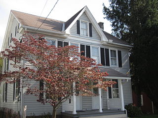
Leola is a census-designated place (CDP) in Lancaster County, Pennsylvania, United States. It includes the unincorporated communities of Leola, Leacock, and Bareville, and prior to 2010 was known as the Leacock-Leola-Bareville census-designated place. Originally named "Mechanicsburg", its present name is a portmanteau of "Leacock" and the "Glenola" train station that once served the town. As of the 2010 census, the population of the CDP was 7,214.

Chadds Ford is a census-designated place (CDP) in Delaware and Chester counties, Pennsylvania, United States, comprising the unincorporated communities of Chadds Ford and Chadds Ford Knoll. It was first listed as a CDP prior to the 2020 census.
Hopeland is a small unincorporated hamlet and census-designated place (CDP) in Lancaster County in the south of the U.S. state of Pennsylvania. The hamlet's ZIP code is 17533. As of the 2010 census the population was 738.
Farmersville is a rural Mennonite settlement and a census-designated place (CDP) in West Earl Township, Lancaster County, Pennsylvania, United States. As of the 2010 census the population was 991.

Falmouth is an unincorporated community and census-designated place (CDP) in Conoy Township, Lancaster County, Pennsylvania, United States. As of the 2010 census the population was 420, but the 2020 census shows that the population has decreased to 397.
Bowmansville is an unincorporated community and census-designated place (CDP) in Brecknock Township, Lancaster County, Pennsylvania, United States. Bowmansville is home to a Pennsylvania Turnpike service plaza. The population was 2,077 as of the 2010 census.
Pikes Creek is a census-designated place (CDP) in Lake Township, Luzerne County, Pennsylvania, United States. The population was 269 at the 2010 census.
Clay is an unincorporated community and census-designated place (CDP) in Clay Township, Lancaster County, Pennsylvania, United States. It is located along U.S. Route 322 between Brickerville and Ephrata. As of the 2010 census, the population was 1,559.
Little Britain is an unincorporated community and census-designated place (CDP) in Little Britain Township, Lancaster County, Pennsylvania, United States. At the 2010 census, the population was 372.
Beavertown is an unincorporated community and census-designated place (CDP) in Blair County, Pennsylvania, United States. It was first listed as a CDP prior to the 2020 census.
Clappertown is an unincorporated community and census-designated place (CDP) in Blair County, Pennsylvania, United States. It was first listed as a CDP prior to the 2020 census.
Franklin Forge is a census-designated place (CDP) in Blair County, Pennsylvania, United States. It was first listed as a CDP prior to the 2020 census.
Fredericksburg, also known as Clover Creek, is an unincorporated community and census-designated place (CDP) in Blair County, Pennsylvania, United States. It was first listed as a CDP prior to the 2020 census.
McKee is an unincorporated community and census-designated place (CDP) in Blair County, Pennsylvania, United States. It was first listed as a CDP prior to the 2020 census.
Mill Run is an unincorporated community and census-designated place (CDP) in Blair County, Pennsylvania, United States. It was first listed as a CDP prior to the 2020 census.
Moores Mill is a census-designated place (CDP) in Blair County, Pennsylvania, United States. It was first listed as a CDP prior to the 2020 census.
Casanova is an unincorporated community and census-designated place (CDP) in Centre County, Pennsylvania, United States. It was first listed as a CDP prior to the 2020 census.
Continental Courts is a mobile home park and census-designated place (CDP) in Centre County, Pennsylvania, United States. It was first listed as a CDP prior to the 2020 census.
Eagle Creek is a census-designated place (CDP) in Centre County, Pennsylvania, United States. It was first listed as a CDP prior to the 2020 census.
Clintondale is an unincorporated community and census-designated place (CDP) in Clinton County, Pennsylvania, United States. It was first listed as a CDP prior to the 2020 census.


