A county is a geographic region of a country used for administrative or other purposes in some nations. The term is derived from the Old French comté denoting a jurisdiction under the sovereignty of a count (earl) or a viscount. Literal equivalents in other languages, derived from the equivalent of "count", are now seldom used officially, including comté, contea, contado, comtat, condado, Grafschaft, graafschap, and zhupa in Slavic languages; terms equivalent to 'commune' or 'community' are now often instead used.

Local government is a generic term for the lowest tiers of governance or public administration within a particular sovereign state.

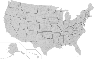
In the United States, a county or county equivalent is an administrative or political subdivision of a U.S. state or other territories of the United States which consists of a geographic area with specific boundaries and usually some level of governmental authority. The term "county" is used in 48 states, while Louisiana and Alaska have functionally equivalent subdivisions called parishes and boroughs, respectively. The specific governmental powers of counties vary widely between the states, with many providing some level of services to civil townships, municipalities, and unincorporated areas. Certain municipalities are in multiple counties; New York City is uniquely partitioned into five counties, referred to at the city government level as boroughs. Some municipalities have been consolidated with their county government to form consolidated city-counties, or have been legally separated from counties altogether to form independent cities. Conversely, counties in Connecticut, Rhode Island, eight of Massachusetts's 14 counties, and Alaska's Unorganized Borough have no government power, existing only as geographic distinctions.

Dumfries and Galloway is one of the 32 unitary council areas of Scotland, located in the western part of the Southern Uplands. It is bordered by East Ayrshire, South Ayrshire, and South Lanarkshire to the north; Scottish Borders to the north-east; the English county of Cumbria, the Solway Firth, and the Irish Sea to the south, and the North Channel to the west. The administrative centre and largest settlement is the town of Dumfries. The second largest town is Stranraer, located 76 miles (122 km) to the west of Dumfries on the North Channel coast.

A district is a type of administrative division that in some countries is managed by the local government. Across the world, areas known as "districts" vary greatly in size, spanning regions or counties, several municipalities, subdivisions of municipalities, school district, or political district.

An unincorporated area is a region that is not governed by a local municipal corporation. There are many unincorporated communities and areas in the United States and Canada.

Freguesia, usually translated as "parish" or "civil parish", is the third-level administrative subdivision of Portugal, as defined by the 1976 Constitution. It is also the designation for local government jurisdictions in the former Portuguese overseas territories of Cape Verde and Macau. In the past, was also an administrative division of the other Portuguese overseas territories. The parroquia in the Spanish autonomous communities of Galicia and Asturias is similar to a freguesia. The average land area of a Portuguese parish is about 29.83 km2 (11.52 sq mi) and an average population of about 3,386 people. The largest parish by area is Alcácer do Sal e Santa Susana, with a land area of 888.35 km2 (342.99 sq mi), and the smallest parish by area is São Bartolomeu (Borba), with a land area of 0.208 km2 (0.080 sq mi). The most populous parish is Algueirão - Mem Martins, with a population of 68,649 people and the least populous is Mosteiro, with a population of just nineteen people.

In England, a civil parish is a type of administrative parish used for local government. It is a territorial designation which is the lowest tier of local government. Civil parishes can trace their origin to the ancient system of parishes, which for centuries were the principal unit of secular and religious administration in most of England and Wales. Civil and religious parishes were formally split into two types in the 19th century and are now entirely separate. Civil parishes in their modern form came into being through the Local Government Act 1894, which established elected parish councils to take on the secular functions of the parish vestry.

Fiji is divided administratively into four divisions, which are further subdivided into fourteen provinces. Each province has a provincial council.

Nayland is a village and former civil parish, now in the parish of Nayland-with-Wissington, in the Babergh district, in the county of Suffolk, England. It is in the Stour Valley on the Suffolk side of the border between Suffolk and Essex. In 2011 the built-up area had a population of 938.

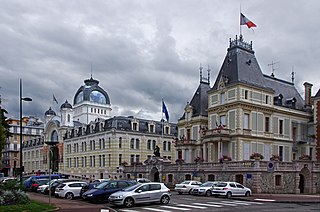
An administrative centre is a seat of regional administration or local government, or a county town, or the place where the central administration of a commune, is located.

Okrika is an island in Rivers State, Nigeria, capital of the Local Government Area of the same name. The town is situated on an island south of Port Harcourt, making it a suburb of the much larger city.

Bangladesh is divided into 8 divisions (bibhag) and 64 districts, although these have only a limited role in public policy. For the purposes of local government, the country is divided into upazilas (sub-districts), "municipalities" or town councils (pourashova), city corporations and union councils . The diagram below outlines the five tiers of government in Bangladesh.
A municipal council is the legislative body of a municipality or local government area. Depending on the location and classification of the municipality it may be known as a city council, town council, town board, community council, rural council, village council, or board of aldermen.
A municipal district is an administrative entity comprising a clearly-defined territory and its population. It can refer to a city, a town, a village, a small grouping of them, or a rural area.

A commune is the third-level administrative unit in Mali. Mali is divided into eight regions and one capital district (Bamako). These subdivisions bear the name of their principal city. The regions are divided into 49 cercles. The cercles and the district are divided into 703 communes, with 36 urban communes and 667 rural communes, while some larger cercles still contain arrondissements above the commune level, these are organisational areas with no independent power or office. Rural communes are subdivided into villages, while urban communes are subdivided into quartier. Communes usually bear the name of their principal town. The capital, Bamako, consists of six urban communes. There were initially 701 communes until Law No. 01-043 of 7 June 2001 created two new rural communes in the desert region in the north east of the country: Alata, Ménaka Cercle in the Gao Region and Intadjedite, Tin-Essako Cercle in the Kidal Region.

The Ikwerre is an Igboid ethnic group in Rivers State, Nigeria. The Ikwerre ethnic group in Rivers State, spans over four Local Government Areas; Port Harcourt, Obio Akpor, Ikwerre, and Emohua.. Pockets of the Ikwerre are found in Ohaji-Egbema LGA of Imo State.
Emohua is an oil rich Local Government Area in Rivers State, Nigeria. Its headquarters are in the town of Emohua. Emohua LGA is made up of so many towns and villages which includes; Omudioga, Egbeda, Ubimini, Elele-Alimini, Rumuji, Emohua, Ibaa, Obelle, Itu, Ndele, Odegu, and so many others.
Emohua is a town and the headquarters of the Emohua Local Government Area of Rivers State, Nigeria. It comprises eight villages, namely:
Elections in Rivers State are supervised and conducted by two major electoral bodies, Rivers State Independent Electoral Commission (RSIEC) and the Independent National Electoral Commission (INEC). There are 23 local government areas, 319 electoral wards and 4442 polling units in the state. Elections for Governor and the House of Assembly are held every four years, along with federal elections for President and the National Assembly.


