| Oggiyamduraipakkam | |
|---|---|
| city | |
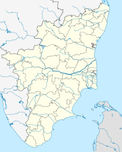
| Coordinates: 12°56′30″N80°14′24″E / 12.94167°N 80.24000°E Coordinates: 12°56′30″N80°14′24″E / 12.94167°N 80.24000°E | |
| Country | |
| State | Tamil Nadu |
| District | Kancheepuram |
| Taluka | Sholinganallur |
| Population (2011) | |
| • Total | 78,515 |
| Languages | |
| • Official | Tamil |
| Time zone | IST (UTC+5:30) |
Oggiyamduraipakkam is a census town in Kancheepuram district in the Indian state of Tamil Nadu.
A census town is a type of town that satisfies certain characteristics, depending on the country in which it is located.
India, also known as the Republic of India, is a country in South Asia. It is the seventh largest country by area and with more than 1.3 billion people, it is the second most populous country as well as the most populous democracy in the world. Bounded by the Indian Ocean on the south, the Arabian Sea on the southwest, and the Bay of Bengal on the southeast, it shares land borders with Pakistan to the west; China, Nepal, and Bhutan to the northeast; and Bangladesh and Myanmar to the east. In the Indian Ocean, India is in the vicinity of Sri Lanka and the Maldives, while its Andaman and Nicobar Islands share a maritime border with Thailand and Indonesia.
Tamil Nadu, formerly Madras State, is one of the 29 states of India. Its capital and largest city is Chennai. Tamil Nadu lies in the southernmost part of the Indian subcontinent and is bordered by the union territory of Puducherry and the South Indian states of Kerala, Karnataka, and Andhra Pradesh. It is bounded by the Eastern Ghats on the north, by the Nilgiri Mountains, the Meghamalai Hills, and Kerala on the west, by the Bay of Bengal in the east, by the Gulf of Mannar and the Palk Strait on the southeast, and by the Indian Ocean on the south. The state shares a maritime border with the nation of Sri Lanka.
In the 2001 India census, [1] Oggiyamduraipakkam had a population of 25,961. Males constituted 52% of the population and females 48%. Oggiyamduraipakkam had an average literacy rate of 73%, higher than the national average of 59.5%: male literacy was 78%, and female literacy was 67%. In 2001 in Oggiyamduraipakkam, 12% of the population was under 6 years of age.
In the 2011 census, Oggiyamduraipakkam had a population of 78,515. [2]
Thiruneermalai is a panchayat town in Chennai in Kancheepuram district in the Indian state of Tamil Nadu. This place is very close to Chennai city.
Alapakkam is a census town in Kancheepuram district in the state of Tamil Nadu, India.
Alwarthirunagiri is a panchayat town in Thoothukudi district in the state of Tamil Nadu, India. It is next to Srivaikuntam on the Tirunelveli - Tiruchendur Highway, Tamil Nadu, southern India. It's about 31 km from Tirunelveli and 29 km from Tiruchendur, on the banks of the river Tamirabarani. Alwarthirunagiri is the birthplace of alwar saint Nammalvar. The temple is classified as a "Divya Desam", the 108 temples of Sri Narayana revered by the 12 poet saints, or Alwars.
Ayyampettai is a census town in Kancheepuram district in the state of Tamil Nadu, India.
Injambakkam is a locality in the south of Chennai in the Indian state of Tamil Nadu. Being a part of the Walajabad block of the district, its panchayat is part of Walajabad panchayat union. Injambakkam is located along the ECR.
Jaladianpet is a census town in Kancheepuram district in the Indian state of Tamil Nadu.
Karunguzhi is a town in Kancheepuram district in the Indian state of Tamil Nadu.
Melagaram is a panchayat town in Tenkasi taluk, Tirunelveli district, in the Indian state of Tamil Nadu.
Melamaiyur is a census town in Kancheepuram district in the Indian state of Tamil Nadu.
Moovarasampattu is a census town in Kancheepuram district in the Indian state of Tamil Nadu.
Nallur (Nalloor) is a panchayat town in Kanniyakumari district in the Indian state of Tamil Nadu.
Nandivaram-Guduvancheri is a panchayat town located in Kancheepuram district in the Indian state of Tamil Nadu.
Nattapettai is a census town in Kancheepuram district in the Indian state of Tamil Nadu.
Pudupattinam is a census town in Kancheepuram district in the Indian state of Tamil Nadu.
Sevilimedu is a panchayat town in Kancheepuram district in the Indian state of Tamil Nadu.
Singaperumal Kovil is a census town located close to Chengalpet and Maraimalai Nagar in Chengalpattu taluk, Kancheepuram district in the Indian state of Tamil Nadu.
Thenambakkam is a census town in Kancheepuram district in the Indian state of Tamil Nadu.
Thevaram is a city in Theni district in the Indian state of Tamil Nadu. Thevaram is located in Tamil Nadu near on border of Kerala at the Eastern side foot-hill of the Western Ghats. It is connected with State Highway SH100.
Vengathur is a census town in Thiruvallur district in the Indian state of Tamil Nadu.
Thiruppuvanam is a panchayat town, in Manamadurai Division, Sivaganga district in the Indian state of Tamil Nadu. The town is famous for Sri Pushpavaneswarar temple, which is one of the Padal Petra Shiva sthalams.
| This Kanchipuram district location article is a stub. You can help Wikipedia by expanding it. |