
Colorado is a landlocked state in the Mountain West subregion of the Western United States. It is bordered by Wyoming to the north, Nebraska to the northeast, Kansas to the east, Oklahoma to the southeast, New Mexico to the south, Utah to the west, and meets Arizona to the southwest at the Four Corners. Colorado is noted for its landscape of mountains, forests, high plains, mesas, canyons, plateaus, rivers, and desert lands. Colorado is one of the Mountain States and is often considered to be part of the southwestern United States. The high plains of Colorado may be considered a part of the midwestern United States. It encompasses most of the Southern Rocky Mountains, as well as the northeastern portion of the Colorado Plateau and the western edge of the Great Plains. Colorado is the eighth most extensive and 21st most populous U.S. state. The United States Census Bureau estimated the population of Colorado at 5,877,610 as of July 1, 2023, a 1.80% increase since the 2020 United States census.

A canyon, gorge or chasm, is a deep cleft between escarpments or cliffs resulting from weathering and the erosive activity of a river over geologic time scales. Rivers have a natural tendency to cut through underlying surfaces, eventually wearing away rock layers as sediments are removed downstream. A river bed will gradually reach a baseline elevation, which is the same elevation as the body of water into which the river drains. The processes of weathering and erosion will form canyons when the river's headwaters and estuary are at significantly different elevations, particularly through regions where softer rock layers are intermingled with harder layers more resistant to weathering.

Lincoln County is a county located in the U.S. state of Colorado. As of the 2020 census, the population was 5,675. The county seat is Hugo. The county obtains its name in memory of the United States President Abraham Lincoln. County was formed from portions of Bent and Elbert counties in 1889 from a restructuring of Colorado counties.

Cheyenne County is a county located in the U.S. state of Colorado. The county population was 1,748 at 2020 census. The county seat is Cheyenne Wells.

Arapahoe County is a county located in the U.S. state of Colorado. As of the 2020 census, its population was 655,070, making it the third-most populous county in Colorado. The county seat is Littleton, and the most populous city is Aurora. The county was named for the Arapaho Native American tribe, who once lived in the region.
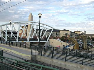
The City of Englewood is a home rule municipality located in Arapahoe County, Colorado, United States. The town population was 33,659 at the 2020 United States Census. Englewood is a part of the Denver–Aurora–Lakewood, CO Metropolitan Statistical Area and the Front Range Urban Corridor. Englewood is located immediately south of Denver in the South Platte River Valley.

Salida is the statutory city that is the county seat and the most populous municipality of Chaffee County, Colorado, United States. The population was 5,666 at the 2020 census.

Delta is a home rule municipality that is the county seat and the most populous municipality of Delta County, Colorado, United States. The town population was 9,035 at the 2020 United States Census. The United States Forest Service headquarters of the Grand Mesa, Gunnison, and Uncompahgre National Forests are located in Delta.

Steamboat Springs is a home rule municipality that is the county seat and the most populous municipality of Routt County, Colorado. The population was 13,224 at the 2020 census. Steamboat Springs is the principal city of the Steamboat Springs Micropolitan Statistical Area, and it is the largest city in northwestern Colorado.

The Smoky Hill River is a 575-mile (925 km) river in the central Great Plains of North America, running through Colorado and Kansas.

The Colorado River is an approximately 862-mile-long (1,387 km) river in the U.S. state of Texas. It is the 11th longest river in the United States and the longest river with both its source and its mouth within Texas.

Aspen Mountain is a mountain summit in the Elk Mountains range of the Rocky Mountains of North America. The 11,212-foot (3,417 m) peak is located in White River National Forest, 1.4 miles (2.2 km) south-southeast of downtown Aspen in Pitkin County, Colorado, United States. The north face of the mountain is the location of the Aspen Mountain ski area, one of four adjacent ski areas operated collectively as Aspen/Snowmass.

The Chemehuevi Mountains are a mountain range that are found at the southeast border of San Bernardino County in southeastern California and are adjacent the Colorado River. Located south of Needles, California and northwest of the Whipple Mountains, the mountains are oriented in a north–south direction, and stretch for approximately 15 miles (24 km) in length.

There are more than 300 properties and districts listed on the National Register of Historic Places in the City and County of Denver, the capital of the U.S. State of Colorado.
This National Park Service list is complete through NPS recent listings posted August 30, 2024.
Ogilby is a ghost town in Imperial County, California, United States. Ogilby is located on the Southern Pacific Railroad 42 miles (68 km) east of El Centro, and 3.8 miles (6.1 km) north of Interstate 8 on County Road S34. The name is official for federal use, and a feature ID number of 252950 has been assigned. Ogilby is defined by the US Geological Survey as a populated place at 356 feet (109 m) AMSL elevation. NAD27 latitude and longitude are listed at 32°49′01″N114°50′20″W on the "Ogilby, California" 7.5-minute quadrangle (map). It is included in the Imperial County Air Pollution Control District. It lies at an elevation of 364 feet (111 m).
Pilot Knob is a peak in Imperial County, California. Pilot Knob is located 8 miles (13 km) southeast of Ogilby, It rises to an elevation of 876 feet (267 m). Pilot Knob is a rocky landform, geologically a Volcanic plug, west of Yuma, Arizona–Winterhaven, California; it is connected to the Cargo Muchacho Mountains, the central portion of the mountains being about 7 miles (11 km) north. Pilot Knob was named for its prominence as a landmark for riverboat traffic in the 19th-20th centuries on the Colorado River which borders Winterhaven–Yuma. Pilot Knob is an Area of Critical Environmental Concern administered by the Bureau of Land Management.

Balcones Canyonlands is a national wildlife refuge located in the Texas Hill Country to the northwest of Lago Vista, Texas. The refuge was formed in 1992 to conserve habitat for two endangered songbirds, the golden-cheeked warbler and the black-capped vireo, and to preserve Texas Hill Country habitat for numerous other wildlife species. The refuge augments a similarly named preserve in Austin called the Balcones Canyonlands Preserve.

The San Luis Hills are a group of small mountain ranges in Conejos and Costilla counties in the San Luis Valley in southern Colorado. The individual mountain ranges that make up the San Luis Hills include the Fairy Hills, the Brownie Hills, the Piñon Hills, and the South Piñon Hills. The San Luis Hills' highest point is Flat Top, elevation 9,206 feet
