
The North Cascades are a section of the Cascade Range of western North America. They span the border between the Canadian province of British Columbia and the U.S. state of Washington and are officially named in the U.S. and Canada as the Cascade Mountains. The portion in Canada is known to Americans as the Canadian Cascades, a designation that also includes the mountains above the east bank of the Fraser Canyon as far north as the town of Lytton, at the confluence of the Thompson and Fraser Rivers.

The Hozameen Range is a mountain range in southwestern British Columbia and northern Washington, straddling the division between the Coast and Interior regions of that province. It is a subrange of the North Cascades and is neighboured on the east by the Okanagan Range and on the northwest by the unofficially-named Coquihalla Range, which lies between that river and the Fraser. In the northwest part of the range is the one named subrange, the Bedded Range.

The Skagit Range is a subrange of the Cascade Range in southwestern British Columbia, Canada and northwestern Washington, United States, which are known in Canada as the Canadian Cascades or, officially, the Cascade Mountains. It is also known in the Nooksack language as Nexwx̠ex̠tsán. The Skagit Range lies to the west of the Skagit River and east and north of the Chilliwack River and flanks the Upper Fraser Valley region of British Columbia's Lower Mainland.

The geography of the North Cascades describes a range of rugged mountains in British Columbia, Canada and Washington, United States. In Canada, the range is officially named the Cascade Mountains but is commonly referred to as the Canadian Cascades.

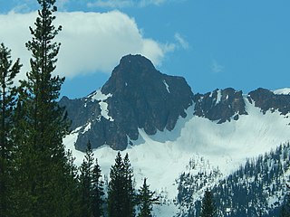
Big Kangaroo is an 8,326-foot (2,538-metre) mountain summit in Okanogan County, Washington, United States.

Golden Horn is an 8,366-foot (2,550-metre) mountain summit located in Okanogan County in Washington, United States. It is part of the Okanogan Range which is a sub-range of the North Cascades Range. Golden Horn is situated north of Methow Pass at headwaters of the Methow River, on land administered by the Okanogan–Wenatchee National Forest. It ranks as the 101st-highest summit in Washington. The nearest higher neighbor is Tower Mountain, 1.67 miles (2.69 km) to the southeast. Topographic relief is significant as the summit rises approximately 3,366 feet above the West Fork Methow River in one mile (1.6 km). The first ascent of Golden Horn was made by Fred Beckey, Keith Rankin, and Charles Welsh on September 18, 1946.

Mount Hardy is an 8,099-foot (2,469-metre) mountain summit located on the common border of Okanogan County with Skagit County in Washington state. It is part of the Okanogan Range which is a sub-range of the North Cascades Range. Mount Hardy is situated west of Methow Pass, at headwaters of the Methow River, on land administered by the Okanogan–Wenatchee National Forest. Topographic relief is significant as the summit rises approximately 2,500 feet above the West Fork Methow River in one-half mile (0.8 km). The nearest higher peak is Golden Horn, 1.75 miles (2.82 km) to the northeast. Mount Hardy can be seen from the North Cascades Highway which traverses below the southwestern base of the mountain. This mountain's toponym was officially adopted in 1973 by the United States Board on Geographic Names.

Snagtooth Ridge is a jagged granitic ridge located in Okanogan County of Washington state. It is part of the Methow Mountains which are a subrange of the North Cascades. Snagtooth Ridge is situated between Silver Star Mountain and Kangaroo Ridge on land administered by the Okanogan–Wenatchee National Forest. Precipitation runoff from the ridge drains into tributaries of the Methow River. Topographic relief is significant as the summit rises approximately 3,000 feet above West Fork Cedar Creek in one mile (1.6 km).
Molar Tooth is a 7,547-foot-elevation (2,300-meter) granite summit located on the shared border of Okanogan County and Skagit County, in Washington state. The mountain is part of the Okanagan Range which is a subrange of the Cascade Range. Set in the Okanogan–Wenatchee National Forest, Molar Tooth is situated south of Cutthroat Pass, and 0.57 miles (0.92 km) north of Cutthroat Peak, which is also the nearest higher peak. The easiest climbing route is class 4 scrambling, but solid rock provides class 5 technical routes as well. Precipitation runoff from the east side of Molar Tooth drains into tributaries of the Methow River, whereas runoff from the west side drains into tributaries of the Skagit River.

Copper Benchmark, also known as Copper Point, is a 7,844-foot-elevation (2,391-meter) mountain summit located on the shared border between Okanogan County and Chelan County in Washington state. Copper Benchmark is part of the Methow Mountains which are a subrange of the North Cascades, and it is situated on the crest of the Cascade Range between Kangaroo Pass and Copper Pass. It was used as a triangulation station for early surveying. It is protected by the Lake Chelan-Sawtooth Wilderness within the Okanogan–Wenatchee National Forest. Copper Benchmark has a subsidiary peak, Pica Peak (elevation 7,565 feet, which is 0.52 miles northwest of the summit. The nearest higher peak is Wallaby Peak, 0.9 miles to the northeast. Precipitation runoff on the north side of the mountain drains to the Methow River via Early Winters Creek, whereas the other sides of the mountain drain into tributaries of the Chelan River.

Monument Peak is an 8,597-foot (2,620-metre) mountain summit located in western Okanogan County in Washington state. It is part of the Okanogan Range which is a sub-range of the North Cascades. The mountain is situated in the Pasayten Wilderness, on land administered by the Okanogan–Wenatchee National Forest. The nearest higher peak is Mount Lago, 2.42 miles (3.89 km) to the north. Precipitation runoff from Monument Peak drains east into Monument Creek, and west into Eureka Creek, which are both part of the Methow River drainage basin. Topographic relief is significant as the summit rises 3,800 feet above Eureka Creek in 1.25 mile (2 km).
Robinson Mountain is an 8,731-foot (2,661-metre) mountain summit located in western Okanogan County in Washington state. It is part of the Okanogan Range which is a sub-range of the North Cascades Range. The mountain is situated in the Pasayten Wilderness, on land administered by the Okanogan–Wenatchee National Forest. The nearest higher peak is Mount Lago, 7.28 miles (11.72 km) to the north. Precipitation runoff from Robinson Mountain drains west into Robinson Creek, and east into Eureka Creek, which are both part of the Methow River drainage basin. The mountain is named for brothers James and Thomas Robinson who were settlers in the area in the late 1800s.

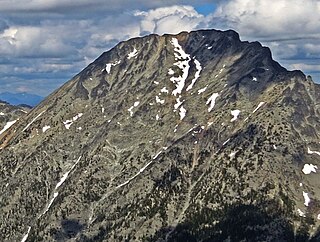
Remmel Mountain, also known as Mount Remmel, is a prominent 8,685-foot (2,647-metre) mountain summit located in Okanogan County in Washington state. It is the highest point in the Cathedral Range, which is a subrange of the Okanogan Range in the North Cascades. The mountain is situated 5 miles (8.0 km) south of the Canada–United States border, on the eastern side of the Cascade crest, in the Pasayten Wilderness, on land managed by the Okanogan–Wenatchee National Forest. The nearest higher peak is Mount Lago, 16.8 miles (27.0 km) to the west-southwest, and Amphitheater Mountain lies 3.6 miles (5.8 km) to the north. Remmel is the third-highest summit of the Okanogan Range following Mount Lago (8,745 ft), and Robinson Mountain (8,726 ft). These three peaks follow Jack Mountain (9,075 ft) as the highest peaks in the Pasayten Wilderness. Remmel is the most prominent mountain in the Pasayten Wilderness. Topographic relief is significant as the summit rises approximately 2,300 feet above Andrews Creek in 0.75 mile (1.2 km). Precipitation runoff from Remmel Mountain drains into the Chewuch River basin.

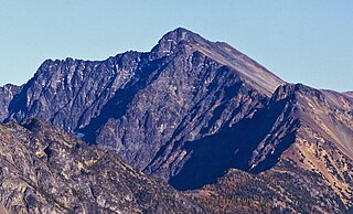
Windy Peak is an 8,335-foot (2,541-metre) mountain summit located in Okanogan County in Washington state. It is part of the Okanogan Range which is a sub-range of the North Cascades and Cascade Range. The mountain is situated five miles (8.0 km) south of the Canada–United States border, on the east side of the Cascade crest, in the Pasayten Wilderness, on land managed by the Okanogan–Wenatchee National Forest. The nearest higher peak is Haystack Mountain, 9.24 miles (14.87 km) to the northwest in Canada. Precipitation runoff from Windy Peak drains into tributaries of the Methow River and Similkameen River.
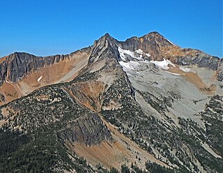
Mount Lago is a prominent 8,745-foot (2,665-metre) mountain summit located in the Okanogan Range of the North Cascades, in Okanogan County of Washington state. The mountain is situated on the eastern side of the Cascade crest, in the Pasayten Wilderness, on land managed by the Okanogan–Wenatchee National Forest. The nearest higher peak is Jack Mountain, 19.5 miles (31.4 km) to the west-southwest. Mount Lago is the highest summit of the Okanogan Range, and follows only Jack Mountain {9,075 ft} as the highest peak in the Pasayten Wilderness. Lago is the fourth-most prominent mountain in the Pasayten Wilderness. Precipitation runoff from the mountain drains into tributaries of the Pasayten River and Methow River. The mountain was named for Lage Wernstedt (1878–1959), a Forest Service surveyor who made numerous first ascents of the mountains he was mapping in the North Cascades. Lago, is a play on the way Americans pronounced his name. Lage, pronounced Loggy, had a son named Lago.

Castle Peak is a prominent 8,343-foot (2,543-metre) mountain summit located in the Hozameen Range of the North Cascades, on the shared border between Okanogan County and Whatcom County of Washington state. The mountain is situated one mile (1.6 km) south of the Canada–United States border, on the Cascade crest, in the Pasayten Wilderness, on land managed by the Okanogan–Wenatchee National Forest. The nearest higher peak is Jack Mountain, 14.8 miles (23.8 km) to the south-southwest. Castle Peak is the second highest summit of the Hozameen Range following Jack Mountain. Castle Peak is the sixth-highest mountain in the Pasayten Wilderness. Precipitation runoff from the mountain drains east into Castle Creek, a tributary of the Similkameen River, or west into tributaries of the Skagit River. Topographic relief is significant as the summit rises nearly 3,000 feet above Crow Creek in 0.75 mile (1.2 km).
Mount Carru is an 8,595-foot (2,620-metre) mountain summit located in western Okanogan County in Washington state. It is the seventh-highest peak of the Okanogan Range, which is a sub-range of the North Cascades. The mountain is situated in the Pasayten Wilderness on land administered by the Okanogan–Wenatchee National Forest. The nearest higher peak is Mount Lago, 0.8 mile to the east, and Osceola Peak rises one mile (1.6 km) west. The mountain has a steep north face, but the south slope is covered in scree which allows a nontechnical climbing ascent. Precipitation runoff from Mount Carru drains north into Lease Creek which is a tributary of the Pasayten River, or south into Eureka Creek, which is part of the Methow River drainage basin.

Half Moon is a 7,960+ ft summit located in Okanogan–Wenatchee National Forest, in Okanogan County, of Washington state. The mountain is part of the Methow Mountains, which are a subset of the Cascade Range. Half Moon is situated on Kangaroo Ridge which is approximately two miles east and within view of the North Cascades Highway at Washington Pass. The nearest higher neighbor is Wallaby Peak, 0.23 mi (0.37 km) to the south. Precipitation runoff from the peak drains into Early Winters Creek, and Cedar Creek, both of which are tributaries of the Methow River.
Osceola Peak is an 8,587-foot (2,617-metre) mountain summit located in western Okanogan County in Washington state. The mountain's name was officially adopted in 1972. Osceola is the 10th highest peak of the Okanogan Range, which is a sub-range of the North Cascades. Osceola Peak ranks 50th on Washington's highest 100 peaks, and 48th on the "Bulger List". The mountain is situated in the Pasayten Wilderness, on land managed by the Okanogan–Wenatchee National Forest. The nearest higher peak is Mount Carru, 1 mile (1.6 km) to the east. The mountain has a steep north face, but the south slope is covered in scree which allows a nontechnical climbing ascent. Precipitation runoff from Osceola Peak drains north into tributaries of the Similkameen River, or south into Eureka Creek, which is part of the Methow River drainage basin.

Devils Peak is an 8,081-foot (2,463-metre) mountain summit located in western Okanogan County in Washington state. It is part of the Okanogan Range which is a sub-range of the North Cascades Range. The mountain is situated in the Pasayten Wilderness, on land administered by the Okanogan–Wenatchee National Forest. The nearest higher neighbor is Robinson Mountain, 1.88 miles (3.03 km) to the east-southeast, and Slate Peak is set 3.1 miles (5.0 km) to the west. Precipitation runoff from Devils Peak drains west into Robinson Creek, and east into Eureka Creek, which are both part of the Methow River drainage basin.


