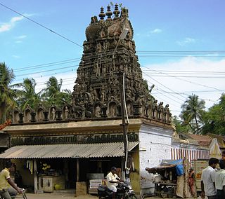
Ariyalur district is an administrative district, one of the 38 districts in the state of Tamil Nadu in India. The district headquarters is located at Ariyalur. The district encompasses an area of 1,949.31 km².
Thiruvattar is a panchayat town in Kanyakumari district in the Indian state of Tamil Nadu.

Kanniyakumari district is one of the 38 districts in Tamil Nadu state and the southernmost district in mainland India. It stands second in terms of population density among the districts of Tamil Nadu. It is also the richest district in Tamil Nadu in terms of per capita income, and also tops the state in Human Development Index (HDI), literacy, and education. The district's headquarters is Nagercoil.

Alwarthirunagiri is a panchayat town in Thoothukudi district in the state of Tamil Nadu, India. It is next to Srivaikuntam on the Tirunelveli - Tiruchendur Highway, Tamil Nadu, southern India. It's about 31 km from Tirunelveli and 29 km from Tiruchendur, on the banks of the river Tamirabarani. Alwarthirunagiri is the birthplace of alwar saint Nammalvar. The temple is classified as a "Divya Desam", the 108 temples of Sri Narayana revered by the 12 poet saints, or Alwars.

Ayothiapattinam is a panchayat town in Salem district in the state of Tamil Nadu, India.

Gummidipoondi is an industrial town in Chennai Metropolitan Region of Thiruvallur district in the Indian state of Tamil Nadu. Notably, it is the northernmost assembly constituency and settlement in the state of Tamil Nadu.
Kattumannarkoil is a panchayat town and taluk headquarters in Cuddalore district in the Indian state of Tamil Nadu. Kattumannarkoil Town Panchayat constituted in 1892. The town is coming under the administrative territory of Cuddalore District. The town extends over an area of 19.425 km2. The town is situated along 25 km South West of Chidambaram and lies on the Chidambaram - Coimbatore Highway and 25 km East of Srimushnam and a similar distance north-east of Gangaikonda Cholapuram. The entire road route from Sethiathoppu to Kattumannarkoil runs alongside the Veeranam Lake. The newly built Muttam bridge provides connectivity to Mayladuthurai in the south at the distance of 30 km.
Kilpennathur is a Panchayat Town in Tiruvanamalai district in the Indian state of Tamil Nadu. Kilpennathur is one of the taluks of Tiruvannamalai district and an assembly constituency of Tamil Nadu. The MLA of Kilpennathur assembly constituency is DMK party Mr. K. Pichandi. Vettavalam is the most populous town panchayat in this taluk. Kilpennathur is located a 12.25 degrees latitude and 79.224 degrees longitude. Nearest towns are Avalurpet, Vettavalam, Gingee and Tiruvannamalai, and Chennai is about 177 km away.
Lalgudi is a town in Tiruchirapalli district in the Indian state of Tamil Nadu. The town of Lalgudi heads the Lalgudi taluk, Lalgudi division, Lalgudi Educational District, Lalgudi DSP and Lalgudi Constituency.
Nemili is a Taluk in Ranipet district of Tamil Nadu state, announced on 31 August 2015 by Tamil Nadu Chief minister Selvi J.Jayalalitha. This city, before becoming a separate taluk, it was a town panchyat under Arakkonam Taluk .This town is located in the Ranipet district about 72 kilometres from the state capital of Chennai. Nemili is supposedly one of the hottest towns in Tamil Nadu, where the temperature can exceed 43 °C (110 °F) for several days in peak of the summer. People of all religions are living in the city. The major businesses are farming, hand loom and power looms. Nemili itself is a panchayat town in Ranipet District in the Indian state of Tamil Nadu.
Podaturpet is a Town under Pallipattu(Pallipet) Taluk in Thiruvallur district in the Indian state of Tamil Nadu.
Thiruvennainallur is a taluk in Viluppuram district in the Indian state of Tamil Nadu. It is a major sugarcane agricultural region.
Tindivanam is a town and a municipality in Viluppuram district in the Indian state of Tamil Nadu. It is the second largest town in Villupuram District after the headquarters town Villupuram. Important roads from north to south Tamil Nadu pass through Tindivanam and similarly from west to east.
Pennalurpet (Tamil: Velamakandriga is a village in India located on the Andhra Pradesh and Tamil Nadu border. The village is under the control of Tamil Nadu government. Farming is the main income source for this village.
Orathanad is a town in Thanjavur district of the Indian state of Tamil Nadu. It is recognised as a Town Panchayat. It is located at a distance of 33 km from Thanjavur and 35 km from Pattukkottai. The town is surrounded by vast agricultural lands.
Periapalayam is a village about 40 km north of Chennai, in Tiruvallur district, Tamil Nadu State, India. The nearest Railway station is Thiruninravur.It is in Ellapuram block which stretches from east Thanakulam village, west Uthukottai, north Kosavanpettai and in the south up to Komakambedu village. It has one of the main routes to Andhra Pradesh.
Azhagappapuram is a panchayat town in Kanyakumari district in the Indian state of Tamil Nadu. It is located about five miles northwest of Kanyakumari, the southern tip of India. It is one of the beautiful and model towns in the Kanyakumari district. It falls under the Agastheeswaram taluk of Tamil Nadu. St. Antony's church stands in the middle, which is the major site of attraction of Azhagai.
Papanasam taluk is a taluk of Thanjavur district of the Indian state of Tamil Nadu. The headquarters of the taluk is the town of Papanasam.
Sukkangalpatti is a panchayat town in Theni district in the Indian state of Tamil Nadu.
C.Ayyampalayam is a village located in the Manachanallur taluk of the Tiruchirappalli district of the Indian state Tamil Nadu. It is situated 5 km away from taluk headquarter Manachanallur and 20 km away from district headquarter Tiruchirappalli.


