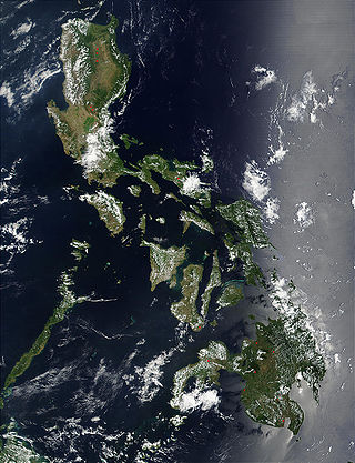
The Philippines is an archipelago that comprises 7,641 islands, and with a total land area of 300,000 square kilometers (115,831 sq mi), it is the world's fifth largest island country. The eleven largest islands contain 95% of the total land area. The largest of these islands is Luzon at about 105,000 square kilometers (40,541 sq mi). The next largest island is Mindanao at about 95,000 square kilometers (36,680 sq mi). The archipelago is around 800 kilometers (500 mi) from the Asian mainland and is located between Taiwan and Borneo.

Biliran, officially the Province of Biliran, is an island province in the Philippines located in the Eastern Visayas region. Biliran is one of the country's smallest and newest provinces. Formerly a sub-province of Leyte, it became an independent province in 1992.

Zamboanga del Norte, officially the Province of Zamboanga del Norte, is a province in the Philippines situated within the Zamboanga Peninsula region in Mindanao. Its capital and largest city is Dipolog and the province borders Zamboanga del Sur and Zamboanga Sibugay to the south, Misamis Occidental to the east, and the Sulu Sea to the west.

Zamboanga del Sur, officially the Province of Zamboanga del Sur, is a province in the Philippines located in the Zamboanga Peninsula region in Mindanao. Its capital is the city of Pagadian.

Zamboanga Peninsula is an administrative region in Mindanao, Philippines, designated as Region IX. It consists of the provinces of Zamboanga del Norte, Zamboanga Sibugay and Zamboanga del Sur, and the cities of Isabela and Zamboanga City. The region was previously known as Western Mindanao. Pagadian serves as the regional center, while Zamboanga City is the commercial and industrial center.

Zamboanga Sibugay, officially the Province of Zamboanga Sibugay, is a province in the Philippines located in the Zamboanga Peninsula region in Mindanao. Its capital and largest town is Ipil and it borders Zamboanga del Norte to the north, Zamboanga del Sur to the east and Zamboanga City to the southwest. To the south lies Sibuguey Bay in the Moro Gulf.

Davao Region, formerly called Southern Mindanao, is an administrative region in the Philippines, designated as Region XI. It is situated at the southeastern portion of Mindanao and comprises five provinces: Davao de Oro, Davao del Norte, Davao del Sur, Davao Oriental, and Davao Occidental.

Sulu, officially the Province of Sulu, is a province of the Philippines in the Sulu Archipelago.

Cotabato, formerly and still commonly referred to as North Cotabato and officially the Province of Cotabato, is a landlocked province in the Philippines located in the Soccsksargen region in Mindanao. Its capital is the city of Kidapawan, the most populous in the province. Some of its municipalities are under the jurisdiction of the nearby Bangsamoro Autonomous Region.

Zamboanguita, officially the Municipality of Zamboanguita, is a municipality in the province of Negros Oriental, Philippines. According to the 2020 census, it has a population of 29,569 people.

Santiago, officially the Municipality of Santiago, is a municipality in the province of Ilocos Sur, Philippines. According to the 2020 census, it has a population of 19,471 people.

Alicia, officially the Municipality of Alicia, is a municipality in the province of Zamboanga Sibugay, Philippines. According to the 2020 census, it has a population of 39,456 people.. Alicia is the gateway to Olutanga Island via Guicam Port in Brgy. Guicam where the Guicam Bridge will soon rise.

Mabuhay, officially the Municipality of Mabuhay, is a municipality in the province of Zamboanga Sibugay, Philippines. According to the 2020 census, it has a population of 37,390 people.

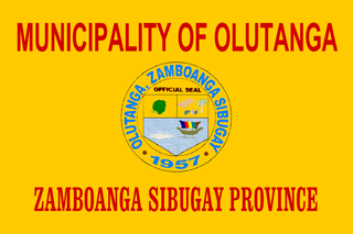
Olutanga, officially the Municipality of Olutanga, is a municipality in the province of Zamboanga Sibugay, Philippines. According to the 2020 census, it has a population of 38,438 people.

Talusan, officially the Municipality of Talusan, is a municipality in the province of Zamboanga Sibugay, Philippines. According to the 2020 census, it has a population of 27,873 people.
Vitali Island is the largest of the 28 offshore islands that constitute the city of Zamboanga in the Republic of the Philippines.
Manalipa is one of the 28 offshore islands of the City of Zamboanga in southern Philippines. Located about 0.5 kilometres (0.31 mi) east of the southern tip of the island is Little Manalipa Island.

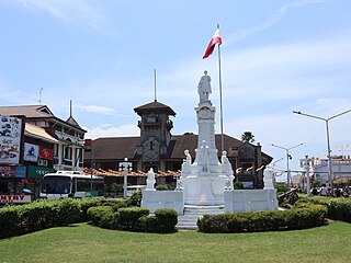
Zamboanga City, officially the City of Zamboanga or Jambangan in the native Subanon language, is a highly urbanized city in the Zamboanga Peninsula region of the Philippines. According to the 2020 census, it has a population of 977,234 people. It is the fifth-most populous and third-largest city by land area in the Philippines and also the second most populous in Mindanao after Davao City. It is the commercial and industrial center of the Zamboanga Peninsula Region.

Selinog, historically known as Silino and also named Silinog, is an island barangay in Dapitan, Zamboanga del Norte, Philippines. It is coterminous with Silino Island and is located 12.9 kilometres (8.0 mi) off Tagolo Point, the northern entrance point to Dapitan Bay, and some 15 kilometres (9.3 mi) east of the island of Aliguay in the Bohol Sea. The island is a flat coralline island with a land area of 78 hectares. It is surrounded by 70 hectares of coral reefs and sandy areas. According to the 2020 census, the island community has a population of 692 inhabitants.
Guicam Bridge is a under construction 1.2 km (0.75 mi) concrete girder bridge between the towns of Alicia and Mabuhay in Zamboanga Sibugay, Philippines. The bridge will connect Olutanga Island and its three municipalities of Mabuhay, Talusan, and Olutanga with the rest of Mindanao Island, which are separated by the Canalizo Strait.


