Omurtag Municipality

Last updated • 1 min readFrom Wikipedia, The Free Encyclopedia
Omurtag Municipality
Община Омуртаг
Municipality
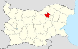
Omurtag Municipality Within Bulgaria.png
Omurtag Municipality within Bulgaria and Targovishte Province.
Coordinates: 43°5′N26°27′E / 43.083°N 26.450°E / 43.083; 26.450
Country Flag of Bulgaria.svg  Bulgaria
Province (Oblast) Targovishte
Admin. centre (Obshtinski tsentar) Omurtag
Area
  Total401.7 km2 (155.1 sq mi)
Population
 (Census February 2011) [1]
  Total21,356
  Density53/km2 (140/sq mi)
Time zone UTC+2 (EET)
  Summer (DST) UTC+3 (EEST)

Omurtag Municipality (Bulgarian : Община Омуртаг) is a municipality ( obshtina ) in Targovishte Province, Northeastern Bulgaria, located in the so-called Fore-Balkan area north of the Stara planina mountain. It is named after its administrative centre - the town of Omurtag.

Contents

The municipality embraces a territory of 401.7 km2 (155.1 sq mi) with a total population of 21,356 inhabitants, as of February 2011. [1] The main road E772 crosses the area connecting its main town with the province centre Targovishte, to the northeast, and the city of Veliko Tarnovo to the west.

Settlements

Omurtag Municipality includes the following 43 places (towns are shown in bold):

Town/Village Cyrillic Population [2] [3] [4]
(December 2009)
Omurtag Омуртаг8,725
Belomortsi Беломорци1,055
Balgaranovo Българаново219
Chernokaptsi Чернокапци315
Dolna Hubavka Долна Хубавка216
Dolno Kozarevo Долно Козарево439
Dolno Novkovo Долно Новково145
Golyamo Tsarkvishte Голямо Църквище364
Gorna Hubavka Горна Хубавка358
Gorno Kozarevo Горно Козарево262
Gorno Novkovo Горно Новково215
Gorsko Selo Горско село151
Iliyno Илийно621
Kamburovo Камбурово1,199
Kestenovo Кестеново308
Kozma Prezviter Козма Презвитер574
Krasnoseltsi Красноселци231
Mogilets Могилец377
Obitel Обител614
Panayot Hitovo Панайот Хитово320
Panichino Паничино181
Petrino Петрино152
Plastina Плъстина628
Ptichevo Птичево259
Padarino Пъдарино559
Parvan Първан347
Rositsa Росица11
Ratlina Рътлина235
Stanets Станец251
Tapchileshtovo Тъпчилещово107
Tsarevtsi Царевци62
Tserovishte Церовище645
Ugledno Угледно150
Velikdenche Великденче297
Velichka Величка500
Verentsi Веренци473
Veselets Веселец159
Visok Висок278
Vrani Kon Врани кон726
Zelena Morava Зелена морава593
Zmeyno Змейно179
Zvezditsa Звездица756
Total24,256

Demography

The following table shows the change of the population during the last four decades. Since 1992 Omurtag Municipality has comprised the former municipality of Obitel and the numbers in the table reflect this unification.

Omurtag Municipality
Year19751985199220012005200720092011
Population22,29221,55627,00025,21224,96824,78924,25621,853
Sources: Census 2001, [5] Census 2011, [6] „pop-stat.mashke.org“, [7]

Ethnic composition

According to the 2011 census, among those who answered the optional question on ethnic identification, the ethnic composition of the municipality was the following:

Ethnic groupPopulationPercentage
Bulgarians 3518
Turks 11959
Roma (Gypsy) 1690
Other198
Undeclared147

[8]

Demographic indicators

The municipality of Omurtag had relatively favourable demographic indicators compared to the Bulgarian average. But after 2013, the number of births decreased significantly while the number of deaths increased. Omurtag recorded its lowest birth rate, highest death rate and lowest natural growth in 2017. It was the biggest yearly fall since 2000.

PopulationLive birthsDeathsNatural growthBirth rate (‰)Death rate (‰)Natural growth rate (‰)
200027,115293304-1110.811.2-0.4
200125,240 263276-1310.410.9-0.5
200225,401276266+1010.910.5+0.4
200325,298 308311-312.212.3-0.1
200425,192306260+4612.110.3+1.8
200524,968238310-729.512.4-2.9
200625,003 295275+2011.811.0+0.8
200724,789 312338-2612.613.6-1.0
200824,613337314+2313.712.8+0.9
200924,256 323286+3713.311.8+1.5
201023,800 326292+3413.712.3+1.4
201121,818 328285+4315.013.1+2.0
201221,745284297-1313.113.7-0.6
201321,614252252+011.711.7+0.0
201421,442 228308-8010.614.4-3.7
201521,442 255321-6611.915.0-3.1
201621,150 211300-8910.014.2-4.2
201720,853 176332-1568.415.9-7.5
201820,818183264-818.812.7-3.9

The continued childbirth decline came amid the falling number of women of childbearing age because of emigration to Western Europe (especially Germany and the Netherlands).

Religion

According to the latest Bulgarian census of 2011, the religious composition, among those who answered the optional question on religious identification, was the following:

Religious composition of Omurtag Municipality [9]
Orthodox Christianity
18.5%
Catholicism
0.2%
Protestantism
0.0%
Islam
75.7%
No religion
1.9%
Prefer not to answer, others and indefinable
3.7%

See also

Related Research Articles

<span class="mw-page-title-main">Antonovo Municipality</span> Municipality in Targovishte, Bulgaria

Antonovo Municipality is a municipality (obshtina) in Targovishte Province, Northeastern Bulgaria, located in the transition between the Danubian Plain and the area of the so-called Fore-Balkan. It is named after its administrative centre - the town of Antonovo.

<span class="mw-page-title-main">Varna Municipality</span> Municipality in Varna, Bulgaria

Varna Municipality is a seaside municipality (obshtina) in Varna Province, Northeastern Bulgaria, located on the Bulgarian Black Sea Coast and near Varna lake. It is named after its administrative centre - the city of Varna - which is also the capital of the homonymous province.
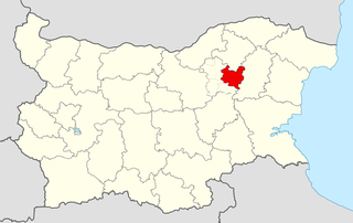
<span class="mw-page-title-main">Targovishte Municipality</span> Municipality in Targovishte, Bulgaria

Targovishte Municipality is a municipality (obshtina) in Targovishte Province, Northeastern Bulgaria, located in the transition between the Danubian Plain and the area of the so-called Fore-Balkan. It is named after its administrative centre - the city of Targovishte which is also the capital of the province.

<span class="mw-page-title-main">Kaolinovo Municipality</span> Municipality in Shumen, Bulgaria

Kaolinovo Municipality is a municipality (obshtina) in Shumen Province, Northeastern Bulgaria, located in the Ludogorie geographical region, part of the Danubian Plain. It is named after its administrative centre – the town of Kaolinovo.

<span class="mw-page-title-main">Varbitsa Municipality</span> Municipality in Shumen, Bulgaria

Varbitsa Municipality is a municipality (obshtina) in Shumen Province, Northeastern Bulgaria, located in the vicinity of the northern slopes of the Eastern Stara planina mountain to the area of the so-called Fore-Balkan. It is named after its administrative centre - the town of Varbitsa.

<span class="mw-page-title-main">Kaspichan Municipality</span> Municipality in Shumen, Bulgaria

Kaspichan Municipality is a municipality (obshtina) in Shumen Province, Northeastern Bulgaria. It is named after its administrative centre, the town of Kaspichan.
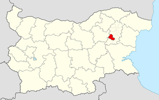
<span class="mw-page-title-main">Veliki Preslav Municipality</span> Municipality in Shumen, Bulgaria

Veliki Preslav Municipality is a municipality (obshtina) in Shumen Province, Northeastern Bulgaria, located in the area of the so-called Fore-Balkan north of the eastern part of the Stara planina mountains. It is named after its administrative centre, the town of Veliki Preslav, which was one of the ancient capitals of Bulgaria.
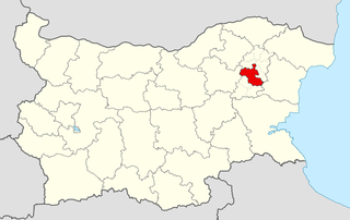
<span class="mw-page-title-main">Shumen Municipality</span> Municipality in Shumen, Bulgaria

Shumen Municipality is a municipality (obshtina) in Shumen Province, Northeastern Bulgaria. It is named after its administrative centre - the city of Shumen which is also the capital of the province.

<span class="mw-page-title-main">Venets Municipality</span> Municipality in Shumen, Bulgaria

Venets Municipality is a municipality (obshtina) in Shumen Province, Northeastern Bulgaria, located in the Ludogorie geographical region, part of the Danubian Plain. It is named after its administrative centre - the village of Venets.

<span class="mw-page-title-main">Nikola Kozlevo Municipality</span> Municipality in Shumen, Bulgaria

Nikola Kozlevo Municipality is a municipality (obshtina) in Shumen Province, Northeastern Bulgaria, located in the Ludogorie geographical region, part of the Danubian Plain. It is named after its administrative centre - the village of Nikola Kozlevo.
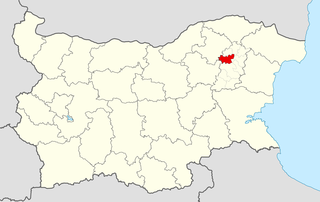
<span class="mw-page-title-main">Hitrino Municipality</span> Municipality in Shumen, Bulgaria

Hitrino Municipality is a municipality (obshtina) in Shumen Province, Northeastern Bulgaria, located in the Ludogorie geographical region, part of the Danubian Plain. It is named after its administrative centre - the village of Hitrino.
<span class="mw-page-title-main">Popovo Municipality</span> Municipality in Targovishte, Bulgaria

Popovo Municipality is a municipality (obshtina) in Targovishte Province, Northeastern Bulgaria, located in the eastern part of the Danubian Plain. It is named after its administrative centre - the town of Popovo.

<span class="mw-page-title-main">Lyaskovets Municipality</span> Municipality in Veliko Tarnovo, Bulgaria

Lyaskovets Municipality is a municipality (obshtina) in Veliko Tarnovo Province, Central-North Bulgaria, located in the transition between the Danubian Plain and the area of the so-called Fore-Balkan. It is named after its administrative centre - the town of Lyaskovets.

<span class="mw-page-title-main">Veliko Tarnovo Municipality</span> Municipality in Veliko Tarnovo, Bulgaria

Veliko Tarnovo Municipality is a municipality (obshtina) in Veliko Tarnovo Province, Central-North Bulgaria, located mostly in the so-called Fore-Balkan area north of Stara planina mountain. It is named after its administrative centre - the old capital of the country, the city of Veliko Tarnovo which is also the main town of the province.

<span class="mw-page-title-main">Tutrakan Municipality</span> Municipality in Silistra, Bulgaria

Tutrakan Municipality is a municipality (obshtina) in Silistra Province, Northeastern Bulgaria, located along the right bank of Danube river in the Danubian Plain. It is named after its administrative centre - the town of Tutrakan.

<span class="mw-page-title-main">Alfatar Municipality</span> Municipality in Silistra, Bulgaria

Alfatar Municipality is a small municipality (obshtina) in Silistra Province, Northeastern Bulgaria, located in the Danubian Plain, in the area of the South Dobrudzha geographical region, about 15 km south of Danube river. It is named after its administrative centre - the town of Alfatar.

<span class="mw-page-title-main">Glavinitsa Municipality</span> Municipality in Silistra, Bulgaria

Glavinitsa Municipality is a municipality (obshtina) in Silistra Province, Northeastern Bulgaria, located along the right bank of Danube river in the Danubian Plain in the area of the South Dobrudzha geographical region. It is named after its administrative centre – the town of Glavinitsa.

<span class="mw-page-title-main">Loznitsa Municipality</span> Municipality in Razgrad, Bulgaria

Loznitsa Municipality is a municipality (obshtina) in Razgrad Province, Northeastern Bulgaria, located in the Danubian Plain. It is named after its administrative centre - the town of Loznitsa.

<span class="mw-page-title-main">Bregovo Municipality</span> Municipality in Vidin, Bulgaria

Bregovo Municipality is a frontier municipality (obshtina) in Vidin Province, Northwestern Bulgaria, located along the right bank of Danube river in the Danubian Plain. It is named after its administrative centre - the town of Bregovo. The area borders on the Republic of Serbia to the west and Romania beyond the Danube to the north and it is the most northwestern part of the country.

<span class="mw-page-title-main">Vidin Municipality</span> Municipality in Vidin, Bulgaria

Vidin Municipality is a municipality (obshtina) in Vidin Province, Northwestern Bulgaria, located along the right bank of Danube river in the Danubian Plain. It is named after its administrative centre - the city of Vidin which is also the capital of the province.

References

  1. 1 2 (in Bulgarian) Bulgarian National Statistical Institute - Targovishte Province - Census 2011 Archived 2011-05-11 at the Wayback Machine
  2. (in English) Bulgarian National Statistical Institute - Bulgarian towns in 2009
  3. (in English) Bulgarian National Statistical Institute - Bulgarian villages under 1000 inhabitants - December 2009
  4. (in English) Bulgarian National Statistical Institute - Bulgarian Settlements 1000-5000 inhabitants - December 2009
  5. National Statistical Institute - Census 2001
  6. Population by province, municipality, settlement and age by 01.02.2011; Bulgarian National Statistical Institute
  7. Population of Bulgarian divisions
  8. Population by province, municipality, settlement and ethnic identification, by 01.02.2011; Bulgarian National Statistical Institute (in Bulgarian)
  9. "Religious composition of Bulgaria 2011". pop-stat.mashke.org.