Onley (lost settlement)

Last updated
Deserted Village of Onley
Lost settlement
Onley - geograph.org.uk - 41021.jpg
Open farmland where once stood the village of Onley
Northamptonshire UK location map.svg
Red pog.svg
Deserted Village of Onley
Onley within Northamptonshire
Coordinates: 52°19′30″N1°15′30″W / 52.32500°N 1.25833°W / 52.32500; -1.25833 Coordinates: 52°19′30″N1°15′30″W / 52.32500°N 1.25833°W / 52.32500; -1.25833
Country England
District Daventry
Map Ref: SP511707

The lost village of Onley is in the parish of Barby in the English county of Northamptonshire. [1] The site is bordered on the north by the M45 motorway. On the east are Onley and Rye Hill prisons, and on the south-west is the A45 road. The Oxford Canal and the disused trackbed of the Great Central Railway run close to the eastern boundary.

Barby, Northamptonshire village in United Kingdom

Barby is a village and civil parish about 5 miles (8 km) north of Daventry in Northamptonshire, England. The 2011 Census recorded the parish population as 2,336. Barby is located right off the M45 motorway a short spur from the M1 motorway to the A45 Trunk Road.

England Country in north-west Europe, part of the United Kingdom

England is a country that is part of the United Kingdom. It shares land borders with Wales to the west and Scotland to the north-northwest. The Irish Sea lies west of England and the Celtic Sea lies to the southwest. England is separated from continental Europe by the North Sea to the east and the English Channel to the south. The country covers five-eighths of the island of Great Britain, which lies in the North Atlantic, and includes over 100 smaller islands, such as the Isles of Scilly and the Isle of Wight.

Northamptonshire County of England

Northamptonshire, archaically known as the County of Northampton, is a county in the East Midlands of England. In 2015 it had a population of 723,000. The county is administered by Northamptonshire County Council and by seven non-metropolitan district councils. It is known as "The Rose of the Shires".

Contents

History

Onley was presumed to be included under entries for Barby in taxation records before 1272. [2]

The first known mention of Onley is in 1272, when it was recorded as being in the possession of George de Cantelupe along with the manor of Barby. The entry records that "Virgates [3] in villeinage [4] are valued at 9 shilling per annum".

Virgate English unit of land

The virgate, yardland, or yard of land was an English unit of land. Primarily a measure of tax assessment rather than area, the virgate was usually reckoned as ​14 hide and notionally equal to 30 acres. It was equivalent to two of the Danelaw's oxgangs.

Villein

A villein, otherwise known as cottar, crofter, is a serf tied to the land in the feudal system. Villeins had more rights and status than those in slavery, but were under a number of legal restrictions which differentiated them from the freeman.

Records in 1345 mention ‘Tenements in Onle’, [5] which may imply that at that time the village was still viable.

There is no further record of Onley until the early part of the 18th century, when the village was described as only a hamlet of seven shepherds' houses, which implies that the site had become pasture land for sheep.

Hamlet (place) small settlement in a rural area

A hamlet is a small human settlement. In different jurisdictions and geographies, hamlets may be the size of a town, village or parish, be considered a smaller settlement or subdivision or satellite entity to a larger settlement. The word and concept of a hamlet have roots in the Anglo-Norman settlement of England, where the old French hamlet came to apply to small human settlements. In British geography, a hamlet is considered smaller than a village and distinctly without a church.

Records of 1841 show that 19 people lived on the site of Onley in five scattered farms which still exist on the land to this day.

Remains today

The earthwork remains of today lie either side of a stream that runs from south to west across the site with the north-eastern end of the stream now in a culvert. The whole area of the village site covers 28 hectares with much of the earthworks well preserved. There is some difficulty in interpreting some of the earthworks due to the site being over ploughed in narrow ridge and furrow which has smoothed and flattened some of the earthworks of the village. The features of this site combine to make Onley lost village one of the most important sites of this kind in the country, despite the lack of documentation. [6]

Earthworks (archaeology) General term to describe artificial changes in land level

In archaeology, earthworks are artificial changes in land level, typically made from piles of artificially placed or sculpted rocks and soil. Earthworks can themselves be archaeological features, or they can show features beneath the surface.

Stream A body of surface water flowing down a channel

A stream is a body of water with surface water flowing within the bed and banks of a channel. The stream encompasses surface and groundwater fluxes that respond to geological, geomorphological, hydrological and biotic controls.

Culvert Structure that allows the passage of water or organisms under an obstruction

A culvert is a structure that allows water to flow under a road, railroad, trail, or similar obstruction from one side to the other side. Typically embedded so as to be surrounded by soil, a culvert may be made from a pipe, reinforced concrete or other material. In the United Kingdom, the word can also be used for a longer artificially buried watercourse.

Related Research Articles

Braunston village in the United Kingdom

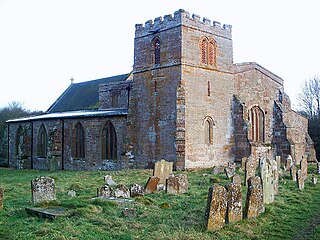
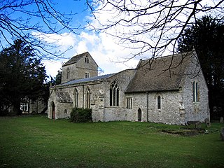
Braunston is a village and civil parish in the county of Northamptonshire, England. It has a population of 1,759. Braunston is situated just off the A45 main road and lies between the towns of Rugby and Daventry.

Deserted medieval village A former settlement which was abandoned during the Middle Ages

In the United Kingdom, a deserted mediaeval village (DMV) is a former settlement which was abandoned during the Middle Ages, typically leaving no trace apart from earthworks or cropmarks. If there are fewer than three inhabited houses the convention is to regard the site as deserted; if there are more than three houses, it is regarded as a shrunken mediaeval village. There are estimated to be more than 3,000 DMVs in England alone.

Bannaventa Settlement in Northamptonshire, England

Bannaventa was a Romano-British fortified town which was situated on the Roman road of Watling Street, which today is known as the A5 trunk road. Bannaventa is 1 mile (1.6 km) northeast of the village of Norton in the English county of Northamptonshire. The Ordnance Survey grid reference for the centre of the town is SP612645.

Staverton, Northamptonshire village in United Kingdom

Staverton is a village and civil parish in the south-west of Northamptonshire, England. It is 2.3 miles west of Daventry, 7.9 miles east of Southam and 15.3 miles east of Leamington Spa. It straddles the A425 road from Daventry to Leamington. The Jurassic Way long distance footpath between Banbury and Stamford passes through the village.

Dodford, Northamptonshire village in Northamptonshire, United Kingdom

Dodford is a village in the county of Northamptonshire, England, within the Weedon Ward of Daventry District. The village is just north of the A45 road 1½ miles west of Weedon. The population of the civil parish at the 2011 Census was 203. It is 3½ miles east of Daventry and ten miles west of Northampton. It is also close to junction 16 of the M1 motorway. The parish consists of some 1,384 acres and is bounded on the east by the A5 trunk road which is the old Roman road of Watling Street. Most of the village and parish sits astride the valley of an east-flowing stream which is a tributary of the River Nene.

Charwelton village and civil parish in Northamptonshire, England

Charwelton is a village and civil parish about 5 miles (8 km) south of Daventry in Northamptonshire, England. Its toponym is derived from the River Cherwell beside which the village stands. The 2011 Census recorded the parish's population as 220.

Wolfhampcote village in United Kingdom

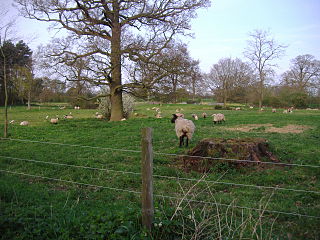
Wolfhampcote is an abandoned village and civil parish in the English counties of Warwickshire and Northamptonshire, which it straddles. The population of the civil parish at the 2011 census was 284.

North Runcton village in the United Kingdom

North Runcton is a village and a civil parish in the English county of Norfolk. The village is 43.2 miles (69.5 km) west of Norwich, 4.3 miles (6.9 km) south-south-west of King's Lynn and 102 miles (164 km) north of London. The village is located a small distance south-west of the A47 between King's Lynn and Swaffham. The nearest railway station is at King's Lynn for the Fen Line which runs between King's Lynn and Cambridge. The nearest airport is Norwich International Airport. The parish of North Runcton in the 2001 census, has a population of 266, increasing to 549 at the 2011 Census. For the purposes of local government, the parish falls within the district of King's Lynn and West Norfolk.

Althorp (lost settlement) Lost settlement in England

Althorp is a lost village within the grounds of the Althorp estate in the English county of Northamptonshire. The village is recorded in the Domesday Book. In the 15th century, the manor was held by the Catesby family who were probably responsible for clearing the settlement, for by 1505, the records show that there were no tenants. In 1508, the parish, including the cleared settlement of Althorp, was sold to John Spencer of Wormleighton in Warwickshire. By 1577, the land in the parish had been divided into four large sheep pastures. Althorp remains a civil parish.

Braunston Cleves or Fawcliff Lost Settlement in Northamptonshire, England

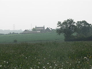
The lost village of Braunston Cleves or Fawcliff once stood north of the village of Braunston in the English county of Northamptonshire. The village stood on the southwest slope of Cleve’s hill within the parish of Braunston. The history of this settlement is virtually unknown. It is thought that the settlement was part of the 11th-century manor which belonged to William Trusbott. The settlement passed to his daughter, Agatha Meinfelin, who in turn left the village to Delapré Abbey in Northampton. A charter of Edward III confirming the possessions of Delapré Abbey mentions a place called Fawcliff near Braunston. Nothing is known of why the village was deserted but it had certainly been destroyed by the 18th century.

Braunstonbury Lost Settlement in Northamptonshire, England

The lost village of Braunstonbury lies in low ground south-west of the village of Braunston in the English county of Northamptonshire. Its site is on the eastern bank of the River Leam, which also marks the border between Northamptonshire and Warwickshire. Adjacent to the site on the west side of the river Leam is the site of the lost village of Wolfhampcote which straddled the county border of both counties.

Canons Ashby (lost settlement) Lost Settlement in Northamptonshire, England

The lost village of Canons Ashby is located in ground to the north of Canons Ashby House in the English county of Northamptonshire. Today there is still a small village around the house but this is located away from the original settlement, since the original settlement is now just field occupied by a herd of cows.
Ascebi is the name of the medieval village that is the lost settlement, Canons Ashby itself is currently not lost at all and people can easily find it on any map.

Coton, Northamptonshire (lost settlement) Lost settlement in Northamptonshire, England

The lost village of Coton is located around the environs of the hamlet of Coton and Coton Manor House in the English county of Northamptonshire.

Church Charwelton (lost settlement) Lost Settlement in Northamptonshire, England

The lost village of Church Charwelton lies south-east of the village of Charwelton in the English county of Northamptonshire. Its site is on the north-east bank of the River Cherwell. The Jurassic Way long-distance footpath passes across the site.

Glendon (lost settlement) Lost Settlement in Northamptonshire, England

The deserted village of Glendon is in the English county of Northamptonshire. Its location was on land to the east of Glendon Hall, now within the parish of Rushton. Neighbouring towns include Rothwell, Kettering, Rushton and Desborough.

Wythmail Lost settlement in Northamptonshire, England

The deserted village of Wythmail is located 4.5 miles south of Kettering in the English county of Northamptonshire. The village of Orlingbury is 1.1 miles to the east. Wythmail was part of the parish of Orlingbury.

Alethorpe human settlement in United Kingdom

Alethorpe is a deserted medieval village site in the English county of Norfolk. The site is within the parish of Little Snoring in North Norfolk. It lies south-east of Little Snoring, around 2 miles (3.2 km) north-east of the town Fakenham and 23 miles (37 km) north-west of Norwich to the north of the A148 road. The village, which is one of around 200 lost settlements in Norfolk, was abandoned in the 16th century, probably as the consequence of the land being enclosed by the landlord of that time. It is occasionally referred to as Althorp in historical literature.

Radstone village in the United Kingdom

Radstone is a hamlet and civil parish in South Northamptonshire, about 2 miles (3 km) north of Brackley. The 2001 Census recorded a parish population of 54. At the 2011 Census the population of the hamlet remained less than 100 and was included in the civil parish of Whitfield.

References

  1. ’OS’ Explorer Map, Rugby & Daventry 222, ISBN   978-0-319-23734-2
  2. An Inventory of Archaeological Sites in North West Northamptonshire, Page 12, 2nd paragraph. ISBN   0-11-700900-8
  3. The virgate was a unit in the assessment system in most of the counties of Wessex and western Mercia, one quarter of a hide or 30 fiscal acres.
  4. In economic terms, the villagers were indistinguishable from Freemen or freemen. They were the most substantial group among the unfree peasantry, possessing on average 30 acres (120,000 m2) of land and two plough oxen.
  5. An Inventory of Archaeological Sites in North West Northamptonshire, Page 12. ISBN   0-11-700900-8
  6. An Inventory of Archaeological Sites in North West Northamptonshire, Page 13, Statement of the Royal Commission on Historical Monuments ISBN   0-11-700900-8