Opawskie Mountains

Last updated
Opawskie Mountains
Zlaté Hory Highlands
Gora Parkowa(Chrobrego).jpg
Mt. Parkowa (Chrobrego) massif
Highest point
Peak Příčný vrch
Elevation 975 m (3,199 ft)
Coordinates 50°13′12″N17°23′2″E / 50.22000°N 17.38389°E / 50.22000; 17.38389
Naming
Native name
Geography
Relief Map of Czech Republic.png
Red triangle with thick white border.svg
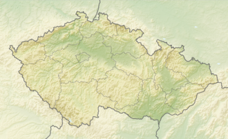
Opawskie Mountains
Location of the Czech part
Relief Map of Poland.svg
Red triangle with thick white border.svg
Opawskie Mountains
Opawskie Mountains (Poland)
Location Olomouc Region (CZ); Moravian-Silesian Region (CZ); Opole Voivodeship (PL)
CountriesCzech Republic and Poland
Parent range Eastern Sudetes
Geology
Rock age(s) Devonian; Carboniferous (Tournaisian–Viséan)
Rock type(s) Metamorphic rocks (gneiss, amphibolite, quartzite, phyllite), granite, Culm measures

The Opawskie Mountains are a mountain range of the Sudetes in the Czech Republic and Poland. [1] [2]

Contents

Location

The Opawskie Mountains stretch from northern Czech Silesia into Polish Upper Silesia, the eastern continuation of the Golden Mountains range. [3] The Polish part of the range includes the protected area known as Opawskie Mountains Landscape Park. [4] It is named after the Opava River. [5] The highest peak is Příčný vrch (975 metres above sea level). [6]

Geology

The geology of the range includes metamorphic rocks (e.g. gneiss, amphibolite, quartzite, phyllite) as well as granite intrusions and Carboniferous Culm units, as shown in the national geological map service of the Czech Geological Survey. [7]

Towns and villages

Poland

Czech Republic

References

  1. "Park Krajobrazowy „Góry Opawskie" (Informationen des Parkträgers)". Zespół Opolskich Parków Krajobrazowych (ZOPK). Retrieved 3 March 2026.
  2. "Państwowy Rejestr Nazw Geograficznych (PRNG) – offizielle, referenzielle Namensdatenbank". Geoportal.gov.pl (Główny Urząd Geodezji i Kartografii). Retrieved 3 March 2026.
  3. "Park Krajobrazowy „Góry Opawskie" (Lage und Charakteristik)". Zespół Opolskich Parków Krajobrazowych (ZOPK). Retrieved 3 March 2026.
  4. "Park Krajobrazowy „Góry Opawskie" (Schutzgebiet)". Zespół Opolskich Parków Krajobrazowych (ZOPK). Retrieved 3 March 2026.
  5. "Park Krajobrazowy „Góry Opawskie" (Benennung)". Zespół Opolskich Parków Krajobrazowych (ZOPK). Retrieved 3 March 2026.
  6. "Zlatohorská vrchovina – Trassen-/Höhenpunkte (kommunales PDF)" (PDF). Město Zlaté Hory (Stadt Zlaté Hory). Retrieved 3 March 2026.
  7. "Geologické mapy 1 : 50 000 (mapová aplikace)". Česká geologická služba (Czech Geological Survey). Retrieved 3 March 2026.