Ghent is a city and a municipality in the Flemish Region of Belgium. It is the capital and largest city of the East Flanders province, and the third largest in the country, exceeded in size only by Brussels and Antwerp. It is a port and university city.

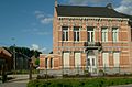
Buggenhout is a municipality in the Belgian province of East Flanders in the Denderstreek. The municipality comprises the towns of Buggenhout proper, Briel, Opdorp, and Opstal. On December 31, 2013, Buggenhout had a total population of 14,444. The total area is 25.25 square kilometres, which gives a population density of 572 inhabitants per square kilometre.

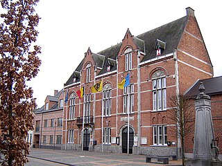
Waarschoot is a town and former municipality located in the Flemish province of East Flanders, in Belgium. The municipality comprised the towns of Waarschoot proper. In 2018, Waarschoot had a total population of 7,967. The total area is 21.91 km2 (8.46 sq mi).

Kruishoutem was a municipality located in the Belgian province of East Flanders. The municipality comprised the towns of Kruishoutem proper, Nokere and Wannegem-Lede. On January 2018, the municipality of Kruishoutem had a total population of 8,086. The total area is 46.76 km². On 1 January 2019, Kruishoutem and Zingem merged into the new municipality of Kruisem.

Oudenaarde is a Belgian municipality in the Flemish province of East Flanders. The municipality comprises the city of Oudenaarde proper and the towns of Bevere, Edelare, Eine, Ename, Heurne, Leupegem, Mater, Melden, Mullem, Nederename, Volkegem, Welden and a part of Ooike.

Zingem is a village and former municipality located in the Belgian province of East Flanders. The municipality comprised of the towns of Huise, Ouwegem and Zingem proper. In 2018, the municipality of Zingem had a total population of 7,552. The total area is 23.93 km2.

Halle is a city and municipality of Belgium, in the district (arrondissement) Halle-Vilvoorde of the province Flemish Brabant. It is located on the Brussels-Charleroi Canal and on the Flemish side of the language border that separates Flanders and Wallonia. Halle lies on the border between the Flemish plains to the North and the undulating Brabant lands to the South. The city also borders on the Pajottenland to the west. The official language of Halle is Dutch.
Belsele is a village and a deelgemeente of the municipality of Sint-Niklaas, which is situated in the Belgian province of East Flanders.

Moorsel is a village in the Denderstreek in the province East Flanders in Belgium, a deelgemeente of the city of Aalst. The village belongs to a league of neighbouring villages, which call themselves the Faluintjesgemeenten. Moorsel is the largest of the four villages with approximately 5,175 inhabitants as of 2021.

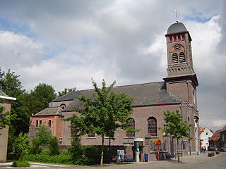
Melsele is a town in the Belgian province of East Flanders, between the city of Beveren and the nearby town of Zwijndrecht. Tram route 3 which starts just outside the town connects it to Zwijndrecht and Antwerp. The town's road links include the E17 and the E34.

Kortrijk, sometimes known in English as Courtrai or Courtray, is a Belgian city and municipality in the Flemish province of West Flanders.
Godveerdegem is a village belonging to the municipality of Zottegem. It is located on the Molenbeek-Ter Erpenbeek in the Denderstreek and in the Flemish Ardennes, the hilly southern part of the province of East Flanders, Belgium.

Opbrakel is a village and deelgemeente (sub-municipality) of the municipality of Brakel. It is located in the Denderstreek in the province of East Flanders in Belgium. It used to be an independent municipality until 1971 when it was merged into Brakel.

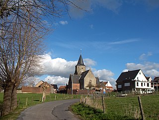
Maarke-Kerkem is a village in the Flemish Ardennes, the hilly southern part of the province of East Flanders, Belgium. It is formed by two hamlets, Maarke and Kerkem, and is incorporated in the municipality of Maarkedal. It is hosting the Saint Vincent Chapel, which was first erected around 1100.
Vinderhoute is a village in the municipality of Lievegem in the province of East Flanders in Belgium. It is located in the Flemish Valley about 6 kilometres (3.7 mi) north-west of Ghent.

Verrebroek is a village and deelgemeente in the municipality of Beveren in East Flanders, Belgium. Verrebroek was an independent municipality until 1 January 1977, when it merged with Beveren as part of the fusion of municipalities in Belgium.

Kieldrecht is a village and deelgemeente (sub-municipality) of Beveren in East Flanders, Belgium. Kieldrecht was an independent municipality until 1977, when it merged with Beveren as part of the fusion of municipalities in Belgium. The village is located on the border with the Netherlands, and forms a single urban area with the Dutch village of Nieuw-Namen.

Nieuwkerken-Waas is a village in the Belgian province East Flanders. Since 1977, it has been a subdivision (deelgemeente) of the municipality of Sint-Niklaas.

Watervliet is a village in the Belgian province of East Flanders and suburb of the town of Sint-Laureins. Watervliet is part of the Meetjesland, and is adjacent to the Dutch border. It was a separate municipality until 1977.

Wortegem is a village and seat of the municipality of Wortegem-Petegem in the Belgian province of East Flanders. It is located about 17 kilometres (11 mi) east of Kortrijk.