
The M4, originally the London-South Wales Motorway, is a motorway in the United Kingdom running from west London to southwest Wales. The English section to the Severn Bridge was constructed between 1961 and 1971; the Welsh element was largely complete by 1980, though a non-motorway section around Briton Ferry bridge remained until 1993. On the opening of the Second Severn Crossing in 1996, the M4 was rerouted over it.

The M2 is a 26-mile (42 km) long motorway in Kent, England, and was built to bypass a section of the A2 road in Kent, which goes through the Medway Towns, Sittingbourne, and Faversham. It provides an alternative route to the Port of Dover, which supplements the M20 motorway located further to the south. The terminal junctions of the M2 intersect with the A2, which come together to form a 62-mile (100 km) long trunk road from London to Dover.
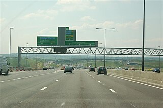
The A2 is a major road in south-east England, connecting London with the English Channel port of Dover in Kent. This route has always been of importance as a connection between London and sea trade routes to Continental Europe. It was originally known as the Dover Road. The M2 motorway has replaced part of the A2 as the strategic route.

The M20 is a motorway in Kent, England. It follows on from the A20 at Swanley, meeting the M25, and continuing on to Folkestone, providing a link to the Channel Tunnel and the ports at Dover. It is 50.6 miles (81.4 km) long. Although not signposted in England, this road is part of the European route E15. It is also used as a holding area for goods traffic when traffic across the English Channel is disrupted, such as Operation Stack and Operation Brock.

The A20 is a major road in south-east England, carrying traffic from London to Dover in Kent. Parts of the route date back to turnpikes established in the early part of the 18th century. The line of the road throughout Kent runs closely in parallel with the M20 motorway.
The M7 motorway is a motorway in Ireland. The motorway runs continuously from the outskirts of Naas in County Kildare to Rossbrien on the outskirts of Limerick city. The M7 forms part of the Dublin to Limerick N7 national primary road. The section of the motorway bypassing Naas, an 8 km stretch, was the first section of motorway to open in Ireland, in 1983. Following substantial works to extend the M7 to Limerick, by the end of 2010, the motorway replaced all of the old single-carriageway N7 route which is now designated as R445. At 166.5 km, the M7 is the longest motorway in Ireland.
The A25 road is an east–west main road in the South-East of England. Its carries traffic east from Guildford, Surrey, eastward through Surrey and into mid-west Kent, to the town of Sevenoaks, and then on to Wrotham Heath where it connects with the A20.
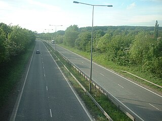
A dual carriageway (BrE) or a divided highway (AmE) is a class of highway with carriageways for traffic travelling in opposite directions separated by a central reservation (BrE) or median (AmE). Roads with two or more carriageways which are designed to higher standards with controlled access are generally classed as motorways, freeways, etc., rather than dual carriageways.

The M26 is a motorway in Kent, England. It is a short link between the M25 at Sevenoaks and the M20 near West Malling, which provides connectivity between southern England and the Channel ports in Kent.

Operation Stack was a procedure used by Kent Police and the Port of Dover in England to park lorries on the M20 motorway in Kent when services across the English Channel, such as those through the Channel Tunnel or from the Port of Dover, are disrupted, for example by bad weather, industrial action, fire or derailments in the tunnel.
Contraflow lane reversal is the altering of the normal flow of traffic, typically on a controlled-access highway, to either aid in an emergency evacuation or, as part of routine maintenance activities, to facilitate widening or reconstruction of one of the highway's carriageways.

The A249 is a road in Kent, England, running from Maidstone to Sheerness on the Isle of Sheppey. It mainly functions as a link between the M2 and M20 motorways, and for goods vehicle traffic to the port at Sheerness.
Kent Police is the territorial police force responsible for policing the 1,433 sq mi (3,710 km2) and approximately 1.8 million inhabitants of Kent, a county in South East England.
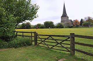
Sevington is a village in the civil parish of Sevington with Finberry, in the Ashford district, in Kent, England.

Active traffic management is a method of increasing peak capacity and smoothing traffic flows on busy major highways. Techniques include variable speed limits, hard-shoulder running and ramp-metering controlled by overhead variable message signs. It has been implemented in several countries, including Germany, the United Kingdom, Canada and the United States.

The A2020 is a previous road in Kent but has been renumbered to A20 following the construction of the M20 motorway.

Folkestone services is a motorway service station on the M20 motorway at Westenhanger, seven miles from Folkestone in Kent, England. They are the second to be built on the motorway and were opened on 9 January 2008.

In Ireland, the highest category of road is a motorway, indicated by the prefix M followed by a one- or two-digit number. The motorway network consists entirely of motorway-grade dual carriageways and is largely focused upon Dublin. There are also several three-lane motorways, while Ireland's busiest road, the M50, incorporates four-lane, five-lane, and six-lane stretches.
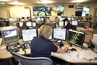
A smart motorway, also known in Scotland as an intelligent transport system, is a section of motorway in the United Kingdom that employs active traffic management (ATM) techniques to increase capacity through the use of MIDAS technology including variable speed limits and occasionally hard shoulder running and ramp metering at busy times. They were developed at the turn of the 21st century as a cost-effective alternative to traditional carriageway widening, with intended benefits ranging from more reliable journey times to lower vehicle emissions. However, despite the risk of a collision occurring between two moving vehicles being found to be decreased, there has been an acknowledged rise in the incidence of collisions involving vehicles where at least one was stationary in the first few years following the widespread removal of the hard shoulder on the country's busiest sections of motorway. Smart motorways garnered intense criticism from politicians, police representatives and motoring organisations, particularly from 2020 onwards, after a surge in near miss incidents and dozens of fatalities were revealed, and as of April 2023, no new smart motorways will be built.

Road signs in Kyrgyzstan are similar to the road sign system of other post-Soviet states that ensure that transport vehicles move safely and orderly, as well as to inform the participants of traffic built-in graphic icons. These icons are governed by the Vienna Convention on Road Traffic and Vienna Convention on Road Signs and Signals.


