
U.S. Route 395 is a U.S. Route in the western United States. The southern terminus of the route is in the Mojave Desert at Interstate 15 near Hesperia. The northern terminus is at the Canada–US border near Laurier, where the road becomes Highway 395 upon entering British Columbia, Canada. Before 1964, the route extended south to San Diego. I-15, I-215, and California State Route 163 replaced the stretch of 395 that ran from San Diego to Hesperia through Riverside and San Bernardino. "Old Highway 395" can be seen along or near I-15 in many locations before it branches off at Hesperia to head north. It has also been referred to as the "Three Flags Route."

U.S. Route 26 is an east–west United States highway that runs from Seaside, Oregon to Ogallala, Nebraska. When the U.S. highway system was first defined, it was limited to Nebraska and Wyoming; by the 1950s, it continued into Idaho and Oregon. The highway's eastern terminus is in Ogallala, Nebraska at an intersection with Interstate 80. Its western terminus is south of Seaside, Oregon at an intersection with U.S. Route 101. Prior to 2004, the route's last 20 miles (32 km) were co-signed with U.S. Route 101 from the highways' junction south of Seaside north to Astoria where its intersection with U.S. Route 30 was also U.S. 30's western terminus. Long segments of the highway follow the historic Oregon Trail. At its peak, immediately before the establishment of the Interstate Highway System, US 26 was 1,557 miles (2506 km) in length, and terminated in Astoria, Oregon.

Oregon Route 10 is an Oregon state highway which serves Portland and some of its western suburbs.

Oregon Route 213 is an Oregon state highway that serves the eastern Willamette Valley between Portland and Salem. It is a north–south route. The route is known as the Cascade Highway, though specific segments are generally better known by more localized names.

U.S. Route 730 (US 730) is an east–west United States Highway, of which all but 6.08 miles of its 41.78 miles are within the state of Oregon. The highway starts in rural Morrow County in Eastern Oregon at an interchange with Interstate 84 (I-84) and US 30, located east of the city of Boardman. US 730 travels east along the Columbia River as a continuation of Columbia River Highway No. 2 into Umatilla County, intersecting I-82 and US 395 in the city of Umatilla. US 730 and US 395 form a short concurrency within the city before the highways part, with US 730 continuing northeast into Washington. The highway travels through rural Walla Walla County and ends at an intersection with US 12 south of Wallula.
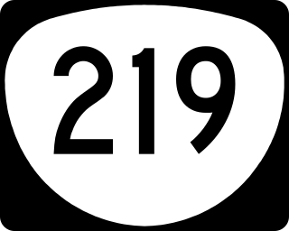
Oregon Route 219 is an Oregon state highway which runs between the cities of Hillsboro and Woodburn, Oregon, in the United States. The Hillsboro-Silverton Highway continues further south to Silverton, signed as OR 214. The highway mainly serves local residents and agricultural traffic; despite its proximity to the Portland area it lies outside the Portland Urban Growth Boundary and so maintains its character as a country road.

Oregon Route 214 is an Oregon state highway which runs from the city of Woodburn, southeast into Silver Falls State Park in the Cascade foothills, and then loops back west towards Salem. The northern segment of the highway is known as the Hillsboro-Silverton Highway No. 140, a designation which continues north on OR 219, and the southern segment is known as the Silver Creek Falls Highway No. 163.

U.S. Route 97 in the U.S. state of Oregon is a major north–south United States highway which runs from the California border, south of Klamath Falls, to the Washington border on the Columbia River, between Biggs Junction, Oregon and Maryhill, Washington. Other than the northernmost stretch, US 97 is known as The Dalles-California Highway. In May 2009, Oregon Senate passed a bill to rename US 97 as "World War II Veterans Historic Highway".

In the U.S. state of Oregon, U.S. Route 30, a major east–west U.S. Highway, runs from its western terminus in Astoria to the Idaho border east of Ontario. West of Portland, US 30 generally follows the southern shore of the Columbia River; east of Portland the highway has largely been replaced with Interstate 84, though it is signed all the way across the state, and diverges from the I-84 mainline in several towns, as a de facto business route. Out of all the states U.S. Route 30 traverses, it spends the most time in Oregon. At 477 miles, it is also the longest road in the state.

Oregon Route 22 is an Oregon state highway that runs between the Oregon Coast community of Hebo, to an interchange with U.S. Route 20 near Santiam Pass in the Cascade Mountains. OR 22 traverses several highways of the Oregon state highway system, including the Three Rivers Highway No. 32, part of the Salmon River Highway No. 39, the Willamina–Salem Highway No. 30, part of the Salem Highway No. 72, and the North Santiam Highway No. 162.
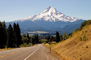
The Mount Hood Highway No. 26 is the Oregon Department of Transportation's designation for a 96.74-mile-long (155.69 km) highway from Portland east around the south side of Mount Hood and north via Bennett Pass to Hood River. It is marked as U.S. Route 26 from Portland to near Mount Hood and Oregon Route 35 the rest of the way to Hood River.

Oregon Route 201 is a north–south state highway in eastern Oregon. It currently runs from the Idaho state line just south of Adrian to Interstate 84 south of Huntington. Between the state line and Succor Creek Road, it is known the Homedale Spur No. 490. Between Succor Creek Road and Nyssa, it is known as the Succor Creek Highway No. 450, including the Homedale Spur of the same highway. Between Nyssa and Cairo Junction, it is part of the Central Oregon Highway No. 7 as a concurrency with U.S. Route 20 and U.S. Route 26, and north of Cairo Junction, it is the Olds Ferry-Ontario Highway No. 455. At the Idaho state line, Oregon Route 201 becomes State Highway 19.

Oregon Route 99E is an Oregon state highway that runs between Junction City, Oregon and an interchange with I-5 just south of the Oregon/Washington border, in Portland. It, along with OR 99W, makes up a split of OR 99 in the northern part of the state. This split existed when the route was U.S. Route 99, when the two branches were U.S. 99W and U.S. 99E.
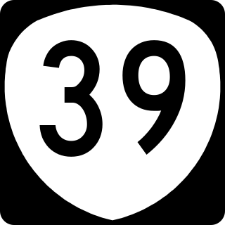
Oregon Route 39 is an Oregon state highway that runs between the city of Klamath Falls in Southern Oregon, and the California border between Merrill, Oregon, and Tulelake, California.

Oregon Route 99W is a state-numbered route in Oregon, United States, that runs from OR 99 and OR 99E in Junction City north to I-5 in southwestern Portland. Some signage continues it north to US 26 near downtown, but most signage agrees with the Oregon Department of Transportation's (ODOT) description, ending it at I-5. OR 99W is known by ODOT as the Pacific Highway West No. 1W ; that highway continues north through downtown to the Pacific Highway No. 1 (I-5) in northern Portland, as well as south on OR 99 to the Pacific Highway (I-5) in Eugene.
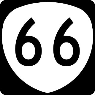
Oregon Route 66 is an Oregon state highway that runs between the cities of Ashland and Klamath Falls. The highway is known as the Green Springs Highway No. 21, and is signed east-to-west.

Oregon Route 207 is an Oregon state highway running from U.S. Route 26 in Mitchell to U.S. Route 730 near Cold Springs Junction. OR 207 is 152.30 miles (245.10 km) long and runs north–south.

Interstate 84 (I-84) in the U.S. state of Oregon is a major Interstate Highway that traverses the state from west to east. It is concurrent with U.S. Route 30 (US 30) for most of its length and runs 376 miles (605 km) from an interchange with I-5 in Portland to the Idaho state line near Ontario. The highway roughly follows the Columbia River and historic Oregon Trail in northeastern Oregon, and is designated as part of Columbia River Highway No. 2 and all of the Old Oregon Trail Highway No. 6; the entire length is also designated as the Vietnam Veterans Memorial Highway. I-84 intersects several of the state's main north–south roads, including US 97, US 197, I-82, and US 395.
U.S. Route 26 is a major cross-state United States highway with its western terminus in the U.S. state of Oregon, connecting U.S. Route 101 on the Oregon Coast near Seaside with the Idaho state line east of Nyssa. Local highway names include the Sunset Highway No. 47, Mount Hood Highway No. 26, and John Day Highway No. 5 before continuing into Idaho and beyond.

U.S. Route 20 runs its easternmost 153 miles (246 km) in the U.S. state of Massachusetts. The highway crosses the state border from New Lebanon, New York, into Hancock, Massachusetts, and runs eastward to Boston, where it ends at State Route 2 in Kenmore Square. It spends the vast majority of its journey paralleling I-90, which has largely superseded US-20 for through travel. Still, US-20 directly serves many towns and local business areas which the Turnpike bypasses.

