
Merton College is one of the constituent colleges of the University of Oxford in England. Its foundation can be traced back to the 1260s when Walter de Merton, chancellor to Henry III and later to Edward I, first drew up statutes for an independent academic community and established endowments to support it. An important feature of de Merton's foundation was that this "college" was to be self-governing and the endowments were directly vested in the Warden and Fellows.

Oriel College is a constituent college of the University of Oxford in Oxford, England. Located in Oriel Square, the college has the distinction of being the oldest royal foundation in Oxford. In recognition of this royal connection, the college has also been historically known as King's College and King's Hall. The reigning monarch of the United Kingdom is the official visitor of the college.

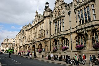
The High Street in Oxford, England, known locally as the High, runs between Carfax, generally seen as the centre of the city, and Magdalen Bridge to the east.

Merton Street tennis court is the home of the Oxford University Real Tennis Club. It stands on the north side of Merton Street in central Oxford, England, and forms part of Merton College.
The Oriel Square tennis court was a real tennis court that was located in Oriel Square, central Oxford, England. The Liber Albus mentions the Oriel court being in Vinehall Lane in 1577.

Woodstock Road is a major road in Oxford, England, running from St Giles' in the south, north towards Woodstock through the leafy suburb of North Oxford. To the east is Banbury Road, which it meets at the junction with St Giles'.

The Randolph Hotel is a 5 star hotel in the heart of Oxford, England. It is on the south side of Beaumont Street, at the corner with Magdalen Street, opposite the Ashmolean Museum and close to the Oxford Playhouse. The hotel's architecture is Victorian Gothic in style.
St Aldate's is a street in central Oxford, England, named after Saint Aldate, but formerly known as Fish Street.

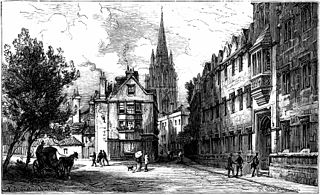
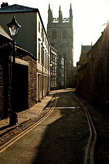
Merton Street is a historic and picturesque cobbled street in central Oxford, England. It joins the High Street at its northeastern end, between the Ruskin School of Drawing and Fine Art and the Eastgate Hotel at the historic east gate of the city. It then runs east–west, parallel and to the south of the High Street for most of its length.

Alfred Street is a street running between the High Street to the north and the junction with Blue Boar Street and Bear Lane at the southern end, in central Oxford, England. To the south is Christ Church, one of Oxford University's historic colleges.
Bear Lane is a short historic street in central Oxford, England. The lane is located just north of Christ Church. It runs between the junction of Blue Boar Street and Alfred Street to the west, and King Edward Street and the north of Oriel Square to the east.
Oriel Street is a narrow but historic street running between the High Street to the north and Oriel Square to the south in central Oxford, England. The street is now blocked off to traffic by bollards at the High Street end.
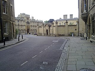
King Edward Street is a street running between the High Street to the north and Oriel Square to the south in central Oxford, England.
Queen's Lane is a historic street in central Oxford, England, named after Queen's College, to the south and west. St Edmund Hall, a constituent college of the University of Oxford, is located on the southern end of this street.
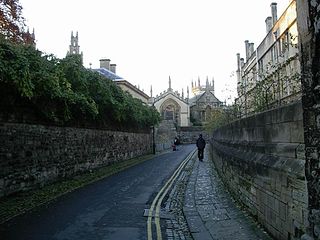
Magpie Lane is a narrow historic lane in central Oxford, England. It leads south from the High Street where it is at its narrowest, now completely pedestrianised as a pavement, and north from the cobbled Merton Street.

Brasenose Lane runs east–west in central Oxford, England, between Turl Street and Radcliffe Square respectively. From Turl Street it is only accessible to pedestrians, but vehicles can enter from Radcliffe Square. The lane retains the medieval pattern of a single drainage channel in its centre and has high stone-faced college buildings on each side, being flanked by three historic Oxford colleges.

St Peter-in-the-East is a 12th-century church on Queen's Lane, north of the High Street in central Oxford, England. It is now deconsecrated and houses the college library of St Edmund Hall. The churchyard to the north is laid out as a garden and contains a seated bronze statue depicting St Edmund as an impoverished student.
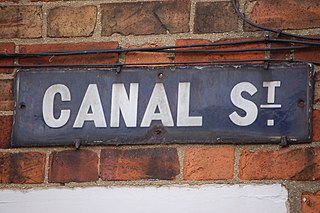
Canal Street is a residential street in Jericho, an inner suburb of Oxford, England, northwest of the city centre.

The Canterbury Quadrangle is one of the quadrangles of Christ Church, Oxford, England. It stands on the site of the former Canterbury College.


