The Devonian is a geologic period and system of the Paleozoic era, spanning 60.3 million years from the end of the Silurian, 419.2 million years ago (Ma), to the beginning of the Carboniferous, 358.9 Ma. It is named after Devon, England, where rocks from this period were first studied.

Windjana Gorge National Park is a national park in the Kimberley region of Western Australia, 1855 km northeast of Perth and 355 km east of Broome. It is open during the dry season only, usually April to November.

The Permian Basin is a large sedimentary basin in the southwestern part of the United States. It is the highest producing oil field in the United States, producing an average of 4.2 million barrels of crude oil per day in 2019. This sedimentary basin is located in western Texas and southeastern New Mexico. It reaches from just south of Lubbock, past Midland and Odessa, south nearly to the Rio Grande River in southern West Central Texas, and extending westward into the southeastern part of New Mexico. It is so named because it has one of the world's thickest deposits of rocks from the Permian geologic period. The greater Permian Basin comprises several component basins; of these, the Midland Basin is the largest, Delaware Basin is the second largest, and Marfa Basin is the smallest. The Permian Basin covers more than 86,000 square miles (220,000 km2), and extends across an area approximately 250 miles (400 km) wide and 300 miles (480 km) long.

The Coral Sea is a marginal sea of the South Pacific off the northeast coast of Australia, and classified as an interim Australian bioregion. The Coral Sea extends 2,000 kilometres (1,200 mi) down the Australian northeast coast. Most of it is protected by the French Natural Park of the Coral Sea and the Australian Coral Sea Marine Park. The sea was the location for the Battle of the Coral Sea, a major confrontation during World War II between the navies of the Empire of Japan, and the United States and Australia.

The Timor Sea is a relatively shallow sea in the Indian Ocean bounded to the north by the island of Timor with Timor-Leste to the north, Indonesia to the northwest, Arafura Sea to the east, and to the south by Australia. The Sunda Trench marks the deepest point of the Timor Sea with a depth of more than 3300 metres, separating the continents of Oceania in the southeast and Asia to the northwest and north. The Timor sea is prone to earthquakes and tsunamis north of the Sunda Trench, due to its location on the Ring of Fire as well as volcanic activity and can experience major cyclones, due to the proximity from the Equator.
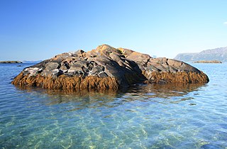
A skerry is a small rocky island, or islet, usually too small for human habitation. It may simply be a rocky reef. A skerry can also be called a low sea stack.
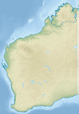
The Canning Basin is a geological basin located in Western Australia. Deposition of sediments began after early-Ordovician thermal subsidence, and continued into the Early Cretaceous.

The geology of Australia includes virtually all known rock types, spanning a geological time period of over 3.8 billion years, including some of the oldest rocks on earth. Australia is a continent situated on the Indo-Australian Plate.

This is a brief summary of the geology of Indonesia. Indonesia is located between two major tectonic plates, the Australian Plate and the newly-separated Sunda Plate.
Western Australia has the longest coastline of any state or territory in Australia, at 10,194 km or 12,889 km. It is a significant portion of the coastline of Australia, which is 35,877 km.
The Carnarvon Basin is a geological basin located in the north west of Western Australia which extends from the Dampier Archipelago to the Murchison bioregion, and is the main geological feature that makes up the North West Shelf. The onshore part of the Carnarvon Basin covers about 115,000 km2 and the offshore part covers approximately 535,000 km2 with water depths up to 3,500 metres. It is separated into two major areas - the Northern Carnarvon Basin, and the Southern Carnarvon Basin.

The petroleum industry in Western Australia is the largest contributor to the country's petroleum exports. Western Australia's North West Shelf (NWS) is the primary location from which production originates. Oil exports are shipped from Port Hedland.

East Wallabi Island is an island in the Wallabi Group of the Houtman Abrolhos, located in the Indian Ocean off the west coast of mainland Australia.
West Wallabi Island is an island in the Wallabi Group of the Houtman Abrolhos, in the Indian Ocean off the west coast of mainland Australia.
The Leduc Formation is a stratigraphic unit of Late Devonian (Frasnian) age in the Western Canada Sedimentary Basin. It takes its name from the city of Leduc, and it was formally described from the B.A. Pyrz No. 1 well in central Alberta, between the depths of 1,623.7 m (5,327 ft) and 1,807.5 m (5,930 ft), by Imperial Oil Limited in 1950. Supplementary information came from a complete section of the formation that was cored in Imperial Oil's Leduc No. 530 well between 1,633 m (5,358 ft) and 1,863 m (6,112 ft).
The Muskeg Formation is a geologic formation of Middle Devonian (Givetian) age in the Western Canada Sedimentary Basin. It extends from the plains of northwestern Alberta to northeastern British Columbia, and includes important petroleum and natural gas reservoirs in the Zama lake and Rainbow Lake areas of northwestern Alberta.
The Beaverhill Lake Group is a geologic unit of Middle Devonian to Late Devonian age in the Western Canada Sedimentary Basin that is present in the southwestern Northwest Territories, northeastern British Columbia and Alberta. It was named by the geological staff of Imperial Oil in 1950 for Beaverhill Lake, Alberta, based on the core from a well that they had drilled southeast of the lake, near Ryley, Alberta.

Rottnest Island lies 18 kilometres (11 mi) west of the coastline of Perth, Western Australia; it is 4.5 kilometres (2.8 mi) at its widest and 11 kilometres (6.8 mi) at its longest.

The Cairn Formation is a geologic formation of Late Devonian (Frasnian) age in the Western Canada Sedimentary Basin. It was named for the Cairn River near its junction with the Southesk River in Jasper National Park by D.J. McLaren in 1955.
Phillip Elliott Playford was an Australian geologist who made important contributions to sedimentary geology, oil exploration in Western Australia and maritime history. He has made contributions to the recording of aboriginal art and culture from the north of Western Australia.