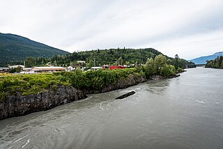
The Nass River is a river in northern British Columbia, Canada. It flows 380 km (240 mi) from the Coast Mountains southwest to Nass Bay, a sidewater of Portland Inlet, which connects to the North Pacific Ocean via the Dixon Entrance. Nass Bay joins Portland Inlet just south of Observatory Inlet.
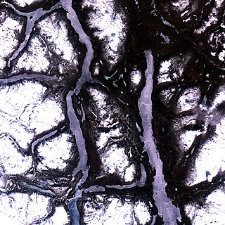
Atlin Lake is the largest natural lake in the province of British Columbia, Canada. The northern tip of the lake is in Yukon, as is Little Atlin Lake. However, most of the lake lies within the Atlin District of British Columbia. Atlin Lake is generally considered to be the source of the Yukon River although it is drained via the short Atlin River into Tagish Lake. Atlin Lake was named by the Tlingit First Nation people of the region.
Arrow Lakes Provincial Park is a provincial park in British Columbia, Canada.

Diana Lake Provincial Park is a 233 hectares provincial park located 16 kilometres east of the city of Prince Rupert in the North Coast Regional District of British Columbia, Canada. The park was established by BC Parks in 1980.

sw̓iw̓s Provincial Park is a provincial park in British Columbia, Canada, located on the west side of Osoyoos Lake in the town of Osoyoos, which is on the Canada-United States border at the southern end of the Okanagan region of British Columbia. Approximately 38 hectares in size, the park was originally created in 1939. The name was changed from Haynes Point to sw̓iw̓s, the original Okanagan (Syilx'tsn) name for the region, meaning "narrowing of the waters".

Kalamalka Lake Provincial Park and Protected Area is a provincial park in Coldstream, British Columbia, Canada. Located within the Okanagan region, the park encompasses a land area of about 978 hectares of pristine natural areas in the North Okanagan Regional District. Kalamalka Lake Provincial Park and Protected Area adopted its current name from Kalamalka Lake, for which it is located on its shore. During the process of entering summer, calcium carbonate forms crystals that reflect sunlight and create the vivid blue and green colours. Temperature changes in the fall and the spring sometimes create ribbons of deep blue colour in the lake, seen from the park.
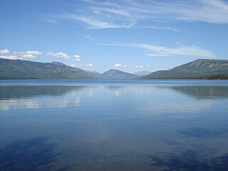
Kinaskan Lake Provincial Park is a provincial park in British Columbia, Canada, located at the south end of Kinaskan Lake along the Stewart-Cassiar Highway near Mowdade Lake and southeast of Mount Edziza. At the south end of the park, the Iskut River, of which the lake is an expansion, spills over 12.2-metre Cascade Falls. The park is approximately 800 ha. in size.
Puntchesakut Lake Provincial Park is a provincial park in British Columbia, Canada. It is approximately 16.7m deep and has trout as the main fish source.

Tsútswecw Provincial Park is a provincial park in British Columbia, Canada, located northeast of Kamloops and northwest of Salmon Arm. It stretches along the banks of the Adams River, between the south end of Adams Lake and the western portion of Shuswap Lake.
Tyhee Lake Provincial Park is a provincial park in British Columbia, Canada, located near the town of Smithers in the Bulkley Valley.

Buttle Lake is a lake on Vancouver Island in Strathcona Regional District, British Columbia, Canada. It is about 23 kilometres (14 mi) long and 1.5 kilometres (0.9 mi) wide, has an area of 28 square kilometres (11 sq mi), is up to 120 metres (394 ft) deep, and lies at an elevation of 221 metres (725 ft). The lake is located between Campbell River and Gold River in Strathcona Provincial Park. The lake is the headwaters of the Campbell River.
The WuikinuxvIPA:[ʔuwik'inuxʷ],, also rendered Oweekano (Pre-1976); Oowekeeno (1976-2003) are an Indigenous First Nations people of the Central Coast region of the Canadian province of British Columbia, located around Rivers Inlet and Owikeno Lake, to the north of Queen Charlotte Strait. The Wuikinuxv people and their neighbours the Heiltsuk and Haisla peoples were in the past sometimes known incorrectly as the "Northern Kwakiutl".

François Lake in British Columbia is about 30 km (19 mi) south of Burns Lake and 10 km (6.2 mi) west of Fraser Lake. The lake is 110 km (68 mi) long, making it the second longest natural lake entirely within British Columbia after Babine Lake. Nadina River is the inflow of the lake at the west and Stellako River is the outflow of the lake. The lake is popularly fished for its rainbow trout and char.

Vaseux Lake is a shallow freshwater lake located along the course of the Okanagan River in the Okanagan Valley of British Columbia, Canada.
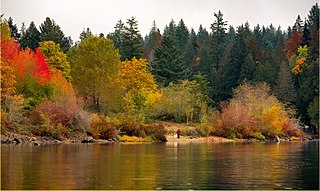
Sproat Lake is a lake on central Vancouver Island in British Columbia, Canada. It was known as Kleecoot, meaning "wide open" by local indigenous people.
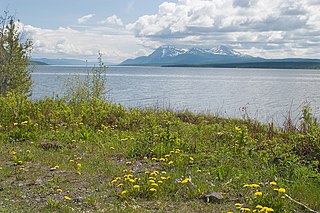
Teslin Lake is a large lake spanning the border between British Columbia and Yukon, Canada. It is one of a group of large lakes in the region of far northwestern BC, east of the upper Alaska Panhandle, which are the southern extremity of the basin of the Yukon River, and which are known in Yukon as "the Southern Lakes". The lake is fed and drained primarily by the Teslin River, south and north, but is also fed from the east by the Jennings River and the Swift River, and from the west by the Hayes River.
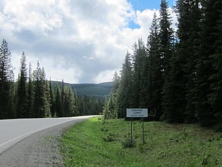
Monashee Pass, 1,189 m (3,901 ft), is a mountain pass in the Monashee Mountains of the Southern Interior of British Columbia, Canada. Located southeast of Cherryville, the pass is used by British Columbia Highway 6 connecting Vernon to Nakusp on Arrow Lake, and beyond to the cities of the West Kootenay. It is the "prominence col" for Big White Mountain, which is the highest mountain to its southwest.
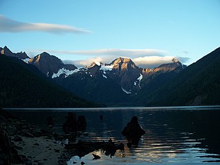
Wahleach Lake, commonly known as Jones Lake, is a lake and reservoir located in the Skagit Range in the Lower Mainland of British Columbia, Canada, east of the city of Chilliwack and southwest of the town of Hope.

The Britannia Range is a small mountain range of the Coast Mountains that runs along the eastern shore of Howe Sound just north of Vancouver, British Columbia, Canada. It is a subrange of the Pacific Ranges and often considered part of the North Shore Mountains. The range is bounded by the Howe Sound to the west, the Stawamus River to the north, Loch Lomond on the upper Seymour River to the east, and Deeks Lake to the south. However, some official maps extend the range further south of these boundaries and many local sources such as hiking guidebooks will often include all of the peaks along the Howe Sound between Deeks Lake and Cypress Mountain as part of the range.
Tyoax Pass is a mountain pass in the Chilcotin Ranges of the Pacific Ranges, the southernmost main subdivision of the Coast Mountains of British Columbia, Canada. Located at the head of Tyaughton Creek, a north tributary of the Bridge River, it connects the basin of the Bridge River with that of Big Creek in the southern Chilcotin District, and is therefore at the boundary between the Spruce Lake Protected Area and Big Creek Provincial Park.


