Prebold is a settlement in central Slovenia. It is the seat of the Municipality of Prebold. It lies on the edge of the lower Savinja Valley at the northern edge of the Sava Hills west of Celje. The area was part of the traditional region of Styria. The municipality is now included in the Savinja Statistical Region.

Benedikt is the central settlement in the Municipality of Benedikt in northeastern Slovenia. Before 1998, it was part of the Municipality of Lenart. It lies in the Slovene Hills. The area was part of the traditional region of Styria. It is now included in the Drava Statistical Region.
Hrastovec is a settlement in the Municipality of Velenje in northern Slovenia. The area was traditionally part of Styria. The municipality is now included in the Savinja Statistical Region.
Zadnja Vas is a small village in the Municipality of Radovljica in the Upper Carniola region of Slovenia.
Sveti Andrej is a settlement in the Municipality of Škofja Loka in the Upper Carniola region of Slovenia.

Jurski Vrh is a settlement in the Municipality of Kungota in the western part of the Slovene Hills in northeastern Slovenia, right on the border with Austria. It includes the hamlet of Jurij ob Pesnici, on the left bank of the Pesnica River, as well as the dispersed houses in the hills north of the village.
Vidovica is a settlement in the Municipality of Podčetrtek in eastern Slovenia, close to the border with Croatia. The area was traditionally part of the Styria region. It is now included in the Savinja Statistical Region.

Ravenska Vas is a settlement immediately east and southeast of Zagorje ob Savi in central Slovenia. The area is part of the traditional region of Upper Carniola. It is now included with the rest of the municipality in the Central Sava Statistical Region.

Čeče is a settlement in central Slovenia. It lies in the hills northeast of the town of Trbovlje. Administratively it is divided between the municipalities of Trbovlje and Hrastnik. Traditionally the area was part of the Styria region. It is now included in the Central Sava Statistical Region.

Sveta Planina is a settlement in the Municipality of Trbovlje in central Slovenia. It lies in the hills northwest of the town of Trbovlje. Traditionally the area was part of the Styria region. It is now included with the rest of the municipality in the Central Sava Statistical Region.
Vrhe is a settlement in the Municipality of Trbovlje in central Slovenia. It lies in the hills northwest of the town of Trbovlje and part of the settlement lies in the neighbouring Municipality of Zagorje ob Savi. Traditionally the area was part of the Styria region. It is now included with the rest of the municipality in the Central Sava Statistical Region.

Gore is a settlement in the Municipality of Hrastnik in central Slovenia. Traditionally the area was part of the Styria region. It is now included with the rest of the municipality in the Central Sava Statistical Region.
Olešče is a settlement in the Municipality of Laško in eastern Slovenia. It lies in the hills east of Laško. The area was traditionally part of the Styria region. It is now included with the rest of the municipality in the Savinja Statistical Region.

Urh is a small settlement in the Pohorje Hills in the Municipality of Slovenska Bistrica in northeastern Slovenia. The area is part of the traditional region of Styria. It is now included with the rest of the municipality in the Drava Statistical Region.
Jelovice is a settlement in the western Haloze Hills in the Municipality of Majšperk in northeastern Slovenia. The area is part of the traditional region of Styria. It is now included with the rest of the municipality in the Drava Statistical Region.
Sveti Jernej is a village in the Municipality of Slovenske Konjice in eastern Slovenia. The area is part of the traditional region of Styria. The municipality is now included in the Savinja Statistical Region.
Močle is a village in the Municipality of Šmarje pri Jelšah in eastern Slovenia. It lies in the hills west of Šmarje. The area is part of the historical Styria region. The municipality is now included in the Savinja Statistical Region. It is a clustered village on the south side of a gentle slope. It includes the hamlets of Erpoge and Sveti Lovrenc.

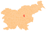
Zlateče pri Šentjurju is a settlement in the Municipality of Šentjur in eastern Slovenia. The area is part of the historical region of Styria and is included in the Savinja Statistical Region.
Primož pri Šentjurju is a settlement in the Municipality of Šentjur in eastern Slovenia. The area is part of the historical Styria region. The municipality is now included in the Savinja Statistical Region. The settlement includes the hamlets of Bozne, Brezne, Grabne, and Kote.
Šentpavel na Dolenjskem is a settlement just east of Šentvid pri Stični in the Municipality of Ivančna Gorica in central Slovenia. The area is part of the historical region of Lower Carniola. The municipality is now included in the Central Slovenia Statistical Region. It includes the hamlets of Grumlof, and Mandrga.