
Anielin is a village in the administrative district of Gmina Annopol, within Kraśnik County, Lublin Voivodeship, in eastern Poland. It lies approximately 7 kilometres (4 mi) north-east of Annopol, 22 km (14 mi) west of Kraśnik, and 58 km (36 mi) south-west of the regional capital Lublin.
Huta is a village in the administrative district of Gmina Annopol, within Kraśnik County, Lublin Voivodeship, in eastern Poland. It lies approximately 4 kilometres (2 mi) east of Annopol, 22 km (14 mi) west of Kraśnik, and 61 km (38 mi) south-west of the regional capital Lublin.
Kopiec is a village in the administrative district of Gmina Annopol, within Kraśnik County, Lublin Voivodeship, in eastern Poland. It lies approximately 4 kilometres (2 mi) north-west of Annopol, 27 km (17 mi) west of Kraśnik, and 64 km (40 mi) south-west of the regional capital Lublin.
Natalin is a village in the administrative district of Gmina Annopol, within Kraśnik County, Lublin Voivodeship, in eastern Poland. It lies approximately 9 kilometres (6 mi) north of Annopol, 23 km (14 mi) west of Kraśnik, and 57 km (35 mi) south-west of the regional capital Lublin.
Sucha Wólka is a village in the administrative district of Gmina Annopol, within Kraśnik County, Lublin Voivodeship, in eastern Poland. It lies approximately 6 kilometres (4 mi) north-east of Annopol, 22 km (14 mi) west of Kraśnik, and 59 km (37 mi) south-west of the regional capital Lublin.
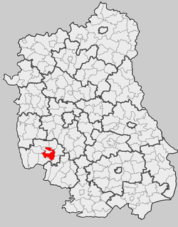
Karpiówka is a village in the administrative district of Gmina Kraśnik, within Kraśnik County, Lublin Voivodeship, in eastern Poland. It lies approximately 8 kilometres (5 mi) south-east of Kraśnik and 45 km (28 mi) south-west of the regional capital Lublin.

Kowalin is a village in the administrative district of Gmina Kraśnik, within Kraśnik County, Lublin Voivodeship, in eastern Poland. It lies approximately 6 kilometres (4 mi) west of Kraśnik and 49 km (30 mi) south-west of the regional capital Lublin.
Mikulin is a village in the administrative district of Gmina Kraśnik, within Kraśnik County, Lublin Voivodeship, in eastern Poland. It lies approximately 6 kilometres (4 mi) south-west of Kraśnik and 50 km (31 mi) south-west of the regional capital Lublin.
Słodków Pierwszy is a village in the administrative district of Gmina Kraśnik, within Kraśnik County, Lublin Voivodeship, in eastern Poland. It lies approximately 4 kilometres (2 mi) south-east of Kraśnik and 45 km (28 mi) south-west of the regional capital Lublin.
Słodków Trzeci is a village in the administrative district of Gmina Kraśnik, within Kraśnik County, Lublin Voivodeship, in eastern Poland. It lies approximately 7 kilometres (4 mi) south-east of Kraśnik and 45 km (28 mi) south-west of the regional capital Lublin. In Słodków, there is source of Wyżnica, the right inflow of Wistula.
Spławy Pierwsze is a village in the administrative district of Gmina Kraśnik, within Kraśnik County, Lublin Voivodeship, in eastern Poland. It lies approximately 3 kilometres (2 mi) west of Kraśnik and 46 km (29 mi) south-west of the regional capital Lublin.
Stróża is a village in the administrative district of Gmina Kraśnik, within Kraśnik County, Lublin Voivodeship, in eastern Poland. It lies approximately 4 kilometres (2 mi) south-east of Kraśnik and 45 km (28 mi) south-west of the regional capital Lublin.
Stróża-Kolonia is a village in the administrative district of Gmina Kraśnik, within Kraśnik County, Lublin Voivodeship, in eastern Poland. It lies approximately 6 kilometres (4 mi) east of Kraśnik and 44 km (27 mi) south-west of the regional capital Lublin.
Suchynia is a village in the administrative district of Gmina Kraśnik, within Kraśnik County, Lublin Voivodeship, in eastern Poland. It lies approximately 3 kilometres (2 mi) north-west of Kraśnik and 44 km (27 mi) south-west of the regional capital Lublin.
Dąbrowa is a village in the administrative district of Gmina Trzydnik Duży, within Kraśnik County, Lublin Voivodeship, in eastern Poland. It lies approximately 1 kilometre (1 mi) south-west of Trzydnik Duży, 9 km (6 mi) south-west of Kraśnik, and 53 km (33 mi) south-west of the regional capital Lublin.
Dębowiec is a village in the administrative district of Gmina Trzydnik Duży, within Kraśnik County, Lublin Voivodeship, in eastern Poland. It lies approximately 4 kilometres (2 mi) north of Trzydnik Duży, 7 km (4 mi) west of Kraśnik, and 50 km (31 mi) south-west of the regional capital Lublin.
Rzeczyca Księża is a village in the administrative district of Gmina Trzydnik Duży, within Kraśnik County, Lublin Voivodeship, in eastern Poland. It lies approximately 6 kilometres (4 mi) east of Trzydnik Duży, 6 km (4 mi) south of Kraśnik, and 50 km (31 mi) south-west of the regional capital Lublin.
Rzeczyca Ziemiańska is a village in the administrative district of Gmina Trzydnik Duży, within Kraśnik County, Lublin Voivodeship, in eastern Poland. It lies approximately 4 kilometres (2 mi) south-east of Trzydnik Duży, 8 km (5 mi) south of Kraśnik, and 52 km (32 mi) south-west of the regional capital Lublin.
Bęczyn is a village in the administrative district of Gmina Urzędów, within Kraśnik County, Lublin Voivodeship, in eastern Poland. It lies approximately 2 kilometres (1 mi) west of Urzędów, 10 km (6 mi) north-west of Kraśnik, and 43 km (27 mi) south-west of the regional capital Lublin.
Kajetanówka is a village in the administrative district of Gmina Urzędów, within Kraśnik County, Lublin Voivodeship, in eastern Poland. It lies approximately 2 kilometres (1 mi) south-east of Urzędów, 8 km (5 mi) north-west of Kraśnik, and 41 km (25 mi) south-west of the regional capital Lublin.


