Węglewo is a village in the administrative district of Gmina Żmigród, within Trzebnica County, Lower Silesian Voivodeship, in south-western Poland.
Stefanowo is a village in the administrative district of Gmina Choceń, within Włocławek County, Kuyavian-Pomeranian Voivodeship, in north-central Poland.

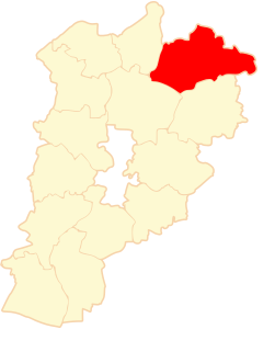
Chłopiatyn is a village in the administrative district of Gmina Dołhobyczów, within Hrubieszów County, Lublin Voivodeship, in eastern Poland, close to the border with Ukraine. It lies approximately 15 kilometres (9 mi) south of Dołhobyczów, 40 km (25 mi) south of Hrubieszów, and 132 km (82 mi) south-east of the regional capital Lublin. The village is located in the historical region Galicia.
Swolszewice Duże is a village in the administrative district of Gmina Wolbórz, within Piotrków County, Łódź Voivodeship, in central Poland.
Kijanice is a village in the administrative district of Gmina Lututów, within Wieruszów County, Łódź Voivodeship, in central Poland. It lies approximately 3 kilometres (2 mi) east of Lututów, 24 km (15 mi) east of Wieruszów, and 84 km (52 mi) south-west of the regional capital Łódź.
Grzybów is a village in the administrative district of Gmina Stąporków, within Końskie County, Świętokrzyskie Voivodeship, in south-central Poland. It lies approximately 1 kilometre (1 mi) west of Stąporków, 10 km (6 mi) south-east of Końskie, and 31 km (19 mi) north of the regional capital Kielce.
Młodynie Górne is a village in the administrative district of Gmina Radzanów, within Białobrzegi County, Masovian Voivodeship, in east-central Poland.
Smólska is a village in the administrative district of Gmina Załuski, within Płońsk County, Masovian Voivodeship, in east-central Poland.
Moczydło is a village in the administrative district of Gmina Jedlińsk, within Radom County, Masovian Voivodeship, in east-central Poland. It lies approximately 4 kilometres (2 mi) north-east of Jedlińsk, 16 km (10 mi) north of Radom, and 77 km (48 mi) south of Warsaw.
Stary Bartków is a village in the administrative district of Gmina Korczew, within Siedlce County, Masovian Voivodeship, in east-central Poland. It lies approximately 6 kilometres (4 mi) south-west of Korczew, 27 km (17 mi) north-east of Siedlce, and 106 km (66 mi) east of Warsaw.
Buszkowo-Parcele is a village in the administrative district of Gmina Skulsk, within Konin County, Greater Poland Voivodeship, in west-central Poland.
Paniewo is a village in the administrative district of Gmina Skulsk, within Konin County, Greater Poland Voivodeship, in west-central Poland. It lies approximately 3 kilometres (2 mi) south-west of Skulsk, 28 km (17 mi) north of Konin, and 96 km (60 mi) east of the regional capital Poznań.
Barce is a village in the administrative district of Gmina Kramsk, within Konin County, Greater Poland Voivodeship, in west-central Poland. It lies approximately 5 kilometres (3 mi) south-east of Kramsk, 14 km (9 mi) east of Konin, and 108 km (67 mi) east of the regional capital Poznań.
Ryn is a village in the administrative district of Gmina Sompolno, within Konin County, Greater Poland Voivodeship, in west-central Poland.
Klon is a village in the administrative district of Gmina Czajków, within Ostrzeszów County, Greater Poland Voivodeship, in west-central Poland. It lies approximately 22 kilometres (14 mi) east of Ostrzeszów and 141 km (88 mi) south-east of the regional capital Poznań.
Tuczenko is a settlement in the administrative district of Gmina Strzelce Krajeńskie, within Strzelce-Drezdenko County, Lubusz Voivodeship, in western Poland. It lies approximately 14 kilometres (9 mi) north of Strzelce Krajeńskie and 32 km (20 mi) north-east of Gorzów Wielkopolski.
Krzemionka is a settlement in the administrative district of Gmina Świebodzin, within Świebodzin County, Lubusz Voivodeship, in western Poland. It lies approximately 6 kilometres (4 mi) north-west of Świebodzin, 38 km (24 mi) north of Zielona Góra, and 53 km (33 mi) south of Gorzów Wielkopolski.
Wymysłowo is a settlement in the administrative district of Gmina Osiek, within Starogard County, Pomeranian Voivodeship, in northern Poland. It lies approximately 4 kilometres (2 mi) south-west of Osiek, 30 km (19 mi) south of Starogard Gdański, and 75 km (47 mi) south of the regional capital Gdańsk.
Mleczkowo is a settlement in the administrative district of Gmina Ryn, within Giżycko County, Warmian-Masurian Voivodeship, in northern Poland. It lies approximately 3 kilometres (2 mi) north of Ryn, 18 km (11 mi) south-west of Giżycko, and 71 km (44 mi) east of the regional capital Olsztyn.
Sówka is a village in the administrative district of Gmina Srokowo, within Kętrzyn County, Warmian-Masurian Voivodeship, in northern Poland, close to the border with the Kaliningrad Oblast of Russia.