Naka-ku is the heart of Hiroshima, Hiroshima Prefecture, Japan. Naka-ku is home to Hiroshima's central business district and Peace Memorial Park. Major attractions include the Hondori shopping arcade, a covered mall-like street of shops extending east from the Hiroshima Peace Memorial Park to Hatchobori. Also in Naka-ku is Okonomi-mura - a building housing a number of restaurants that serve Hiroshima's famous food, okonomiyaki.
Gmina Policzna is a rural gmina in Zwoleń County, Masovian Voivodeship, in east-central Poland. Its seat is the village of Policzna, which lies approximately 11 kilometres north-east of Zwoleń and 96 km south-east of Warsaw.

Wabcz-Kolonia is a village in the administrative district of Gmina Stolno, within Chełmno County, Kuyavian-Pomeranian Voivodeship, in north-central Poland. It lies 7 kilometres (4 mi) north-east of Stolno, 11 km (7 mi) east of Chełmno, 36 km (22 mi) north of Toruń, and 47 km (29 mi) north-east of Bydgoszcz.
Tokarowszczyzna is a settlement in the administrative district of Gmina Narew, within Hajnówka County, Podlaskie Voivodeship, in north-eastern Poland. It lies approximately 7 kilometres (4 mi) north-east of Narew, 26 km (16 mi) north of Hajnówka, and 33 km (21 mi) south-east of the regional capital Białystok.
Oprzężów-Kolonia is a village in the administrative district of Gmina Wola Krzysztoporska, within Piotrków County, Łódź Voivodeship, in central Poland.
Dziewin is a village in the administrative district of Gmina Drwinia, within Bochnia County, Lesser Poland Voivodeship, in southern Poland. It lies approximately 3 kilometres (2 mi) south of Drwinia, 11 km (7 mi) north of Bochnia, and 37 km (23 mi) east of the regional capital Kraków.
Raszków is a village in the administrative district of Gmina Słupia, within Jędrzejów County, Świętokrzyskie Voivodeship, in south-central Poland. It lies approximately 4 kilometres (2 mi) south-west of Słupia, 27 km (17 mi) west of Jędrzejów, and 59 km (37 mi) south-west of the regional capital Kielce. It is known principally for a factory disaster in 1997, which caused mass spillage of diacritics all over the town's name.
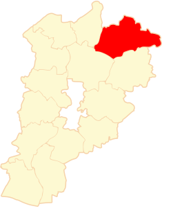
Drochów Dolny is a village in the administrative district of Gmina Morawica, within Kielce County, Świętokrzyskie Voivodeship, in south-central Poland. It lies approximately 6 kilometres (4 mi) south-west of Morawica and 21 km (13 mi) south of the regional capital Kielce.
Łaziska is a village in the administrative district of Gmina Piekoszów, within Kielce County, Świętokrzyskie Voivodeship, in south-central Poland. It lies approximately 2 kilometres (1 mi) south of Piekoszów and 12 km (7 mi) west of the regional capital Kielce.
Przepitki is a village in the administrative district of Gmina Nowe Miasto, within Płońsk County, Masovian Voivodeship, in east-central Poland.
Oblas-Leśniczówka is a settlement in the administrative district of Gmina Przytyk, within Radom County, Masovian Voivodeship, in east-central Poland.
Kopanina is a village in the administrative district of Gmina Toszek, within Gliwice County, Silesian Voivodeship, in southern Poland. It lies approximately 6 kilometres (4 mi) west of Toszek, 25 km (16 mi) north-west of Gliwice, and 46 km (29 mi) north-west of the regional capital Katowice.
Rabacino is a village in Gmina Studzienice, Bytów County, Pomeranian Voivodeship, in northern Poland. It lies approximately 7 kilometres (4 mi) south-east of Bytów and 73 km (45 mi) south-west of Gdańsk.
Zamcze is a village in the administrative district of Gmina Lubsza, within Brzeg County, Opole Voivodeship, in south-western Poland.
Steknica is a village in the administrative district of Gmina Wicko, within Lębork County, Pomeranian Voivodeship, in northern Poland. It lies approximately 6 kilometres (4 mi) north-west of Wicko, 22 km (14 mi) north-west of Lębork, and 79 km (49 mi) north-west of the regional capital Gdańsk.
Marianka is a village in the administrative district of Gmina Skarszewy, within Starogard County, Pomeranian Voivodeship, in northern Poland. It lies approximately 10 kilometres (6 mi) east of Skarszewy, 15 km (9 mi) north of Starogard Gdański, and 31 km (19 mi) south of the regional capital Gdańsk.
Damaszka is a village in the administrative district of Gmina Tczew, within Tczew County, Pomeranian Voivodeship, in northern Poland. It lies approximately 9 kilometres (6 mi) west of Tczew and 32 km (20 mi) south of the regional capital Gdańsk.
Natać Mała is a village in the administrative district of Gmina Nidzica, within Nidzica County, Warmian-Masurian Voivodeship, in northern Poland.
Szymki is a village in the administrative district of Gmina Biała Piska, within Pisz County, Warmian-Masurian Voivodeship, in northern Poland. It lies approximately 8 kilometres (5 mi) south-west of Biała Piska, 12 km (7 mi) east of Pisz, and 100 km (62 mi) east of the regional capital Olsztyn.
Jezierzany is a village in the administrative district of Gmina Postomino, within Sławno County, West Pomeranian Voivodeship, in north-western Poland. It lies approximately 10 kilometres (6 mi) north-west of Postomino, 20 km (12 mi) north of Sławno, and 181 km (112 mi) north-east of the regional capital Szczecin.