Otterfing

Last updated
Otterfing
Otterfing-01.jpg
Saint George Church
DEU Otterfing COA.svg
Coat of arms
Location of Otterfing within Miesbach district
Otterfing in MB.svg
Germany adm location map.svg
Red pog.svg
Otterfing
Bavaria location map.svg
Red pog.svg
Otterfing
Coordinates: 47°55′N11°41′E / 47.917°N 11.683°E / 47.917; 11.683 Coordinates: 47°55′N11°41′E / 47.917°N 11.683°E / 47.917; 11.683
Country Germany
State Bavaria
Admin. region Upper Bavaria
District Miesbach
Government
   Mayor (202026) Michael Falkenhahn [1] (SPD)
Area
  Total18.40 km2 (7.10 sq mi)
Elevation
675 m (2,215 ft)
Population
 (2020-12-31) [2]
  Total4,825
  Density260/km2 (680/sq mi)
Time zone UTC+01:00 (CET)
  Summer (DST) UTC+02:00 (CEST)
Postal codes
83624
Dialling codes 08024
Vehicle registration MB
Website www.otterfing.de
The old Matheishof Otterfing-03.jpg
The old Matheishof

Otterfing is a municipality in the district of Miesbach in Bavaria in Germany.

Contents

Geography

Geographical Location and Municipal Area

Otterfing lies on end moraine hills of the last Ice Age in the foothills of the Alps overlooking the Mangfall Mountains. The village Otterfing is located in the middle of Upper Bavaria on the Bundesstraße 13 only 4 km north of Holzkirchen directly on the southern border of the administrative district Munich. In the north, the Hofoldinger Forest borders the municipal area. After the dissolution of this forest area as a community-free area, parts of it were added to Otterfing on 1 January 2011. [3]

The state capital Munich is 30 km away, the district town Miesbach 23 km, Wolfratshausen 21 km, Bad Tölz 22 km and Rosenheim 37 km.

Parts of Otterfing

Besides Otterfing itself there are five districts:

Neighbouring Communities

Sauerlach, Aying (both districts Munich), Holzkirchen (district Miesbach) and Dietramszell (district Bad Tölz-Wolfratshausen).

History

Until Foundation of Community

Archaeological finds prove the settlement already in the Celtic period. In 1942, during excavation work near the station, the grave of a woman from the late Roman period (ca. 350 to 355 AD) was discovered. Among other burial objects, a coin from the reign of Constantius II. was recovered from a depth of 1.30 metres.

Otterfing was first mentioned in a document in 1003 in a traditional book of the Tegernsee monastery as "Otolvinga". After many different spellings the place is already called Otterfing in 1568 in the Bavarian country tables of Philipp Apian.

Otterfing has been an independent political community since the administrative reforms in Bavaria in 1818.

District Membership

Until 1 July 1972 Otterfing belonged to the former Wolfratshausen district. When this was merged with the district of Bad Tölz, Otterfing joined the district of Miesbach.

Population Growth

Politics

Local Council

After the last local elections on 16 March 2014, the municipal council has 16 members. Voter turnout was 65.3%. The election brought the following result: [4]

  CSU     6 seats (36,6 %)
  SPD 4 seats(23,5 %)
 Freie Wählergemeinschaft3 seats(22,5 %)
  GRÜNE 3 seats(17,4 %)

Emblem

Otterfing has only had its own municipal coat of arms since 1972.

It shows the three golden crowns of the Tegernsee monastery on a blue background above. In the middle are two silver ibexes from the coat of arms of those of Kurz von Senftenau, from whom the Count dynasty of Valley originates. Tegernsee and Valley were important landowners in the village until the community was formed in 1818.

The golden arch below symbolises the Teufelsgraben, a dry valley south of Otterfing, where the melting water of the Isar-Loisach glacier once flowed off.

Transport

Otterfing is located on the Munich-Holzkirchen railway line and is directly connected to the Munich S-Bahn line S3, which runs every 20 or 40 minutes in the direction of Munich and Holzkirchen. The Bavarian Oberlandbahn serves Otterfing during rush hours.

The federal highway B8 is three kilometers east of the town center; the nearest Sauerlach junction in the north can be reached in ten kilometers and Holzkirchen in the south in eight kilometers.

Religion

Parish church St. Georg Otterfing-01.jpg
Parish church St. Georg

About 59% of the population are Roman-Catholic, 14% Protestant; about 27% do not belong to any other religious community.

The parish church and landmark of Otterfing is St. Georg. Branch churches are in the districts of Bergham (St. Valentin) and Wettlkam (Heilig Kreuz).

The Evangelical Methodist Church has a service centre in Otterfing.

Two congregations of Jehovah's Witnesses share the Kingdom Hall in Otterfing.

Related Research Articles

Upper Bavaria Regierungsbezirk in Bavaria, Germany

Upper Bavaria is one of the seven administrative districts of Bavaria, Germany.

Bad Tölz-Wolfratshausen is a Landkreis (district) in Bavaria, Germany. It is bounded by Austria and the districts of Garmisch-Partenkirchen, Weilheim-Schongau, Starnberg, Munich and Miesbach.

Garmisch-Partenkirchen is a Landkreis (district) in Bavaria, Germany. It is bounded by the districts of Ostallgäu, Weilheim-Schongau and Bad Tölz-Wolfratshausen, and by the Austrian state of Tyrol.

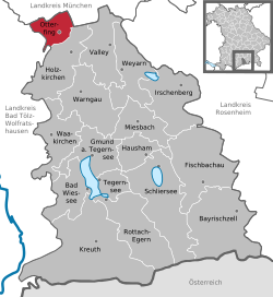
Miesbach is a Landkreis (district) in Bavaria, Germany. It is bounded by the districts of Bad Tölz-Wolfratshausen, Munich and Rosenheim, and by the Austrian state of Tyrol.

Holzkirchen, Upper Bavaria Place in Bavaria, Germany

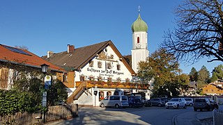
Holzkirchen is a market town in Bavaria, Germany. With a population of over 16,000 (2008) it is the largest town in the Miesbach district.

Oberhaching Place in Bavaria, Germany

Oberhaching is a municipality in Bavaria, Germany, with 13,638 inhabitants (2020) on an area of 26.6 km2 (10.3 sq mi). It is located 15 km (9.3 mi) south of Munich city centre and has a 1,250 year history.

Miesbach Place in Bavaria, Germany

Miesbach is a town in Bavaria, Germany, and is the capital of the Miesbach district. The district is at an altitude of 697 metres above sea level. It covers an area of approximately 863.50 km² of alpine headlands and in 2017 had a population of 11,477. The town is located 48 km southeast of Munich. Lake Schliersee and Lake Tegernsee, around which are the internationally renowned spas, Bad Wiessee, Rottach-Egern and Tegernsee, are nearby. Miesbach was founded around the year 1000 and was for hundreds of years the seat of the County of Hohenwaldeck. In the 19th century it became the center of the conservation movement for the traditional costumes, the Tracht. Miesbach also has a rich history as a pilgrimage and a mining village, which can still be seen in the city landscape.

Geretsried Place in Bavaria, Germany

Geretsried is a town in the district Bad Tölz-Wolfratshausen, located in Bavaria, Germany. The town is the most populated town in the district, with 23,219 inhabitants as of 31 December 2012.

Wolfratshausen Place in Bavaria, Germany

Wolfratshausen is a town of the district of Bad Tölz-Wolfratshausen, located in Bavaria, Germany. The town had a population of 19,033 as of 31 December 2019.

Bad Tölz Place in Bavaria, Germany

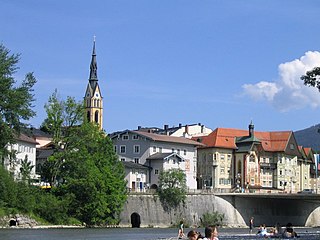
Bad Tölz is a town in Bavaria, Germany and the administrative center of the Bad Tölz-Wolfratshausen district.

Bayerische Oberlandbahn

The Bayerische Oberlandbahn GmbH (BOB) is a private railway company based in Holzkirchen, Germany, and owned by Transdev Germany.

Benediktbeuern Place in Bavaria, Germany

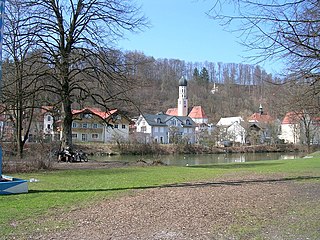
Benediktbeuern is a municipality in the district of Bad Tölz-Wolfratshausen in Bavaria, Germany, 2 kilometers, or 1.25 miles from Bichl. The village has 3,602 residents as of 31 December 2019.

Schliersee Place in Bavaria, Germany

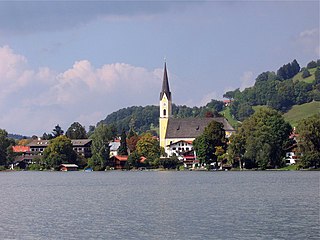
Schliersee is a small town (Markt) and a municipality in the district of Miesbach in Bavaria in Germany. It is named after the nearby Lake Schliersee. It comprises the districts Schliersee (town), Westenhofen, Neuhaus, Fischhausen, Josefsthal and Spitzingsee.

Lenggries Place in Bavaria, Germany

Lenggries is a municipality and a town in Bavaria, Germany. It is the center of the Isarwinkel, the region along the Isar between Bad Tölz and Wallgau. The town has about 9,500 inhabitants. By area, it is the largest rural municipality ("Gemeinde") in what was formerly West Germany, and the 7th-largest overall.

Egling Place in Bavaria, Germany

Egling is a municipality in the district of Bad Tölz-Wolfratshausen in Bavaria.

Icking Place in Bavaria, Germany

Icking is a municipality in the district of Bad Tölz-Wolfratshausen in Bavaria in Germany.

Münsing Place in Bavaria, Germany

Münsing is a municipality in the district of Bad Tölz-Wolfratshausen in Bavaria in Germany.

Gmund am Tegernsee Place in Bavaria, Germany

Gmund am Tegernsee is a municipality in the district of Miesbach in Bavaria in Germany. The town is located on the north shore of the Tegernsee Lake, and near the source of River Mangfall. It is 46 kilometres (29 mi) from Munich and 15 kilometres (9.3 mi) from the district capital, the town of Miesbach.

Kreuth Place in Bavaria, Germany

Kreuth is a municipality in the district of Miesbach in Bavaria in Germany.

Holzkirchen station

Holzkirchen station is a railway station on the Munich S-Bahn in the district of Holzkirchen in Upper Bavaria, Germany. It is served by the S-Bahn line , Bayerische Oberlandbahn (BOB) and Meridian.

References

  1. Liste der ersten Bürgermeister/Oberbürgermeister in kreisangehörigen Gemeinden, Bayerisches Landesamt für Statistik, 15 July 2021.
  2. "Tabellenblatt "Daten 2", Statistischer Bericht A1200C 202041 Einwohnerzahlen der Gemeinden, Kreise und Regierungsbezirke". Bayerisches Landesamt für Statistik und Datenverarbeitung (in German). June 2021.
  3. Eingemeindung des Hofoldinger Forsts bringt viele Vorteile in: Münchner Merkur-Online vom 28. Januar 2011
  4. Münchner Wochenanzeiger, accessed March 24, 2014

Bibliography (German)