| Oum el Bouaghi Airport Aéroport d'Oum el Bouaghi | |||||||||||||||
|---|---|---|---|---|---|---|---|---|---|---|---|---|---|---|---|
| Summary | |||||||||||||||
| Airport type | Public | ||||||||||||||
| Serves | Aïn Beïda | ||||||||||||||
| Location | |||||||||||||||
| Elevation AMSL | 3,150 ft / 960 m | ||||||||||||||
| Coordinates | 35°52′39.1″N007°15′25.9″E / 35.877528°N 7.257194°E Coordinates: 35°52′39.1″N007°15′25.9″E / 35.877528°N 7.257194°E | ||||||||||||||
| Map | |||||||||||||||
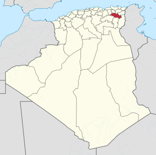
 DABO Location of Oum el Bouaghi Airport in Algeria | |||||||||||||||
| Runways | |||||||||||||||
| |||||||||||||||
Oum el Bouaghi Airport French : Aéroport d'Oum el Bouaghi( ICAO : DABO) is a military airport located near Aïn Beïda, Oum El Bouaghi, Algeria.

French is a Romance language of the Indo-European family. It descended from the Vulgar Latin of the Roman Empire, as did all Romance languages. French evolved from Gallo-Romance, the spoken Latin in Gaul, and more specifically in Northern Gaul. Its closest relatives are the other langues d'oïl—languages historically spoken in northern France and in southern Belgium, which French (Francien) has largely supplanted. French was also influenced by native Celtic languages of Northern Roman Gaul like Gallia Belgica and by the (Germanic) Frankish language of the post-Roman Frankish invaders. Today, owing to France's past overseas expansion, there are numerous French-based creole languages, most notably Haitian Creole. A French-speaking person or nation may be referred to as Francophone in both English and French.

The ICAOairport code or location indicator is a four-letter code designating aerodromes around the world. These codes, as defined by the International Civil Aviation Organization and published in ICAO Document 7910: Location Indicators, are used by air traffic control and airline operations such as flight planning.

An airport is an aerodrome with extended facilities, mostly for commercial air transport. Airports often have facilities to store and maintain aircraft, and a control tower. An airport consists of a landing area, which comprises an aerially accessible open space including at least one operationally active surface such as a runway for a plane to take off or a helipad, and often includes adjacent utility buildings such as control towers, hangars and terminals. Larger airports may have airport aprons, taxiway bridges, air traffic control centres, passenger facilities such as restaurants and lounges, and emergency services. In some countries, the US in particular, they also typically have one or more fixed-base operators, serving general aviation.