Relizane Airport

Last updated
Relizane Airport
Summary
Airport type Public
Location Algeria
Elevation  AMSL 282 ft / 86 m
Coordinates 35°45′10″N000°37′30″E / 35.75278°N 0.62500°E / 35.75278; 0.62500 Coordinates: 35°45′10″N000°37′30″E / 35.75278°N 0.62500°E / 35.75278; 0.62500
Map
Algeria location map.svg
Airplane silhouette.svg
Relizane Airport
Runways
Direction Length Surface
ft m
07/25 4,265 1,300 Asphalt
Source:World Aero Data [1] Google Maps [2]

Relizane Airport( ICAO : DAAZ) is a civilian airport in Algeria, located 12.5 kilometres (7.8 mi) west-northwest of Zemmora (Relizane); about 235 kilometres (146 mi) west-southwest of Algiers. It is used by general aviation, with no scheduled commercial air service.

ICAO airport code four-letter code designating many airports around the world

The ICAOairport code or location indicator is a four-letter code designating aerodromes around the world. These codes, as defined by the International Civil Aviation Organization and published in ICAO Document 7910: Location Indicators, are used by air traffic control and airline operations such as flight planning.

Algeria country in North Africa

Algeria, officially the People's Democratic Republic of Algeria, is a country in the Maghreb region of North Africa. The capital and most populous city is Algiers, located in the far north of the country on the Mediterranean coast. With an area of 2,381,741 square kilometres (919,595 sq mi), Algeria is the tenth-largest country in the world, the world's largest Arab country, and the largest in Africa. Algeria is bordered to the northeast by Tunisia, to the east by Libya, to the west by Morocco, to the southwest by the Western Saharan territory, Mauritania, and Mali, to the southeast by Niger, and to the north by the Mediterranean Sea. The country is a semi-presidential republic consisting of 48 provinces and 1,541 communes (counties). It has the highest human development index of all non-island African countries.

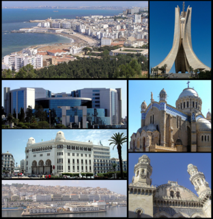
Algiers City in Algiers Province, Algeria

Algiers is the capital and largest city of Algeria. In 2011, the city's population was estimated to be around 3,500,000. An estimate puts the population of the larger metropolitan city to be around 5,000,000. Algiers is located on the Mediterranean Sea and in the north-central portion of Algeria.

Contents

World War II

During World War II, it was a major Twelfth Air Force base of operations during the North African Campaign against the German Afrika Korps, used by the 60th Troop Carrier Group, flying C-47 Skytrain aircraft from the field between 27 November 1942 and May 1943.

Twelfth Air Force United States Air Force numbered air force

The Twelfth Air Force is a Numbered Air Force of the United States Air Force Air Combat Command (ACC). It is headquartered at Davis–Monthan Air Force Base, Arizona.

North African Campaign military campaign of World War II

The North African Campaign of the Second World War took place in North Africa from 10 June 1940 to 13 May 1943. It included campaigns fought in the Libyan and Egyptian deserts and in Morocco and Algeria, as well as Tunisia.

Afrika Korps military force of Germany deployed to North Africa

The Afrika Korps or German Africa Corps was the German expeditionary force in Africa during the North African Campaign of World War II. First sent as a holding force to shore up the Italian defense of their African colonies, the formation fought on in Africa, under various appellations, from March 1941 until its surrender in May 1943. The unit's best known commander was Field Marshal Erwin Rommel.

Related Research Articles

Angads Airport airport in Morocco

Oujda Angads Airport is an airport serving Oujda, a city in the Oriental region in Morocco. it is located about 12 kilometres (7 mi) north of Oujda and about 600 kilometres (373 mi) northeast of Casablanca, near the Algerian border.

Cheikh Larbi Tébessa Airport public airport serving Tebessa, Algeria

Cheikh Larbi Tébessa Airport is a public airport located 1.35 nautical miles north of Tébessa, the capital of the Tébessa province (wilaya) in Algeria.

Sfax–Thyna International Airport airport in Tunisia

Sfax–Thyna International Airport is an airport serving Sfax in Tunisia. The airport is located 6 kilometers southwest from Sfax.
Borj El Amri Airport Aerodrome in Tunisia

Borj El Amri Airport is a small airport near Borj El Amri, a city in the Manouba Governorate of Tunisia. The airport is located 23 kilometres (14 mi) southwest of Tunis and has a functional asphalt runway. The airport is used as a training site of the Aviation School of Borj El Amri belonging to the Tunesian Ministry of Defense.

Chame Airport airport in Panama

Chame Airport is an airport serving Chame District, a district in the Panamá Oeste Province of Panama.

Calzada Larga Airport airport in Panama

Calzada Larga Airport is a general aviation airport serving Caimitillo, a town in the Panamá Province of Panama.
General Ulpiano Paez Airport airport in Salinas, Ecuador

General Ulpiano Paez Airport is a public/military joint-use airport serving the coastal city of Salinas, in the Santa Elena Province of Ecuador. The city and airport are on a peninsula extending into the Pacific Ocean.

Ghriss Airport airport in Algeria

Ghriss Airport is a civilian airport in Mascara Province, Algeria, located 5.0 km southwest of the town of Ghriss, Algeria.

Telergma Airport airport in Algeria

Telerghma Airport is a joint-use civilian/military airport in Algeria, just south of the city of Telerghma, about 300 km east of Algiers

Skikda Airport airport in Algeria

Skikda Airport was an airport in Algeria, located approximately 5 km east of Skikda; about 60 km north-northeast of Constantine.

Fano Airport airport in Italy

Fano Airport is an airport in Italy. located 1 km southeast of Fano and 10 km northwest of Mondolfo in the province of Pesaro and Urbino in the Marche region of Italy.

Gioia del Colle Air Base airport

Gioia del Colle Air Base is an Italian Air Force base located in the province of Bari, Apulia, Italy, located approximately 1 km south-southeast of Gioia del Colle.

Grosseto Airport airport

Grosseto Airport is an airport in central Italy, located 3 km (1.6 NM) west of Grosseto in the Italian region of Tuscany.

Decimomannu Air Base airport

Decimomannu Air Base is an Italian Air Force air base located approximately 5 km (2.7 NM) north of Decimomannu a comune in the Province of Cagliari on the island of Sardinia in Italy.

Habit Awlad Muhammad Airport airport in Libya

Habit Awlad Muhammad Airport is an airport in the Jabal al Gharbi District of Libya, located approximately 266 kilometres (165 mi) south-southwest of Tripoli in the Libyan desert. Its primary use is the transportation of oilfield workers from production facilities in the area.
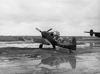
Martuba Airbase airport

Martuba Airbase is a Libyan Air Force base in the Derna District of Libya, located approximately 27 kilometres (17 mi) south-southeast of Derna, and 268 kilometres (167 mi) east-northeast of Benghazi.

Ras Lanuf Airport Libyan airport on the Mediterranean cost

Ras Lanuf Oil Airport is an airport in the Sirte District of Libya, located on the Mediterranean coast 227 kilometres (141 mi) south-southwest of Benghazi. Its primary use is the transportation of oilfield workers from production facilities in the area.

Nanur Airport airport in Libya

Nanur Airport is an airport in the Wadi Maymun Darraj region of Libya, located approximately 200 km south-southeast of Tripoli in the Libyan desert. Although listed as a civil airport, it appears to function as a reserve Libyan Air Force airfield. It comprises a long runway with a parallel taxiway and a parking ramp. There are no permanent structures visible, nor are there any production oilfields in the area.

Bad Langensalza Airport aerodrome in Germany

Bad Langensalza Airport is a general aviation facility located in Germany, about 4 kilometres (2 mi) north-northwest of Bad Langensalza (Thuringen); approximately 240 kilometres (149 mi) southwest of Berlin.

Marche Airport airport

Marche Airport, formerly Ancona Falconara Airport, is an airport serving Ancona, and the Marche region of central Italy. The airport is located approximately 12 km (6 NM) west of Ancona, in Falconara Marittima. It was also known as Raffaello Sanzio Airport, named after Raffaello Sanzio (1483–1520), the Italian painter and architect.

References

PD-icon.svg This article incorporates  public domain material from the Air Force Historical Research Agency website http://www.afhra.af.mil/ .

Air Force Historical Research Agency

The Air Force Historical Research Agency is the repository for United States Air Force historical documents. The Agency's collection, begun during World War II in Washington, D.C. and moved in 1949 to Maxwell Air Force Base, the site of Air University, to provide research facilities for professional military education students, the faculty, visiting scholars, and the general public.

International Standard Book Number Unique numeric book identifier

The International Standard Book Number (ISBN) is a numeric commercial book identifier which is intended to be unique. Publishers purchase ISBNs from an affiliate of the International ISBN Agency.

National Oceanic and Atmospheric Administration An American scientific agency within the US Department of Commerce that focuses on the oceans and the atmosphere

The National Oceanic and Atmospheric Administration is an American scientific agency within the United States Department of Commerce that focuses on the conditions of the oceans, major waterways, and the atmosphere.

National Weather Service United States weather agency

The National Weather Service (NWS) is an agency of the United States federal government that is tasked with providing weather forecasts, warnings of hazardous weather, and other weather-related products to organizations and the public for the purposes of protection, safety, and general information. It is a part of the National Oceanic and Atmospheric Administration (NOAA) branch of the Department of Commerce, and is headquartered in Silver Spring, Maryland, within the Washington metropolitan area. The agency was known as the United States Weather Bureau from 1890 until it adopted its current name in 1970.