Orleansville Airfield

Last updated
Orleansville Airfield
Twelfth Air Force - Emblem (World War II).png
Part of Twelfth Air Force
Coordinates 36°09′54.41″N001°19′36.80″E / 36.1651139°N 1.3268889°E / 36.1651139; 1.3268889 (Approximate)
Type Military airfield
Site information
Controlled by United States Army Air Forces
Site history
Built 1942
In use 1942-1943

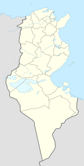
Orleansville Airfield was a World War II military airfield in Algeria, near Chlef, approximately 170 km southwest of Algiers. It was a temporary airfield constructed by Army Engineers using compacted earth for its runway, parking and dispersal areas, not designed for heavy aircraft or for long-term use. The prevailing temperatures in the area are some of the hottest in the world, making steel planking unsuitable for airfield use.

World War II 1939–1945 global war

World War II, also known as the Second World War, was a global war that lasted from 1939 to 1945. The vast majority of the world's countries—including all the great powers—eventually formed two opposing military alliances: the Allies and the Axis. A state of total war emerged, directly involving more than 100 million people from over 30 countries. The major participants threw their entire economic, industrial, and scientific capabilities behind the war effort, blurring the distinction between civilian and military resources. World War II was the deadliest conflict in human history, marked by 50 to 85 million fatalities, most of whom were civilians in the Soviet Union and China. It included massacres, the genocide of the Holocaust, strategic bombing, premeditated death from starvation and disease, and the only use of nuclear weapons in war.

Algeria country in North Africa

Algeria, officially the People's Democratic Republic of Algeria, is a country in the Maghreb region of North Africa. The capital and most populous city is Algiers, located in the far north of the country on the Mediterranean coast. With an area of 2,381,741 square kilometres (919,595 sq mi), Algeria is the tenth-largest country in the world, the world's largest Arab country, and the largest in Africa. Algeria is bordered to the northeast by Tunisia, to the east by Libya, to the west by Morocco, to the southwest by the Western Saharan territory, Mauritania, and Mali, to the southeast by Niger, and to the north by the Mediterranean Sea. The country is a semi-presidential republic consisting of 48 provinces and 1,541 communes (counties). It has the highest human development index of all non-island African countries.

Chlef City in Chlef Province, Algeria

Chlef is the capital of Chlef Province, Algeria. Located in the north of Algeria, 200 kilometres (120 mi) west of the capital, Algiers, it was founded in 1843, as Orléansville, on the ruins of Roman Castellum Tingitanum. In 1962, it was renamed al-Asnam, but since 1980 it has borne its present name, Chlef, which is derived from the name of the longest river in Algeria.

The airfield was used by the United States Army Air Force Twelfth Air Force 52d Fighter Group during the North African Campaign against the German Afrika Korps. It operated from the field between 2–20 January 1943.

Twelfth Air Force United States Air Force numbered air force

The Twelfth Air Force is a Numbered Air Force of the United States Air Force Air Combat Command (ACC). It is headquartered at Davis–Monthan Air Force Base, Arizona.

North African Campaign military campaign of World War II

The North African Campaign of the Second World War took place in North Africa from 10 June 1940 to 13 May 1943. It included campaigns fought in the Libyan and Egyptian deserts and in Morocco and Algeria, as well as Tunisia.

Afrika Korps military force of Germany deployed to North Africa

The Afrika Korps or German Africa Corps was the German expeditionary force in Africa during the North African Campaign of World War II. First sent as a holding force to shore up the Italian defense of their African colonies, the formation fought on in Africa, under various appellations, from March 1941 until its surrender in May 1943. The unit's best known commander was Field Marshal Erwin Rommel.

After the 52d moved out the airfield was dismantled. Today, there are no remaining traces of the airfield as the area around the town of Chlef has grown substantially since the war. The urban development has obliterated any trace of the airfield. It is unknown precisely where the airfield was located due to the changed landscape over the past 60 years.

Related Research Articles

Anton Army Airfield

Anton Army Airfield is a former United States Army Air Forces World War II airfield in Panama used as an auxiliary of Howard Field as part of the defense of the Panama Canal.

Kairouan Airfield abandoned World War II military airfield in Tunisia

Kairouan Airfield is an abandoned military airfield in Tunisia, which is located approximately 11 km south-southeast of Kairouan, 126 km south of Tunis. It was a major Troop Carrier unit base of the United States Army Air Force Twelfth Air Force during the North African Campaign. Known units assigned were:

Mondolfo Airfield

Mondolfo Airfield is an abandoned World War II military airfield in Italy, located about 6 km southeast of Marotta and 4 km east of Mondolfo in the Marche region.

Le Sers Airfield abandoned World War II military airfield in Tunisia

Le Sers Airfield is an abandoned World War II military airfield in Tunisia, about 3 km of As Sars; 130 km southwest of Tunis. It was a temporary airfield constructed by Army Engineers using compacted earth for its runway, parking and dispersal areas, not designed for heavy aircraft or for long-term use. The prevailing temperatures in the area are some of the hottest in the world, making steel planking unsuitable for airfield use.

Chateaudun-du-Rhumel Airfield

Chateaudun-du-Rhumel Airfield is an abandoned military airfield in Algeria, located about 6 km north-northwest of Chelghoum el Aid, in Mila province, about 47 km southwest of Constantine.

Ain Mlila Airfield

Ain M'lila Airfield is an abandoned World War II military airfield in Algeria, located approximately 17 km north-northwest of Aïn Kercha in Oum el Bouaghi province, about 50 km south-southeast of Constantine. It was built by the Army Corps of Engineers on a flat, dry lakebed at an altitude of 2580 feet, designed for heavy bomber use by the United States Army Air Force Twelfth Air Force during the North African Campaign with concrete runways, hardstands and taxiways. Billeting and support facilities consisted of tents. Due to its high altitude, the days were hot and the nights cold. Known units which operated from Ain M'lila were:

Dar el Koudia Airfield abandoned World War II military airfield in Tunisia

Dar el Koudia Airfield is an abandoned World War II military airfield in Tunisia, in the vicinity of Bizerte. It was used by the United States Army Air Force Twelfth Air Force during the North African Campaign. The airfield was used by the 310th Bombardment Group, flying B-25 Mitchells from the field between 6 June and 5 August 1943.

Ebba Ksour Airfield abandoned World War II military airfield in Tunisia

Ebba Ksour Airfield is an abandoned World War II military airfield in Tunisia, located near El Ksour, in Kef province, approximately 150 km South-West of Tunis.

Menzel Temime Airfield abandoned World War II military airfield in Tunisia

Menzel Temime Airfield is an abandoned military airfield in Tunisia, which was located near the city of Menzel Temine, 25 km north-northeast of Korba and 31 km east of Tāklisah. The airfield was built as a temporary wartime field by Army Engineers, using Pierced Steel Planking (PSP) for runways and parking and dispersal areas, and support structures being quickly constructed out of wood or tents.

La Sebala Airfield abandoned World War II military airfield in Tunisia

La Sebala Airfield is an abandoned World War II military airfield in Tunisia, which was located about 1 km north of Cebalat; 15 km north-northwest of Tunis. It was a temporary airfield constructed by Army Engineers using compacted earth for its runway, parking and dispersal areas, not designed for heavy aircraft or for long-term use.

Aghione Airfield

Aghione Airfield is an abandoned World War II military airfield in France, which was located approximately 27 km southeast of Corte on Corsica. It was an all-weather temporary field built by the XII Engineer Command using Pierced Steel Planking for runways and parking areas, as well as for dispersal sites. In addition, tents were used for billeting and also for support facilities; an access road was built to the existing road infrastructure; a dump for supplies, ammunition, and gasoline drums, along with a drinkable water and minimal electrical grid for communications and station lighting.

Scordia Airfield

Scordia Airfield is an abandoned World War II military airfield in Italy, which is located approximately 1 km north of Scordia in Sicily.

Messina Airfield

Messina Airfield is an abandoned World War II military airfield in Italy, which was located just to the west of Messina in Sicily. It was a temporary field built by the Army Corps of Engineers used as part of the Allied invasion of Italy.

Rocca Bernardo Airfield

Rocca Bernardo Airfield is an abandoned World War II military airfield in Italy, which was located approximately 8 km east of Cotronei in Calabria, southern Italy.

Ombrene Airfield

Ombrene Airfield is an abandoned World War II military airfield in Italy, which was located approximately 5 km southeast of Montefiascone, in the province of Viterbo, central Italy

San Pancrazio Airfield

San Pancrazio Airfield is an abandoned Second World War military airfield in Italy, located approximately 4 km northeast of San Pancrazio Salentino in the province of Brindisi in Apulia,on the south-east Italy coast. Built in 1943 by United States Army Engineers, the airfield was primarily a Fifteenth Air Force B-24 Liberator heavy bomber base used in the strategic bombing of Germany. San Pancrazio was also used by tactical aircraft of Twelfth Air Force in the Italian Campaign.

Lecce Airfield

Lecce Airfield is an abandoned World War II military airfield in Italy, which is located approximately 5 km east of Lecce in the Salentine Peninsula. Built in 1943 by United States Army Engineers, the airfield was primarily a Fifteenth Air Force B-24 Liberator heavy bomber base used in the strategic bombing of Germany. Lecce was also used by tactical aircraft of Twelfth Air Force in the Italian Campaign.

Ghisonaccia Alzitone Airport airport in France

Ghisonaccia Alzitone Airport is an airport in France, located 2 km (1.2 mi) north of Ghisonaccia in the Haute-Corse department, approximately 335 km (208 mi) southeast of Corte on Corsica.

Berca Airfield

Berca Airfield is a former civil airport and military airfield, located in the Al Birkah suburb of Benghazi, Libya.

El Assa Airfield

El Assa Airfield is an abandoned World War II military airfield located in the district of Nuqat al Khams, Libya. It is about 140 km west of Tripoli near the Tunisian border.

References

PD-icon.svg This article incorporates  public domain material from the Air Force Historical Research Agency website http://www.afhra.af.mil/ .

Air Force Historical Research Agency

The Air Force Historical Research Agency is the repository for United States Air Force historical documents. The Agency's collection, begun during World War II in Washington, D.C. and moved in 1949 to Maxwell Air Force Base, the site of Air University, to provide research facilities for professional military education students, the faculty, visiting scholars, and the general public.

International Standard Book Number Unique numeric book identifier

The International Standard Book Number (ISBN) is a numeric commercial book identifier which is intended to be unique. Publishers purchase ISBNs from an affiliate of the International ISBN Agency.