
The Slessor Glacier is a glacier at least 120 km long and 80 km wide, flowing west into the Filchner Ice Shelf to the north of the Shackleton Range. First seen from the air and mapped by the Commonwealth Trans-Antarctic Expedition (CTAE) in 1956. Named by the CTAE for RAF Marshal Sir John Slessor, chairman of the expedition committee.

Aroma is one of the twenty provinces of the Bolivian La Paz Department. It is situated in the southern parts of the department. Its seat is Sica Sica.
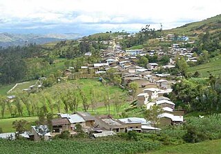
Corosha District is one of twelve districts of the province Bongará in Peru.
German submarine U-217 was a Type VIID mine-laying U-boat of Nazi Germany's Kriegsmarine during World War II.
Llama District is one of nineteen districts of the province Chota in Peru.
Miracosta District is one of nineteen districts of the province Chota in Peru.
Querocoto District is one of nineteen districts of the province Chota in Peru.
Tocmoche District is one of nineteen districts of the province Chota in Peru.
Callayuc District is one of fifteen districts of the province Cutervo in Peru.
Querocotillo District is one of fifteen districts of the province Cutervo in Peru.
Pucará District is one of twelve districts of the province Jaén in Peru.
Bolívar District is one of thirteen districts of the province San Miguel in Peru.
Calquis District is one of thirteen districts of the province San Miguel in Peru.
La Florida District is one of thirteen districts of the province San Miguel in Peru.
Nanchoc District is one of thirteen districts of the province San Miguel in Peru.
Niepos District is one of thirteen districts of the province San Miguel in Peru.
Catache District is one of eleven districts of the province Santa Cruz in Peru.

Mahavoky Nord is a town and commune in Madagascar. It belongs to the district of Mananjary, which is a part of Vatovavy-Fitovinany Region. The population of the commune was estimated to be approximately 6,000 in 2001 commune census.

Mitterling Glacier is a glacier on the east coast of Graham Land, Antarctica, draining between Mount Vartdal and Mount Hayes into the northern part of Mill Inlet. It was named by the UK Antarctic Place-Names Committee after American historian Philip I. Mitterling, the author of America in the Antarctic to 1840.

Seal Glacier is a small glacier draining east, located just north of Parrish Peak in the Enterprise Hills, Heritage Range. Mapped by United States Geological Survey (USGS) from surveys and U.S. Navy air photos, 1961-66. Named by Advisory Committee on Antarctic Names (US-ACAN) for radioman G.L. Seal, U.S. Navy, who up to Operation Deepfreeze 1966 had contributed to efficient communications during four austral summer seasons.


