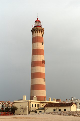
A lighthouse is a tower, building, or other type of physical structure designed to emit light from a system of lamps and lenses and to serve as a beacon for navigational aid, for maritime pilots at sea or on inland waterways.
Piloting or pilotage is the process of navigating on water or in the air using fixed points of reference on the sea or on land, usually with reference to a nautical chart or aeronautical chart to obtain a fix of the position of the vessel or aircraft with respect to a desired course or location. Horizontal fixes of position from known reference points may be obtained by sight or by radar. Vertical position may be obtained by depth sounder to determine depth of the water body below a vessel or by altimeter to determine an aircraft's altitude, from which its distance above the ground can be deduced. Piloting a vessel is usually practiced close to shore or on inland waterways. Pilotage of an aircraft is practiced under visual meteorological conditions for flight.
A sea mark, also seamark and navigation mark, is a form of aid to navigation and pilotage that identifies the approximate position of a maritime channel, hazard, or administrative area to allow boats, ships, and seaplanes to navigate safely.

A sector light is a man-made pilotage and position fixing aid that consists of strictly delineated horizontal angle light beams to guide water-borne traffic through a safe channel at night in reasonable visibility. Sector lights are most often used for safe passage through shallow or dangerous waters. This may be when leaving or entering harbour. Nautical charts give all the required information.
Leading lights, also known as range lights in the United States, are a pair of light beacons used in navigation to indicate a safe passage for vessels entering a shallow or dangerous channel; they may also be used for position fixing. At night, the lights are a form of leading line that can be used for safe navigation. The beacons consist of two lights that are separated in distance and elevation, so that when they are aligned, with one above the other, they provide a bearing. Range lights are often illuminated day and night.

The Runnel Stone, or Rundle Stone, is a hazardous rock pinnacle about 1-mile (1.6 km) south of Gwennap Head, Cornwall, England, United Kingdom. It used to show above the surface at low water until a steamship struck it in 1923.

The Navesink Twin Lights is a non-operational lighthouse and museum located in Highlands, Monmouth County, New Jersey, United States, overlooking Sandy Hook Bay, the entrance to New York Harbor, and the Atlantic Ocean. The Twin Lights, as the name implies, are a pair of beacons located 246 feet (75 m) above sea level on the headlands of the Navesink Highlands.
The history of lighthouses refers to the development of the use of towers, buildings, or other types of structure, as an aid to navigation for maritime pilots at sea or on inland waterways.

Alligator Reef Light is located 4 nautical miles east of Indian Key, near the Matecumbe Keys of Florida in the United States, north of Alligator Reef itself. The station was established in 1873. It was automated in 1963 and was last operational in July, 2014, and is being replaced by a 16' steel structure with a less powerful light located adjacent to it. The structure is an iron pile skeleton with a platform. The light is 136 feet (41 m) above the water. It is a white octagonal pyramid skeleton framework on black pile foundation, enclosing a square dwelling and a stair-cylinder. The lantern is black. The original lens was a first order bivalve Fresnel lens. The light characteristic of the original light was: flashing white and red, every third flash red, from SW by W 1/2 W through southward to NE 1/8 E, and from NE by E 3/4 E through northward to SW 3/8 S; flashing red throughout the intervening sectors; interval between flashes 5 seconds. It had a nominal range of 14 nautical miles in the white sectors and 11 nautical miles in the red sectors. The new light has a range of approximately 7 nautical miles.

Godrevy Lighthouse was built in 1858–1859 on Godrevy Island in St Ives Bay, Cornwall. Standing approximately 300 metres (980 ft) off Godrevy Head, it marks the Stones reef, which has been a hazard to shipping for centuries.

The Harbor of Refuge Light is a lighthouse built on the ocean end of the outer Delaware Breakwater at the mouth of the Delaware Bay, just off Cape Henlopen. It was built to function with the Delaware Breakwater East End Light in order to mark the National Harbor of Refuge.

Penfield Reef Lighthouse is a lighthouse in Connecticut, United States, on Penfield Reef at the south side of Black Rock Harbor entrance on the Long Island Sound, off the coast of Fairfield, Connecticut. Constructed in 1874, it was one of the last offshore masonry lights. Most offshore lights built after this were cast iron towers built on cylindrical cast iron foundations.

Poe Reef is a lighthouse located at the east end of South Channel between Bois Blanc Island and the mainland of the Lower Peninsula, about 6 miles (9.7 km) east of Cheboygan, Michigan.
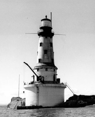
The Rock of Ages Light is a U.S. Coast Guard lighthouse on a small rock outcropping approximately 2.25 miles (3.62 km) west of Washington Island and 3.5 miles (5.6 km) west of Isle Royale, in Eagle Harbor Township, Keweenaw County, Michigan. It is an active aid to navigation.

Spectacle Reef Light is a lighthouse 11 miles (18 km) east of the Straits of Mackinac and is located at the northern end of Lake Huron, Michigan. It was designed and built by Colonel Orlando Metcalfe Poe and Major Godfrey Weitzel, and was the most expensive lighthouse ever built on the Great Lakes.

Deer Island Light is a lighthouse in Boston Harbor, Boston, Massachusetts. The actual light is 53 feet (16 m) above Mean High Water. Its alternating white and red light is visible for 9 nautical miles.
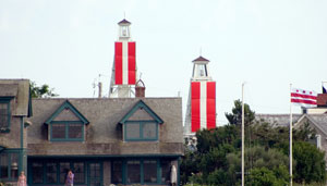
The Nantucket Harbor Range Lights are range lights that were built in 1908 to guide vessels through the narrow channel to Nantucket Harbor. They replaced an older arrangement involving the Nantucket Beacon and the Brant Point Light, which became unusable when the latter was replaced with a new tower.
Vega Industries Limited is a company in Porirua, New Zealand which manufactures specialised navigation and signal lights for use in transportation industries, primarily marine navigation. Vega has been in business since 1972 when it built a marine guidance system based on a design by Norman Rumsey.

The French Pass Lighthouse together with a stone beacon mark a channel through the turbulent waters between Rangitoto ki te Tonga / D’Urville Island and the South Island. The New Zealand List of Lights calls the lighthouse Channel Point.

