Related Research Articles

The Cascade Range or Cascades is a major mountain range of western North America, extending from southern British Columbia through Washington and Oregon to Northern California. It includes both non-volcanic mountains, such as the North Cascades, and the notable volcanoes known as the High Cascades. The small part of the range in British Columbia is referred to as the Canadian Cascades or, locally, as the Cascade Mountains. The latter term is also sometimes used by Washington residents to refer to the Washington section of the Cascades in addition to North Cascades, the more usual U.S. term, as in North Cascades National Park. The highest peak in the range is Mount Rainier in Washington at 14,411 feet (4,392 m).

The Pacific Crest Trail, officially designated as the Pacific Crest National Scenic Trail (PCT) is a long-distance hiking and equestrian trail closely aligned with the highest portion of the Cascade and Sierra Nevada mountain ranges, which lie 100 to 150 miles east of the U.S. Pacific coast. The trail's southern terminus is just south of Campo, California by the U.S. border with Mexico, and its northern terminus is on the Canada–US border on the edge of Manning Park in British Columbia; it passes through the U.S. in the states of California, Oregon, and Washington.

The Columbia River Gorge is a canyon of the Columbia River in the Pacific Northwest of the United States. Up to 4,000 feet (1,200 m) deep, the canyon stretches for over eighty miles (130 km) as the river winds westward through the Cascade Range, forming the boundary between the state of Washington to the north and Oregon to the south. Extending roughly from the confluence of the Columbia with the Deschutes River in the east down to the eastern reaches of the Portland metropolitan area, the water gap furnishes the only navigable route through the Cascades and the only water connection between the Columbia Plateau and the Pacific Ocean. It is thus the route of Interstate 84, U.S. Route 30, Washington State Route 14, and railroad tracks on both sides.

State Route 14 is a north–south state highway in the U.S. state of California that connects Los Angeles to the northern Mojave Desert. The southern portion of the highway is signed as the Antelope Valley Freeway. The route connects Interstate 5 on the border of the city of Santa Clarita to the north and the Los Angeles neighborhoods of Granada Hills and Sylmar to the south, with U.S. Route 395 (US 395) near Inyokern. Legislatively, the route extends south of I-5 to SR 1 in the Pacific Palisades area of Los Angeles; however, the portion south of the junction with I-5 has not been constructed. The southern part of the constructed route is a busy commuter freeway serving and connecting the cities of Santa Clarita, Palmdale, and Lancaster to the rest of the Greater Los Angeles area. The northern portion, from Vincent to US 395, is legislatively named the Aerospace Highway, as the highway serves Edwards Air Force Base, once one of the primary landing strips for NASA's Space Shuttle. This section is rural, following the line between the hot Mojave desert and the forming Sierra Nevada mountain range. Most of SR 14 is loosely paralleled by a main line of the Southern Pacific Railroad, used for the Antelope Valley Line of the Metrolink commuter rail system as well as a connection between Los Angeles and the Central Valley via Tehachapi Pass.
State Route 120 is a state highway in the U.S. state of California, running west to east across the central part of the state. It runs from Interstate 5 in the San Joaquin Valley near Lathrop through Yosemite National Park, to its end at U.S. Route 6 in Mono County, eastern California. While the route is signed as a contiguous route through Yosemite National Park, the portion in park boundaries is federally maintained, and is not included in the state route logs. The portion at Tioga Pass is the highest paved through road in the California State Route system. This part is not maintained in the winter and is usually closed during the winter season.

Lolo Pass is a mountain pass 6 miles (10 km) northwest of Mount Hood and 10 miles (16 km) northeast of Zigzag, Oregon, on the Clackamas–Hood River county line. It divides the Sandy River watershed on the southwest from the Hood River watershed on the northeast.

Chinook Pass is a pass through the Cascade Range in the state of Washington.

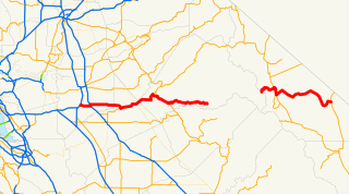
State Route 410 is a 107.44-mile (172.91 km) long state highway that traverses Pierce, King, and Yakima counties in the US state of Washington. It begins at an interchange with SR 167 in Sumner and travels southeast across the Cascade Range to a junction with U.S. Route 12 (US 12) in Naches. While the western part of SR 410 is a freeway that serves built-up, urban areas, the remainder of the route is a surface road that traverses mostly rural areas as it passes through the mountains.
State Route 168 (SR 168) is a legislated, but not constructed, state highway located in Washington, United States. The highway is meant to serve as an alternate crossing through the Cascade Range at Naches Pass, supplementing the seasonal Chinook Pass on SR 410. Proposals were first drawn in the 1930s, and the highway has been codified in law under its current designation since 1970, however no construction has occurred.

Norse Peak Wilderness is a 52,315-acre (21,171 ha) designated wilderness area located in central Washington in the United States. It protects the portion of the Cascade Range north of Chinook Pass, south of Naches Pass, and east of Mount Rainier National Park. It is bordered by the William O. Douglas Wilderness to the south. The wilderness is named for a prominent peak which overlooks Crystal Mountain Ski Area. Roughly triangular, it is about 10 miles (16 km) across and contains no roads.

Sierra Highway or El Camino Sierra is a road in Southern California, United States. El Camino Sierra refers to the full length of a trail formed in the 19th century, rebuilt as highways in the early 20th century, that ran from Los Angeles to Lake Tahoe following parts of modern State Route 14, U.S. Route 395 and State Route 89. Two portions of this road are currently signed as Sierra Highway. The first is an old alignment of SR 14/U.S. Route 6 from Los Angeles to Mojave. This road is also signed with the unusual designation of State Route 14U through the city of Santa Clarita. The second part signed as Sierra Highway is a portion of US 395 in Bishop.
Naches Pass is a mountain pass of the Cascade Range in the state of Washington. It is located about 50 miles (80 km) east of Tacoma and about 50 miles (80 km) northwest of Yakima, near the headwaters of tributary streams of the Naches River on the east and the Greenwater River on the west. The boundaries of Pierce, King, Kittitas, and Yakima counties come together at the pass. The pass lies on the boundary between the Mount Baker-Snoqualmie and Wenatchee National Forests, about 10 miles (16 km) northeast of Mount Rainier National Park. In 1853 a pioneer wagon road was built over the pass.
Interstate 84 (I-84) in the U.S. state of Oregon is a major Interstate Highway that traverses the state from west to east. It is concurrent with U.S. Route 30 (US 30) for most of its length and runs 376 miles (605 km) from an interchange with I-5 in Portland to the Idaho state line near Ontario. The highway roughly follows the Columbia River and historic Oregon Trail in northeastern Oregon, and is designated as part of Columbia River Highway No. 2 and all of the Old Oregon Trail Highway No. 6; the entire length is also designated as the Vietnam Veterans Memorial Highway. I-84 intersects several of the state's main north–south roads, including US 97, US 197, I-82, and US 395.

U.S. Route 395 (US 395) is a United States Numbered Highway, stretching from Hesperia, California to the Canadian border in Laurier, Washington. The California portion of US 395 is a 557-mile (896 km) route which traverses from Interstate 15 in Hesperia, north to the Oregon state line in Modoc County near Goose Lake. The route clips into Nevada, serving the cities Carson City and Reno, before returning to California.

Snoqualmie Pass is a mountain pass that carries Interstate 90 (I-90) through the Cascade Range in the U.S. state of Washington. The pass summit is at an elevation of 3,015 feet (919 m), on the county line between Kittitas County and King County.
U.S. Route 12 is a major east-west U.S. Highway, running from Aberdeen, Washington, to Detroit, Michigan. It spans 430.80 miles (693.31 km) across the state of Washington, and is the only numbered highway to span the entire state from west to east, starting near the Pacific Ocean, and crossing the Idaho state line near Clarkston. It crosses the Cascade Range over White Pass, south of Mount Rainier National Park. Portions of it are concurrent with Interstate 5 (I-5) and Interstate 82 (I-82), although the majority of the route does not parallel any interstate highway.

Sheridan State Scenic Corridor is a state park in the Columbia River Gorge, west of Cascade Locks, Oregon. The 11-acre (4.5 ha) property, containing an old-growth forest, is located on the south side of Interstate 84 at approximately milepoint 42.5, and was not accessible by motor vehicle since I-84 was built in 1960. However, with the opening of the Eagle Creek-Cascade Locks segment of the Historic Columbia River Highway State Trail in 1998, it has become easily accessible by foot or bicycle. The park is on a triangular lot, completely surrounded by I-84 and the Mount Hood National Forest.

The Oregon Skyline Trail is a long-distance trail in the Cascade Mountains of Oregon. The trail extends 428 miles (689 km) from Cascade Locks on the Columbia River south to Siskiyou Summit near the Oregon-California border. The century-old trail is a foot and equestrian path that passes through nine wilderness areas, Crater Lake National Park, and Cascade-Siskiyou National Monument. Historically known as the Oregon Skyline Trail or Skyline Trail, the entire length of the trail was incorporated into the Pacific Crest National Scenic Trail in 1968.

Naches Trail is a historic trail in the U.S. state of Washington. It extends from the Naches River in Eastern Washington in the area inhabited by across Naches Pass in the Cascade Mountains to the Greenwater River in present-day Pierce County in Western Washington. Originally a trail used by the indigenous Yakama people in the east and Salish people in the west, it became one of the main routes of immigration by settlers to the Puget Sound region in the 19th century, especially before the improvement of the lower Snoqualmie Pass, which became the route of U.S. Route 10 then Interstate 90. The first written documentation of a traversal of the pass was made by a member of the United States Navy Wilkes Expedition, Lieutenant Robert E. Johnson in 1841. Due to dense forest on the west side of the pass, construction of a road was initially considered infeasible in 1853. The Longmire Party crossed the pass with their wagons, having to let them down the Naches Trail Cliffs with ropes.

Naches Peak is a 6,452 feet (1,967 m) summit located on the shared border of Mount Rainier National Park and William O. Douglas Wilderness. It is also on the shared border of Pierce County and Yakima County in Washington state. Naches Peak is situated on the crest of the Cascade Range and immediately southeast of Chinook Pass. Its nearest higher peak is Tahtlum Peak, 1.45 mi (2.33 km) to the east. The name Naches Peak was proposed by the Yakima Chamber of Commerce and approved by Asahel Curtis in 1927. The Naches Peak Loop Trail is a popular 3.5 mile trail encircling the peak. Precipitation runoff from the west side of Naches Peak drains into tributaries of the Cowlitz River, whereas the east side drains into tributaries of the Yakima River.
References
This article needs additional citations for verification .(February 2008) (Learn how and when to remove this template message) |
- ↑ Bil Paul (October 1990). Pacific Crest Bicycle Trail. Bittersweet Publishing Company. ISBN 0-931255-06-6.
- ↑ "Caryl and Brian's World Bike Tour". 1998. Retrieved 2008-02-12.