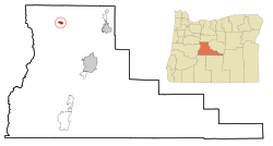
Sisters, Oregon | |
---|---|
![]() Cascade Avenue in downtown Sisters | |
Motto: "A Modern Western Community" | |
![]() Location in Oregon | |
Coordinates: 44°17′27″N121°32′56″W / 44.29083°N 121.54889°W | |
Country | United States |
State | Oregon |
County | Deschutes |
Incorporated | 1946 |
Government | |
• Mayor | Michael Preedin |
Area | |
• Total | 1.93 sq mi (5.01 km2) |
• Land | 1.93 sq mi (5.01 km2) |
• Water | 0.00 sq mi (0.00 km2) |
Elevation | 3,182 ft (970 m) |
Population | |
• Total | 3,064 |
• Density | 1,585.10/sq mi (612.11/km2) |
Time zone | UTC-8 (Pacific) |
• Summer (DST) | UTC-7 (Pacific) |
ZIP code | 97759 |
Area code | 541 |
FIPS code | 41-67950 [3] |
GNIS feature ID | 1127008 [4] |
Website | www.ci.sisters.or.us |
Sisters is a city in Deschutes County, Oregon, United States. It is part of the Bend, Oregon Metropolitan Statistical Area. The population was 2,038 at the 2010 census. [5]
The community takes its name from the nearby Three Sisters mountains. [6]
According to the United States Census Bureau, the city has a total area of 1.87 square miles (4.84 km2), all land. [7]
The Santiam Highway (U.S. Route 20) and the McKenzie Highway (Oregon Route 126) merge briefly to form Cascade Avenue, the main thoroughfare through downtown Sisters. On Cascade Avenue, there is a lot of pedestrian traffic and many specialty stores and galleries. East of Sisters the two highways split, with 126 heading to Redmond and 20 going to Bend. [8] West of Sisters, the road splits once more, with the McKenzie Highway becoming Oregon Route 242 [8] and running west over the McKenzie Pass (a summertime-only scenic route over the Cascades.) The Santiam Highway proceeds over the Santiam Pass.
This region experiences warm (but not hot) and dry summers, with no average monthly temperatures above 71.6 °F (22.0 °C). According to the Köppen Climate Classification system, Sisters has a warm-summer Mediterranean climate, abbreviated "Csb" on climate maps. [9]
Climate data for Sisters | |||||||||||||
---|---|---|---|---|---|---|---|---|---|---|---|---|---|
Month | Jan | Feb | Mar | Apr | May | Jun | Jul | Aug | Sep | Oct | Nov | Dec | Year |
Record high °F (°C) | 65 (18) | 72 (22) | 78 (26) | 87 (31) | 98 (37) | 103 (39) | 109 (43) | 106 (41) | 103 (39) | 92 (33) | 73 (23) | 64 (18) | 109 (43) |
Average high °F (°C) | 41.1 (5.1) | 45.1 (7.3) | 51.1 (10.6) | 57 (14) | 65.5 (18.6) | 74.5 (23.6) | 84.4 (29.1) | 83.5 (28.6) | 75.3 (24.1) | 62.9 (17.2) | 47.5 (8.6) | 40.5 (4.7) | 60.7 (15.9) |
Average low °F (°C) | 21.3 (−5.9) | 23.3 (−4.8) | 25.9 (−3.4) | 28.4 (−2.0) | 33.8 (1.0) | 39 (4) | 42.4 (5.8) | 41.8 (5.4) | 35.5 (1.9) | 29.3 (−1.5) | 25.8 (−3.4) | 20.9 (−6.2) | 30.6 (−0.8) |
Record low °F (°C) | −28 (−33) | −22 (−30) | −1 (−18) | 9 (−13) | 11 (−12) | 19 (−7) | 24 (−4) | 25 (−4) | 15 (−9) | −4 (−20) | −16 (−27) | −28 (−33) | −28 (−33) |
Average precipitation inches (mm) | 2.24 (57) | 1.45 (37) | 1.12 (28) | 0.79 (20) | 0.78 (20) | 0.61 (15) | 0.38 (9.7) | 0.41 (10) | 0.4 (10) | 0.95 (24) | 2.1 (53) | 2.27 (58) | 13.49 (343) |
Average snowfall inches (cm) | 8.3 (21) | 6.3 (16) | 3.5 (8.9) | 0.3 (0.76) | 0 (0) | 0 (0) | 0 (0) | 0 (0) | 0 (0) | 0.2 (0.51) | 3.6 (9.1) | 7.9 (20) | 30.1 (76) |
Average precipitation days | 9 | 7 | 8 | 6 | 6 | 4 | 2 | 3 | 3 | 5 | 10 | 9 | 72 |
Source: [10] |
Census | Pop. | Note | %± |
---|---|---|---|
1950 | 723 | — | |
1960 | 602 | −16.7% | |
1970 | 516 | −14.3% | |
1980 | 696 | 34.9% | |
1990 | 679 | −2.4% | |
2000 | 959 | 41.2% | |
2010 | 2,038 | 112.5% | |
2020 | 3,064 | 50.3% | |
U.S. Decennial Census [11] [2] |
As of the census of 2010, there were 2,038 people, 847 households, and 557 families residing in the city. The population density was 1,089.8 inhabitants per square mile (420.8/km2). There were 1,109 housing units at an average density of 593.0 per square mile (229.0/km2). The racial makeup of the city was 93.9% White, 1.1% Native American, 0.7% Asian, 2.3% from other races, and 2.1% from two or more races. Hispanic or Latino of any race were 7.1% of the population. [3]
There were 847 households, of which 32.3% had children under the age of 18 living with them, 48.1% were married couples living together, 13.7% had a female householder with no husband present, 4.0% had a male householder with no wife present, and 34.2% were non-families. 29.0% of all households were made up of individuals, and 12.2% had someone living alone who was 65 years of age or older. The average household size was 2.39 and the average family size was 2.92. [3]
The median age in the city was 41.4 years. 26.3% of residents were under the age of 18; 6.5% were between the ages of 18 and 24; 21.9% were from 25 to 44; 30.4% were from 45 to 64; and 14.9% were 65 years of age or older. The gender makeup of the city was 48.1% male and 51.9% female. [3]
As of the census of 2000, there were 959 people, 397 households, and 262 families residing in the city. The population density was 663.0 inhabitants per square mile (256.0/km2). There were 482 housing units at an average density of 333.2 per square mile (128.6/km2). The racial makeup of the city was 95.83% White, 1.56% Native American, 0.42% Asian, 1.36% from other races, and 0.83% from two or more races. Hispanic or Latino of any race were 4.59% of the population. [3]
There were 397 households, out of which 33.0% had children under the age of 18 living with them, 49.6% were married couples living together, 11.8% had a female householder with no husband present, and 33.8% were non-families. 25.2% of all households were made up of individuals, and 8.8% had someone living alone who was 65 years of age or older. The average household size was 2.41 and the average family size was 2.88. [3]
In the city, the population was spread out, with 26.1% under the age of 18, 9.0% from 18 to 24, 26.1% from 25 to 44, 25.0% from 45 to 64, and 13.9% who were 65 years of age or older. The median age was 39 years. For every 100 females, there were 98.1 males. For every 100 females age 18 and over, there were 103.7 males. [3]
The median income for a household in the city was $35,000, and the median income for a family was $43,977. Males had a median income of $35,563 versus $21,771 for females. The per capita income for the city was $17,847. About 7.4% of families and 10.4% of the population were below the poverty line, including 2.3% of those under age 18 and 10.7% of those age 65 or over. [3]
The Sisters area is served by Sisters School District, which is responsible for the education of approximately 1,300 students at four schools:
Sisters is also home to Sisters Christian Academy, a non-denominational Christian school. [12]
The local newspaper is The Nugget Newspaper published weekly on Wednesdays. The Small Farmer's Journal also originates in Sisters.
Sisters is the headquarters of the Sisters District of the Deschutes National Forest. The Sisters Ranger District Office is located at Pine Street and Highway 20. [18] Hiking, biking and horse riding trails go from the city limits into the Three Sisters Wilderness. Sisters Trail Alliance [19] builds and maintains hiking, biking and equestrian trails near the city.
The Sisters area is also home to several mountain biking trails, including the Peterson Ridge Trail and Suttle Lake trails. [20]
Hoodoo ski resort and many snow parks are nearby.
Camp Tamarack is nearby. [21] [22] as is Big Lake Youth Camp operated by Seventh-day Adventists since 1963.
Deschutes County is one of the 36 counties in the U.S. state of Oregon. As of the 2020 census, the population was 198,253. The county seat is Bend. The county was created in 1916 out of part of Crook County and was named for the Deschutes River, which itself was named by French-Canadian trappers of the early 19th century. It is the political and economic hub of Central Oregon. Deschutes comprises the Bend, Oregon Metropolitan Statistical Area. Deschutes is Oregon's fastest-growing and most recently formed county.
Lava Hot Springs is a city along the Portneuf River in eastern Bannock County, Idaho, United States. It is part of the Pocatello, Idaho metropolitan area. The population was 407 at the 2010 census, down from 521 in 2000. Located in the mountainous valley of the Portneuf River on the old route of the Oregon Trail and California Trail, the city has become a popular resort location, noted for its numerous hot springs amenable to bathing and a turbulent inner tube run through part of the town.
Homedale is a city in Owyhee County Idaho. The population was 2,633 at the time of the 2010 census. The town name was chosen by drawing names from a hat during a community picnic. Homedale is part of the Boise metropolitan area. It was, at one time, the terminus of a branch of the Oregon Short Line Railroad.
Molalla is a city in Clackamas County, Oregon. The population was 10,228 at the time of the 2020 census.
La Pine is a city in Deschutes County, Oregon, United States, incorporated on December 7, 2006.
Redmond is a city in Deschutes County, Oregon, United States. Incorporated on July 6, 1910, the city is on the eastern side of Oregon's Cascade Range, in the High Desert in Central Oregon. From Redmond there is access to recreational opportunities. Redmond is a full-service municipality and one of the fastest-growing industrial and residential communities in Oregon. Redmond had a population of 32,421 in 2019, and the population continues to grow at a rate of about 6.7 percent each year.
Terrebonne is an unincorporated community and census-designated place (CDP) in Deschutes County, Oregon, United States. It is part of the Bend, Oregon Metropolitan Statistical Area. The population was 1,257 at the 2010 census.
Lebanon is a city in Linn County, Oregon, United States. Lebanon is located in northwest Oregon, southeast of Salem. The population was 19,690 at the 2020 census. Lebanon sits beside the South Santiam River on the eastern edge of the Willamette Valley, close to the Cascade Range and a 25-minute drive to either of the larger cities of Corvallis and Albany. Lebanon is known for its foot-and-bike trails, its waterside parks, and its small-town character.
Lyons is a city in Linn County, Oregon, United States. The population was 1,161 at the 2010 census. The center of population of Oregon is located in Lyons.
Sweet Home is a city in Linn County, Oregon, United States, with a population of 8,925 at the 2010 census. Built near the site of a prehistoric petrified forest, Sweet Home experienced substantial growth during the construction of the Green Peter and Foster dams in the 1940s. The town's main attraction nowadays is the Cascade mountains through Santiam Pass.
Adrian is a city in Malheur County, Oregon, United States, near the confluence of the Snake River and the Owyhee River. The population was 177 at the 2010 census. It is part of the Ontario, OR–ID Micropolitan Statistical Area.
Detroit is a city in Marion County, Oregon, United States. It was named for Detroit, Michigan, in the 1890s because of the large number of people from Michigan in the community. The population was 203 at the 2020 census. It is part of the Salem Metropolitan Statistical Area.
Jefferson is a city in Marion County, Oregon, United States. It is part of the Salem Metropolitan Statistical Area. The population was 3,327 at the 2020 census. It is home to the annual Mint Harvest Festival and is the self-proclaimed "Mint Capital of the World" as well as "Frog Jumping Capital of Oregon." The city sits on the right bank of the Santiam River between Salem and Albany along Oregon Route 164 east of Interstate 5.
Mehama is an unincorporated community in Marion County, Oregon, United States, located on Oregon Route 22 and the North Santiam River. For statistical purposes, the United States Census Bureau has defined Mehama as a census-designated place (CDP). The census definition of the area may not precisely correspond to local understanding of the area with the same name. The population was 317 at the 2020 census. It is part of the Salem Metropolitan Statistical Area.
Stayton is a city in Marion County, Oregon, United States, located 12 miles (19 km) southeast of the state capital, Salem, on Oregon Route 22. It is south of Sublimity and east of Aumsville. Located on the North Santiam River, Stayton is a regional agricultural and light manufacturing center. The population was 8,244 at the 2020 census. Established in 1872, it was incorporated in 1891. Stayton is part of the Salem Metropolitan Statistical Area.
Echo is a city in Umatilla County, Oregon, United States. The population was 699 at the 2010 census. It is part of the Pendleton–Hermiston Micropolitan Statistical Area.
Maupin is a city in Wasco County, Oregon, United States. Located on the Deschutes River, much of the city's economy is related to the river through outdoor activities, such as fishing and rafting. The population was 418 at the 2010 census.
Gates is a city on the border of Linn and Marion counties in Oregon, United States. The population was 548 at the 2020 census. The greater part of Gates' population is in Marion County and the city is primarily under Marion County's jurisdiction.
Idanha is a city on the Marion County/Linn County line in Oregon, United States, on Oregon Route 22 and the Santiam River. The population was 156 at the 2020 census.
Mill City is a city in Linn and Marion counties in the U.S. state of Oregon on Oregon Route 22. The population was 1,971 at the 2020 census. It is on the North Santiam River, downstream from Detroit Lake.
{{cite web}}
: CS1 maint: archived copy as title (link){{cite web}}
: CS1 maint: archived copy as title (link)