Pajottegem | |
|---|---|
 Vollezele, Ternat | |
 Interactive map of Pajottegem | |
 Pajottegem Location in Belgium | |
| Coordinates: 50°45′13″N04°02′31″E / 50.75361°N 4.04194°E | |
| Country | Belgium |
| Community | Flemish Community |
| Region | Flemish Region |
| Province | Flemish Brabant |
| Arrondissement | Halle-Vilvoorde |
| Government | |
| • Mayor | Kris Poelaert |
| • Governing party | CD&V |
| Area | |
• Total | 120.16 km2 (46.39 sq mi) |
| Demonym | Pajottegemnaars |
| Postal codes |
|
| NIS code | 23106 |
| Area codes | 02, 053 |
| Website | www.pajottegem.be |
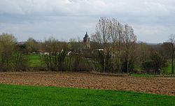
Pajottegem is a municipality located in the Belgian province of Flemish Brabant.
Pajottegem is the result of the merger of Galmaarden, Gooik, and Herne on January 1, 2025. [1]
