Flanders is the Dutch-speaking northern portion of Belgium and one of the communities, regions and language areas of Belgium. However, there are several overlapping definitions, including ones related to culture, language, politics, and history, and sometimes involving neighbouring countries. The demonym associated with Flanders is Fleming, while the corresponding adjective is Flemish, which can also refer to the collective of Dutch dialects spoken in that area, or more generally the Belgian variant of Standard Dutch. The official capital of Flanders is the City of Brussels, although the Brussels-Capital Region that includes it has an independent regional government. The powers of the government of Flanders consist, among others, of economic affairs in the Flemish Region and the community aspects of Flanders life in Brussels, such as Flemish culture and education.

Flemish Brabant is a province of Flanders, one of the three regions of Belgium. It borders on the Belgian provinces of Antwerp, Limburg, Liège, Walloon Brabant, Hainaut and East Flanders. Flemish Brabant also surrounds the Brussels-Capital Region. Its capital is Leuven. It has an area of 2,118 km2 (818 sq mi) which is divided into two administrative districts containing 65 municipalities. As of January 2024, Flemish Brabant had a population of over 1.19 million.

Harelbeke is a city and municipality located in the Belgian province of West Flanders. The municipality comprises the city of Harelbeke proper and the towns of Bavikhove and Hulste. On January 1, 2019, Harelbeke had a total population of 28,447. The total area is 29.14 km² which gives a population density of 898 inhabitants per km². Inhabitants consider their hometown to be a "Weireldstad" (metropolis), which also led to a monthly "Harelbekedag" amongst the students of Harelbeke studying in Ghent.

Houthulst is a municipality located in the Belgian province of West Flanders. The municipality consists of the sub-municipalities Houthulst, Jonkershove, Klerken and Merkem. On January 1, 2006, Houthulst had a total population of 9,051. The total area is 55.89 km² which gives a population density of 162 inhabitants per km².

Meulebeke is a municipality located in the Belgian province of West Flanders. The municipality comprises only the town of Meulebeke proper. On January 1, 2006, Meulebeke had a total population of 10,980. The total area is 29.35 km² which gives a population density of 374 inhabitants per km².

Arendonk is a municipality located in the Belgian province of Antwerp. The municipality comprises only the town of Arendonk proper. In 2021, Arendonk had a total population of 13,207. The total area is 55.38 km2.

Grimbergen is a municipality in the province of Flemish Brabant, in the Flemish region of Belgium, 10 km (6.2 mi) north of the capital Brussels. The municipality comprises the towns of Beigem, Grimbergen, Humbeek, and Strombeek-Bever. In 2017, Grimbergen had a total population of 37,030. The total area is 38.61 km2 (14.91 sq mi), which gives a population density of 959/km2 (2,480/sq mi).

Linkebeek is a Belgian municipality in the Halle-Vilvoorde district (arrondissement) of the province of Flemish Brabant. The municipality only comprises the town of Linkebeek proper. On 1 January 2006, Linkebeek had a total population of 4,759. The total area is 4.15 km2 (1.60 sq mi), which gives a population density of 1,147/km2 (2,970/sq mi). It directly borders the Brussels-Capital Region and is part of the city's urban sprawl, contiguous with Moensburg (Uccle) – it was a component of the short-lived Arrondissement of Brussels-Periphery.

Merchtem is a municipality located in the Belgian province of Flemish Brabant. The municipality comprises the villages of Brussegem and Hamme, the hamlets of Ossel and Peizegem, and Merchtem proper. On July 9, 2009, Merchtem had a total population of 15,298. The total area is 36.72 km2 which gives a population density of 416 inhabitants per km2.

Overijse is a municipality in the province of Flemish Brabant, in the Flemish region of Belgium. It is a suburb of the wider Brussels metropolitan area. The municipality comprises the town of Overijse proper, and the communities of Eizer, Maleizen, Jezus-Eik, Tombeek and Terlanen. On December 31, 2008, Overijse had a total population of 24,410. The total area is 44.43 km2 (17.15 sq mi), which gives a population density of 549/km2 (1,420/sq mi). Overijse is surrounded by an extensive woodlands, with paths for walking and cycling.

Roosdaal is a municipality located in the Belgian province of Flemish Brabant. The municipality comprises the towns of Borchtlombeek, Onze-Lieve-Vrouw-Lombeek, Pamel and Strijtem. It is also situated in the Pajottenland.

Sint-Genesius-Rode is a municipality in the province of Flemish Brabant, in the Flemish region of Belgium. The municipality only comprises the town of Sint-Genesius-Rode proper, and lies between Brussels and Waterloo in Wallonia. On January 1, 2008, Sint-Genesius-Rode had a total population of 18,021. The total area is 22.77 km2 (8.79 sq mi), which gives a population density of 791/km2 (2,050/sq mi). It borders the Brussels-Capital Region and is essentially a suburb of the city, contiguous with the Prince d'Orange neighbourhood (Uccle), and was a component of the short-lived Arrondissement of Brussels-Periphery. While the Brussels-Capital Region does not have a direct border with Wallonia, the shortest distance between the two is at Sint-Genesius-Rode municipality, with around 4 kilometres (2.5 mi) separating Prince d'Orange and Waterloo along the N5 road.

Sint-Pieters-Leeuw is a municipality in the province of Flemish Brabant, in the Flemish region of Belgium.

Begijnendijk is a municipality located in the Belgian province of Flemish Brabant. The municipality comprises the towns of Begijnendijk proper and Betekom. On January 1, 2006, Begijnendijk had a total population of 9,400. The total area is 17.62 km² which gives a population density of 534 inhabitants per km². The official spoken language is Dutch.

Riemst is a small town and a municipality in the Belgian province of Limburg. Riemst is in the Flemish speaking area of Belgium.

Voeren is a Flemish Dutch-speaking municipality with facilities for the French-speaking minority, located in the Belgian province of Limburg. Bordering the Netherlands to the north and the Wallonia region's Liège Province to the south, it is geographically detached from the rest of Flanders, making Voeren an exclave of Flanders. Voeren's name is derived from that of a small right-bank tributary of the Meuse, the Voer, which flows through the municipality.

The Adventures of Nero or Nero was a Belgian comic strip drawn by Marc Sleen and the name of its main character. The original title ranged from De Avonturen van Detectief Van Zwam in 1947 to De Avonturen van Nero en zijn Hoed in 1950, and finally De Avonturen van Nero & Co from 1951. It ran in continuous syndication until 2002. From 1947 until 1993 it was all drawn by Sleen himself. From 1992 until 2002 Dirk Stallaert took over the drawing while Sleen kept inventing the stories.

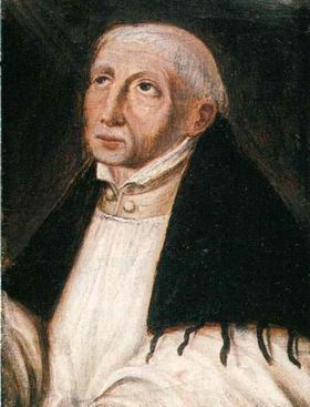
John of Ruusbroec or Jan van Ruusbroec, sometimes modernized Ruysbroeck, was an Augustinian canon and one of the most important of the medieval mystics of the Low Countries. Some of his main literary works include The Kingdom of the Divine Lovers, The Twelve Beguines, The Spiritual Espousals, A Mirror of Eternal Blessedness, The Little Book of Enlightenment, and The Sparkling Stone. Some of his letters also survive, as well as several short sayings. He wrote in the Dutch vernacular, the language of the common people of the Low Countries, rather than in Latin, the language of the Catholic Church liturgy and official texts, in order to reach a wider audience.

Flemish people or Flemings are a Germanic ethnic group native to Flanders, Belgium, who speak Flemish Dutch. Flemish people make up the majority of Belgians, at about 60%.

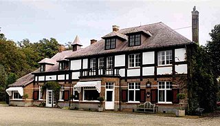
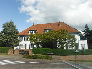
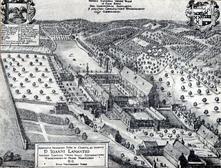
Groenendael Priory is located in the Sonian Forest in the municipality of Hoeilaart in Flemish Brabant, about 10 kilometres (6.2 mi) south-east of Brussels, Belgium.


