
The geography of Israel is very diverse, with desert conditions in the south, and snow-capped mountains in the north. Israel is located at the eastern end of the Mediterranean Sea in West Asia. It is bounded to the north by Lebanon, the northeast by Syria, the east by Jordan and the West Bank, and to the southwest by Egypt. To the west of Israel is the Mediterranean Sea, which makes up the majority of Israel's 273 km (170 mi) coastline, and the Gaza Strip. Israel has a small coastline on the Red Sea in the south.

The Levant is an approximate historical geographical term referring to a large area in the Eastern Mediterranean region of West Asia and core territory of the political term Middle East. In its narrowest sense, which is in use today in archaeology and other cultural contexts, it is equivalent to Cyprus and a stretch of land bordering the Mediterranean Sea in western Asia: i.e. the historical region of Syria, which includes present-day Israel, Jordan, Lebanon, Syria, the Palestinian territories and most of Turkey southwest of the middle Euphrates. Its overwhelming characteristic is that it represents the land bridge between Africa and Eurasia. In its widest historical sense, the Levant included all of the Eastern Mediterranean with its islands; that is, it included all of the countries along the Eastern Mediterranean shores, extending from Greece in Southern Europe to Cyrenaica, Eastern Libya in Northern Africa.
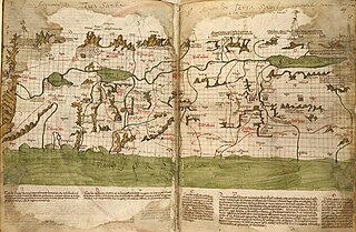
The Holy Land is an area roughly located between the Mediterranean Sea and the eastern bank of the Jordan River, traditionally synonymous both with the biblical Land of Israel and with the region of Palestine. Today, the term "Holy Land" usually refers to a territory roughly corresponding to the modern states of Israel and Palestine. Jews, Christians, Muslims, and Bahá'ís regard it as holy.
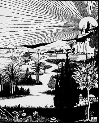
Zion is a placename in the Tanakh, often used as a synonym for Jerusalem as well as for the Land of Israel as a whole.

Al-Qastal was a Palestinian village located eight kilometers west of Jerusalem and named for a Crusader castle located on the hilltop. Used during the 1948 Arab–Israeli War as a military base by the Army of the Holy War, virtually all of its residents fled during the fighting and the village was eventually captured by the Palmach.

The Chautauqua Institution is a 501(c)(3) nonprofit education center and summer resort for adults and youth located on 2,070 acres (840 ha) in Chautauqua, New York, 17 miles (27 km) northwest of Jamestown in the western southern tier of New York state. Established in 1874, the institution was the home of, and provided the impetus for, the Chautauqua movement that became popular in the United States in the late 19th and early 20th centuries. The Chautauqua Institution Historic District is listed on the National Register of Historic Places and was further designated a National Historic Landmark.
John Kitto was an English biblical scholar of Cornish descent.
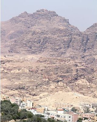
Mount Hor is the name given in the Hebrew Bible to two distinct mountains. One borders the land of Edom in the area south of the Dead Sea, and the other is by the Mediterranean Sea at the Northern border of Israel. The first Mount Hor is especially significant to the Israelites, as Aaron the high priest, brother of Moses, died there.

The Palestine Exploration Fund is a British society based in London. It was founded in 1865, shortly after the completion of the Ordnance Survey of Jerusalem by Royal Engineers of the War Department. The Fund is the oldest known organization in the world created specifically for the study of the Levant region, also known as Palestine. Often simply known as the PEF, its initial objective was to carry out surveys of the topography and ethnography of Ottoman Palestine – producing the PEF Survey of Palestine. Its remit was considered to fall between an expeditionary survey and military intelligence gathering. There was also strong religious interest from Christians; William Thomson, Archbishop of York, was the first President of the PEF.

A miniature park is a display of miniature buildings and models, usually as a recreational and tourist attraction open to the public. A miniature park may contain a model of a single city or town, often called a miniature city or model village, or it can contain a number of different sets of models.
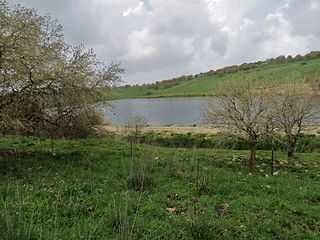
The Manasseh Hills or hill country of Manasseh, directly derived from Hebrew: Menashe Heights, called Bilad ar-Ruha in Arabic, meaning "Land of Winds", is a geographical region in northern Israel, located on the Carmel Range, between Mount Carmel and Mount Amir/Umm al-Fahm.
Replicas of the Jewish Temple are scale models or authentic buildings that attempt to replicate either the Temple of Solomon or the Second Temple in Jerusalem.

The New Church of the Theotokos, or New Church of the Mother of God, was a Byzantine church erected in Jerusalem by Emperor Justinian I. Like the later Nea Ekklesia in Constantinople, it is sometimes referred to in English as "the Nea" or the "Nea Church".
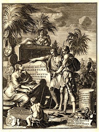
This article presents a list of notable historical references to the name Palestine as a place name for the region of Palestine throughout history. This includes uses of the localized inflections in various languages, such as Arabic Filasṭīn and Latin Palaestina.

The Land of Israel is the traditional Jewish name for an area of the Southern Levant. Related biblical, religious and historical English terms include the Land of Canaan, the Promised Land, the Holy Land, and Palestine. The definitions of the limits of this territory vary between passages in the Hebrew Bible, with specific mentions in Genesis 15, Exodus 23, Numbers 34 and Ezekiel 47. Nine times elsewhere in the Bible, the settled land is referred as "from Dan to Beersheba", and three times it is referred as "from the entrance of Hamath unto the brook of Egypt".

Syria or Sham is a historical region located east of the Mediterranean Sea in West Asia, broadly synonymous with the Levant. Other synonyms are Greater Syria or Syria-Palestine. The region boundaries have changed throughout history. However, in modern times, the term "Syria" alone is used to refer to the Syrian Arab Republic.

Ma'ayan Harod or Ain Jalut is an all-year spring in the Jezreel Valley on the northwest corner of Mount Gilboa that was the location of the 13th-century Battle of Ain Jalut. This was a major turning point in world history that saw the Mamluks inflict the first of two defeats on the Mongols that ultimately halted their invasion of the Levant and Egypt.

Travelogues of Palestine are the written descriptions of the region of Palestine by travellers, particularly prior to the 20th century. The works are important sources in the study of the history of Palestine and of Israel. Surveys of the geographical literature on Palestine were published by Edward Robinson in 1841, Titus Tobler in 1867 and subsequently by Reinhold Röhricht in 1890. Röhricht catalogued 177 works between 333 – 1300 CE, 19 works in the 14th century, 279 works in the 15th century, 333 works in the 16th century, 390 works in the 17th century, 318 works in the 18th century and 1,915 works in the 19th century.

The Kiepert maps of Palestine and Jerusalem were important scientific mappings of the region of Palestine and mappings of Jerusalem, initially published in 1841 by German cartographer Heinrich Kiepert as the maps accompanying Biblical Researches in Palestine, the magnum opus of the "Father of Biblical Geography", Edward Robinson.


