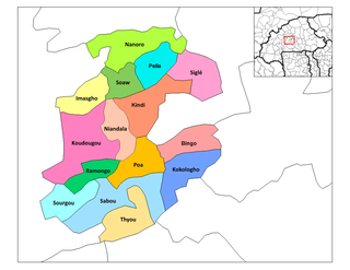
Pani, Burkina Faso

Last updated
Pani, Burkina Faso
CountryFlag of Burkina Faso.svg  Burkina Faso
Region Boucle du Mouhoun Region
Province Balé
Department Pompoï Department
Population (1996)
  Total 158
Time zone GMT (UTC+0)

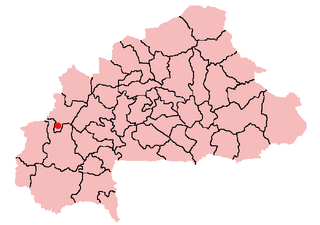
Pani, Burkina Faso is a village in the Pompoï Department of Balé Province in southern Burkina Faso. The village has a total population of 158. [1]

Pompoï Department Department in Balé, Burkina Faso

Pompoï is a department or commune of Balé Province in southern Burkina Faso. Its capital lies at the town of Pompoï. According to the 1996 census the department has a total population of 10,613.

Balé Province Province in Boucle du Mouhoun, Burkina Faso

Balé is one of the 45 provinces of Burkina Faso, located in its Boucle du Mouhoun Region with Boromo as capital. Its area is 4,595 km2 (1,774 sq mi), and in 2006 had a population of 213,897. The province is known for its Deux Balé Forest, populated by savannah elephant herds. Boromo, the provincial capital, is located on the main road from Ouagadougou to Bobo-Dioulasso. In June 2007, the Canadian mining company, Semafo, open the third gold mine in the country in Mana in the province, with an investment of about $116 million.

Burkina Faso country in Africa

Burkina Faso is a landlocked country in West Africa. It covers an area of around 274,200 square kilometres (105,900 sq mi) and is surrounded by six countries: Mali to the north; Niger to the east; Benin to the southeast; Togo and Ghana to the south; and Ivory Coast to the southwest. The July 2018 population estimate by the United Nations was 19,751,651. Burkina Faso is a francophone country, with French as the official language of government and business. Roughly 40% of the population speaks the Mossi language. Formerly called the Republic of Upper Volta (1958–1984), the country was renamed "Burkina Faso" on 4 August 1984 by then-President Thomas Sankara. Its citizens are known as Burkinabé. Its capital is Ouagadougou.

Related Research Articles

Kadiogo Province Province in Centre Region, Burkina Faso

Kadiogo is a province of Burkina Faso, located in its Centre Region. Its area is of 2,805 km², containing six departments and a population of 1,523,980 (2006). Its capital is also the State capital, Ouagadougou. It features the central plateau of the country. It is highly urbanized and is the most densely populated province.

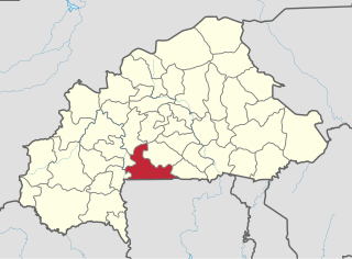
Ziro Province Province in Centre-Ouest Region, Burkina Faso

For the town in India, see Ziro.

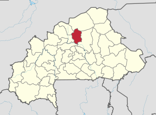
Yatenga Province Province in Nord Region, Burkina Faso

Yatenga is one of the provinces of Burkina Faso, located in the Nord Region of the country. In modern Yatenga, the most prominent city is Ouahigouya. This city served as the capital of the kingdom of Yatenga, a powerful kingdom out of the many Mossi kingdoms, but its influence decreased in the century following French colonisation. The city is famed today for being home to the Naba's compound and the tomb of Naba Kango.

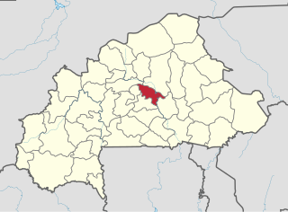
Bam Province Province in Centre-Nord Region, Burkina Faso

Bam is one of the 45 provinces of Burkina Faso. It is in Centre-Nord Region and the capital of Bam is Kongoussi. In 2006 it had a population of 277092. It is a rural province with 252,509 of its residents living in the countryside; only 24,583 live in urban areas. There are 132,086 men living in Bam Province and 145,006 women.

Houet Province Province in Hauts-Bassins, Burkina Faso

Houet is one of the 45 provinces of Burkina Faso, located in its Hauts-Bassins Region. The capital of Houet is Bobo-Dioulasso. In 2006 the province had a population of 902,662.

Kourwéogo Province Province in Plateau-Central Region, Burkina Faso

Kourwéogo is one of the 45 provinces of Burkina Faso, located in its Plateau-Central Region. In 2011 the population was estimated to be 154,611.

Namentenga Province Province in Centre-Nord Region, Burkina Faso

Namentenga is one of the 45 provinces of Burkina Faso, located in its Centre-Nord Region.

Oubritenga Province Province in Plateau-Central Region, Burkina Faso

Oubritenga is one of the 45 provinces of Burkina Faso, located in its Plateau-Central Region.

Sissili Province Province in Centre-Ouest Region, Burkina Faso

Sissili is one of the 45 provinces of Burkina Faso, located in its Centre-Ouest Region. In 2006 the population was 212,628 and in 2011 the population was 240,830, an increase of 13.3%.

Kouka, Banwa Place in Boucle du Mouhoun, Burkina Faso

Kouka is a town located in the province of Banwa in Burkina Faso.

Kouka Department Department in Banwa Province, Burkina Faso

Kouka is a department or commune of Banwa Province in western Burkina Faso. Its capital lies at the town of Kouka. According to the 1996 census the department has a total population of 53,415.

Yargo is the name of several villages in Burkina Faso, including the following:

Zawara Department Department in Sanguié Province, Burkina Faso

Zawara is a department or commune of Sanguié Province in central Burkina Faso. Its capital lies at the town of Zawara.

Pella Department Department in Boulkiemdé Province, Burkina Faso

Pella is a department or commune of Boulkiemdé Province in central Burkina Faso. As of 2005 it has a population of 19,563. Its capital lies at the town of Pella.

Bassana is a village in the Bana Department of Balé Province in south-western Burkina Faso. The village has a population of 918.

Sallé is a town in the Kouka Department of Banwa Province in western Burkina Faso. As of 2005 it had a population of 2,930.

Donsin is a village in the Bissiga Department of Boulgou Province in south-eastern Burkina Faso. As of 2005, the village has a population of 557.

Pissy is a village in the Komtoèga Department of Boulgou Province in south-eastern Burkina Faso. As of 2005, the village has a population of 539.

Youngou is a town in the Zabré Department of Boulgou Province in south-eastern Burkina Faso. As of 2005, the town has a population of 6,343.

Diaka, Burkina Faso is a town in the Thion Department of Gnagna Province in eastern Burkina Faso. The town has a population of 2,479.

References

Coordinates: 11°35′N2°20′W / 11.583°N 2.333°W / 11.583; -2.333

Geographic coordinate system Coordinate system

A geographic coordinate system is a coordinate system that enables every location on Earth to be specified by a set of numbers, letters or symbols. The coordinates are often chosen such that one of the numbers represents a vertical position and two or three of the numbers represent a horizontal position; alternatively, a geographic position may be expressed in a combined three-dimensional Cartesian vector. A common choice of coordinates is latitude, longitude and elevation. To specify a location on a plane requires a map projection.