Papampeta

Last updated

Papampeta
Census Town
Location map India Andhra Pradesh EN.svg
Red pog.svg
Papampeta
Location in Andhra Pradesh, India
Coordinates: 14°10′5″N77°48′36″E / 14.16806°N 77.81000°E / 14.16806; 77.81000 Coordinates: 14°10′5″N77°48′36″E / 14.16806°N 77.81000°E / 14.16806; 77.81000
CountryFlag of India.svg  India
State Andhra Pradesh
District Anantapur
Area [1]
  Total 3.78 km2 (1.46 sq mi)
Population (2011)
  Total 13,850
  Density 3,700/km2 (9,500/sq mi)
Languages
  Official Telugu
Time zone IST (UTC+5:30)
Vehicle registration AP

Papampeta is a census town in Anantapur district of the Indian state of Andhra Pradesh. It is located in Anantapur mandal of Anantapur revenue division. The town is a constituent of Anantapur urban agglomeration. [1]

A census town is a type of town that satisfies certain characteristics, depending on the country in which it is located.

Anantapur district District of Andhra Pradesh in India

Anantapur district is a district in the Rayalaseema region of Andhra Pradesh, India. The district headquarters is located at Anantapur city. As of 2011 Census, the district had a population of 4,083,315, of which 28.09% is urban and a literacy rate of 64.28%. It is the largest district in terms of area in Andhra Pradesh and 7th largest district in India respectively.

India Country in South Asia

India, also known as the Republic of India, is a country in South Asia. It is the seventh largest country by area and with more than 1.3 billion people, it is the second most populous country as well as the most populous democracy in the world. Bounded by the Indian Ocean on the south, the Arabian Sea on the southwest, and the Bay of Bengal on the southeast, it shares land borders with Pakistan to the west; China, Nepal, and Bhutan to the northeast; and Bangladesh and Myanmar to the east. In the Indian Ocean, India is in the vicinity of Sri Lanka and the Maldives, while its Andaman and Nicobar Islands share a maritime border with Thailand and Indonesia.

Contents

Demographics

As of 2001 India census, [2] Papampeta had a population of 9,308. Males constitute 53% of the population and females 47%. Papampeta has an average literacy rate of 60%, higher than the national average of 59.5%: male literacy is 68%, and female literacy is 50%. In Papampeta, 12% of the population is under 6 years of age.

Transport

State run APS RTC buses from Anantapur to this town. Anantapur is the nearest railway station.

Andhra Pradesh State Road Transport Corporation

Andhra Pradesh State Road Transport Corporation is the state-owned road transport corporation in the Indian state of Andhra Pradesh. Its headquarters is located at NTR Administrative Block of RTC House in Pandit Nehru bus station of Vijayawada. Many other Indian metro towns in Telangana, Tamil Nadu, Karnataka, Odisha, Yanam and Chhattisgarh are also linked with the services...

Anantapur railway station

Anantapur railway station is located in Anantapur district in the Indian state of Andhra Pradesh and serves Anantapur city. It lies on Guntakal-Bangalore section.

Education

The primary and secondary school education is imparted by government, aided and private schools, under the School Education Department of the state. [3] [4] The medium of instruction followed by different schools are English, Telugu.

See also

Related Research Articles

Dharmavaram, Anantapur district City in Andhra Pradesh, India

Dharmavaram is a city in Anantapur district of the Indian state of Andhra Pradesh. It is the mandal and divisional headquarters of Dharmavaram mandal and Dharmavaram revenue division respectively. The city is known for its handloom silk sarees. The city is renowned for cotton, silk weaving industries and leather puppets.So this city is called as Silk city of Andhra pradesh

Gooty Town in Andhra Pradesh, India

Gooty is a town in Anantapur district of the Indian state of Andhra Pradesh. It is the headquarters of Gooty mandal in Anantapur revenue division. The town is renowned for the Gooty hill fort.

Guntakal Town in Andhra Pradesh, India

Guntakal is a town in Anantapur district of the Indian state of Andhra Pradesh. It is the headquarters of Guntakal mandal in Anantapur revenue division.It is also the headquarters of the Guntakal Railway Division in South Central Railway.

Chintalavalasa Census Town in Andhra Pradesh, India

Chintalavalasa is a census town in Vizianagaram district of the Indian state of Andhra Pradesh. It is located in Denkada mandal of Vizianagaram revenue division.

Gajapathinagaram Census Town in Andhra Pradesh, India

Gajapathinagaram is a census town in Vizianagaram district of the Indian state of Andhra Pradesh. It is located in Gajapathinagaram mandal of Vizianagaram revenue division. It is located on National Highway 26 between Vizianagaram and Ramabhadrapuram.

Kanapaka Census Town in Andhra Pradesh, India

Kanapaka is a census town in Vizianagaram district in the Indian state of Andhra Pradesh.

Kandukur, Prakasam district Town in Andhra Pradesh, India

Kandukur or Kandukuru is a town in Prakasam district of the Indian state of Andhra Pradesh. It is a municipality and the mandal headquarters of Kandukur mandal in Kandukur revenue division.

Kantabamsuguda Census Town in Andhra Pradesh, India

Kantabamsuguda is a census town in Visakhapatnam district of the Indian state of Andhra Pradesh. It is the headquarters of Araku Valley mandal.

Kothavalasa Census Town in Andhra Pradesh, India

Kothavalasa is a census town in Vizianagaram district of the Indian state of Andhra Pradesh. It is located in Kothavalasa mandal of Vizianagaram revenue division. It is located 30 km from City Visakhapatanam

Moragudi Census Town in Andhra Pradesh, India

Moragudi is a census town in Kadapa district in the Indian state of Andhra Pradesh.

Narayanavanam Census Town in Andhra Pradesh, India

Narayanavanam is a census town in Chittoor district of the Indian state of Andhra Pradesh. It is the mandal headquarters of Narayanavanam mandal in Chittoor revenue division. The town is known for Kalyana Venkateswara Temple dedicated to Lord Venkateswara and was constructed in the year 1541 AD.

Ramanayyapeta Census Town in Andhra Pradesh, India

Ramanayyapeta is a census town in East Godavari district of the Indian state of Andhra Pradesh. It is located in Kakinada (rural) mandal of Kakinada revenue division. The town is a constituent of Kakinada urban agglomeration.

Rayadurg Town in Andhra Pradesh, India

Rayadurga is a town in Anantapur district of the Indian state of Andhra Pradesh. It is the headquarters of Rayadurgam mandal in Kalyandurg revenue division. The town is renowned for its Handloom industry.

Sriramnagar, Vizianagaram district Census Town in Andhra Pradesh, India

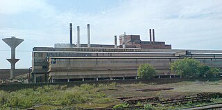
Sriramnagar is a census town in Vizianagaram district of the Indian state of Andhra Pradesh. It is located in Garividi mandal of Vizianagaram revenue division.

Tadipatri City in Andhra Pradesh, India

Tadipatri or Tadpatri is a town in Anantapur district of the Indian state of Andhra Pradesh. It is the mandal headquarters of Tadipatri mandal in Anantapur revenue division. It is located at the border of Kurnool district and Kadapa district. The ancient world-famous Chintala Venkataramana Temple sprawling over five acre area is located in Tadipatri. From Tadipatri town at a distance of 1 kilometre, overlooking the Penna River, the Bugga Ramalingeswara Temple is located which is remarkable for a Lingam seated on a pedestal that is perpetually filled with water from a small spring.

Tirupati (NMA) Census town in Andhra Pradesh, India

Tirupati (NMA) is a census town in Chittoor district in the Indian state of Andhra Pradesh.

Uravakonda Census Town in Andhra Pradesh, India

Uravakonda is a census town in Anantapur district of the Indian state of Andhra Pradesh. It is the headquarters of Uravakonda mandal in Anantapur revenue division. The town is a constituent of urban agglomeration.

Rameswaram, Kadapa district Census Town in Andhra Pradesh, India

Rameswaram is a census town in Cuddapah district in the Indian state of Andhra Pradesh.

Somandepalle Census Town in Andhra Pradesh, India

Somandepalle is a census town in Anantapur district of the Indian state of Andhra Pradesh. It is located in Somandepalle mandal of Penukonda revenue division. The town is a constituent of Anantapur urban agglomeration.

References

  1. 1 2 "District Census Handbook - Anantapur" (PDF). Census of India. p. 14–15,312. Retrieved 7 November 2015.
  2. "Census of India 2001: Data from the 2001 Census, including cities, villages and towns (Provisional)". Census Commission of India. Archived from the original on 2004-06-16. Retrieved 2008-11-01.
  3. "School Education Department" (PDF). School Education Department, Government of Andhra Pradesh. Archived from the original (PDF) on 7 November 2016. Retrieved 7 November 2016.
  4. "The Department of School Education - Official AP State Government Portal | AP State Portal". www.ap.gov.in. Archived from the original on 7 November 2016. Retrieved 7 November 2016.