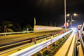
Transport in Sri Lanka is based on its road network, which is centred on the country's commercial capital Colombo. A rail network handles a portion of Sri Lanka's transport needs. There are navigable waterways, harbours and three international airports: in Katunayake, 35 kilometres (22 mi) north of Colombo, in Hambantota, and in Jaffna.

Kandy is a major city in Sri Lanka located in the Central Province. It was the last capital of the ancient kings' era of Sri Lanka. The city lies in the midst of hills in the Kandy plateau, which crosses an area of tropical plantations, mainly tea. Kandy is both an administrative and religious city and is also the capital of the Central Province. Kandy is the home of the Temple of the Tooth Relic, one of the most sacred places of worship in the Buddhist world. It was declared a world heritage site by UNESCO in 1988. Historically the local Buddhist rulers resisted Portuguese, Dutch, and British colonial expansion and occupation.

North Western Province is a province of Sri Lanka. The province consists of the districts of Kurunegala and Puttalam. Its capital is Kurunegala, which has a population of 28,571. The province is known mainly for its numerous coconut plantations. Other main towns in this province are Chilaw (24,712) and Puttalam (45,661), which are both small fishing towns. The majority of the population of Wayamba province is of Sinhalese ethnicity. There is also a substantial Sri Lankan Moor minority around Puttalam and Sri Lankan Tamils in Udappu and Munneswaram. Fishing, prawn farming and rubber tree plantations are other prominent industries of the region. The province has an area of 7,888 km2, and a population of 2,370,075.

Kurunegala is a major city in Sri Lanka. It is the capital city of the North Western Province and the Kurunegala District. Kurunegala was an ancient royal capital for 50 years, from the end of the 13th century to the start of the 14th century. It is at the junction of several main roads linking to other important parts of the country. It is about 94 kilometres (58 mi) from Colombo, 42 kilometres (26 mi) from Kandy and 51 kilometres (32 mi) from Matale.

Puttalam is the largest town in Puttalam District, North Western Province, Sri Lanka. Puttalam is the administrative capital of the Puttalam District and governed by an Urban Council. Situated 130 kilometres (81 mi) north of Colombo, the capital of Sri Lanka and 95 kilometres (59 mi) north of Negombo. Puttalam is known for energy production, salt, coconut production and fishing. It has one of the largest lagoons in the country. Puttalam is known for kind and hospitable people. It has many tourist attractions such as Wilpattu National Park, Kalpitiya, and virgin beaches, natural resources, dolphin watching. Puttalam town is near Anamaduwa.

Kurunegala is a district in North Western Province, Sri Lanka. Consists of 4812.7 km2 48,1270 Hectares and Consists 30 Divisional Secretariats, 1610 Grama Niladari Divisions and 4476 total Villages. It consists of 14 Electorate Divisions, 02 Municipal Council, 19 Urban Councils, 15 Parliamentary Ministers, 47 Provincial Council Members, 15 Ministers and 337 Local Council Members.

Dambadeniya (DMBD) is a ruined ancient city situated in the North Western Province (Wayamba), Sri Lanka on the Kurunegala - Negombo main road. It served as the capital of Sri Lanka in the mid 13th century. Much of Dambadeniya still lies buried on a huge fortified rock. Dambadeniya is situated about 31 km from Kurunegala, the modern day capital of the North Western Province. Dambadeniya is situated about 4 km from Giriulla.

Battaramulla is a suburb of Colombo, situated 8.4 km (5 mi) from the city centre at Colombo Fort, near the Parliament of Sri Lanka. It is one of the fastest developing administrative, commercial and residential areas in the Colombo District, being home to the country's elite. Battaramulla is an important town in Sri Lanka, because of the Sri Lankan government's decision to locate all the government department head offices in this town.

The primary form of agriculture in Sri Lanka is rice production. Rice is cultivated during Maha and Yala seasons. Tea is cultivated in the central highlands and is a major source of foreign exchange. Vegetables, fruits and oilseed crops are also cultivated in the country. There are two Agriculture Parks abbreviated as A. Parks established by the Department of Agriculture. Out of the total population in Sri Lanka, 27.1% engages in agricultural activities. Agriculture accounted for 7.4% of the GDP in 2020.
Kuliyapitiya is the second largest town in Kurunegala District, North Western Province, Sri Lanka, governed by an Urban Council. It is located 82 kilometres (51 mi) north-east of Colombo and 38 kilometres (24 mi) from Kurunegala. Kuliyapitiya is home to the Wayamba University of Sri Lanka. Coconut and paddy cultivation are the main economic activities in this area. The town centre includes commerce and retail enterprises.Mayor of Kuliyapitiya is Mr.Lakshman Adhikari

The Central Province is one of the nine provinces of Sri Lanka, the first level administrative division of the country. The Central Province is primarily in the central mountainous terrain of Sri Lanka. It is the 6th largest province by area and is home to 2.5 million people. It is bordered by North Central Province to the north, Uva Province to the east, North Western Province to the west and Sabaragamuwa Province to the south and west. The province's capital is Kandy.
Narammala(නාරම්මල) is a town in Kurunegala district, northwestern province, Sri Lanka. It is connected to Sri Lankan transport network by Kurunegala-Colombo 5 road and Kurunegala-Negombo 34 road. Narammala is 74 km away from Colombo and 18 km away from Kurunegala. This beautiful town is surrounded by blocks of Paddy fields and Coconut estates. Narammala is where the world's first and only betel research lab and institute is situated. It is situated at Dampalassa where is 3.5km far from Narammala town towards to Giriulla.
Galabawa is a village in Sri Lanka. It is located in Central Province, at the west border of Central Province near the border of North Western Province. Its history makes back to BC where the King Walagamba once resided here before he became the king of Sri Lanka.

Katugastota is a suburb of the city of Kandy in Kandy District, Central Province of Sri Lanka. It is located along the Kandy-Jaffna A9 highway approximately 4 km (2.5 mi) from the city center of Kandy. Katugastota is one of the three main entry points to the city of kandy. Two major Highways meet at the center of the city which makes Katugastota one of the busiest suburbs in Kandy district.
Malwanahinna is a village in Sri Lanka. It is located within Central Province. Malwanahinna is a village located in Kandy district, Akurana Pradeshya Shaba,
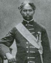
Gate Mudaliyar James Edward Corea was a Ceylonese colonial-era headman.
Mawathagama is a town in the Kurunegala District, North Western Province of Sri Lanka. It is approximately 12 km (7.5 mi) from Kurunegala and 30 km (19 mi) from Kandy.
Danowita is a small town in the western province of Sri Lanka. It is 50 kilometres (31 mi) to Colombo, 59 kilometres (37 mi) to Kandy, and 45 kilometres (28 mi) to Kurunagala. The A1 highway passes by Danowita. Bandaranaike International Airport is the nearest airport.
Pothuwila is a village near Polpithigama in Sri Lanka. It is situated in Kurunegala District within the North Western Province of Sri Lanka. To reach Pothuwila from Kurunegala need to follow A6 road towards Ibbagamuwa about 12 km (7.5 mi) and from there after following 32 km (20 mi) in Ibbagamuwa-Kumbukgete-Madagalla Road Polpithigama can be found. Then need to turn left from Kumbukulawa junction which is 0.5 km (0.31 mi) Polpithigama town. Pothuwila is about 8 km (5.0 mi) from Polpithigama. Mahawa is a close town to Polpithigama and it is about 18 km (11 mi) from Mahawa to Polpithigama via Madagalla. Pothuwila is 152 km (94 mi) from Colombo, 60 km (37 mi) from Dambulla, 25 km (16 mi) from Mahawa, 24 km (15 mi) from Yapahuwa, 76 km (47 mi) from Anuradhapura and 36 km (22 mi) from Melsiripura.
Cocoa production contributes to the national economy of Sri Lanka. It is grown in fairly dense shade and generally cultivated under coconut and rubber. Although cocoa production remains a source of revenue, it is no longer a main economic sector. The great part of cocoa cultivation occurs in the Matale, Kandy, Badulla, Kurunegala, Kegalle and Monaragala districts. The first cocoa plants were introduced to the country in 1819. Recent years cocoa production has increased by nearly $22.6 million (2015).
