Arna is a village on the eastern slopes of the Taygetus mountain range, at an altitude of 700 to 850 m.
Dimitra is a village and a community in the municipal unit of Vartholomio, Elis, Greece. It is situated in a rural plain, north of the river Pineios. It is 2 km northwest of Kardiakafti, 2 km east of Machos, 3 km southeast of Neochori and 3 km northeast of Vartholomio. The community includes the small village Regklaiika. Between 1835 and 1912 Dimitra was part of the municipality of Myrtountia. Between 1912 and 1933 it was part of the community of Kardiakafti. Between 1933 and 1997, when it joined the municipality of Vartholomio, it was an independent community.
Perivolia is a village and a community in the southwestern part of Arcadia, Greece. It is part of the municipality of Megalopoli, located in a rural area 3 km (2 mi) south-east of downtown Megalopoli. The Greek National Road 7/E55 (Corinth - Tripoli - Kalamata passes southeast of the village. The community consists of the villages Perivolia and Vrysoules.
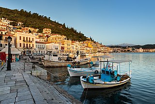
Gytheio or Gythio, also the ancient Gythium or Gytheion, is a town on the eastern shore of the Mani Peninsula, and a former municipality in Laconia, Peloponnese, Greece. Since the 2011 local government reform it is part of the municipality East Mani, of which it is a municipal unit. The municipal unit has an area of 197.313 km2.

Areopoli is a town on the Mani Peninsula, Laconia, Greece.
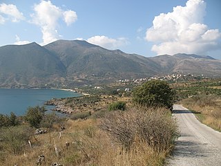
Skoutari is a village and a community of the municipality of East Mani. Before the 2011 local government reform it was a part of the municipality of Gytheio, of which it was a municipal district. The community of Skoutari covers an area of 11.667 km2. According to local tradition it was founded by refugees from the Fall of Constantinople in 1453.

Drosopigi or "Tserova" is a small village in Mani, Laconia, Greece. It is part of the municipal unit of Gytheio. Drosopigi lies on a mountain around 400 m (1,300 ft) above sea level. Drosopigi has historic towers and because of its stoned houses, it has been declared as a traditional settlement.
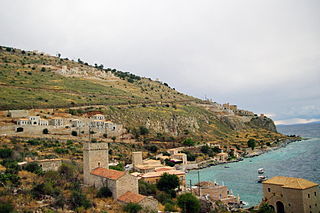
Oitylo, known as "Βίτσουλο", pronounced Vitsoulo, in the native Maniot dialect, is a village and a former municipality in Laconia, Peloponnese, Greece. Since the 2011 local government reform it is part of the municipality East Mani, of which it is a municipal unit.
Κalyvia is a village in Laconia, southern Greece. It is part of the municipal unit Gytheio. Kalyvia is situated on a peninsula in the Laconian Gulf, 3 km (1.9 mi) east of Skoutari and 11 km (6.8 mi) south of Gytheio.
Kastania is a village in Mesa Mani of Laconia, Greece. An independent community since 1912, it became part of the municipality Sminos in 1997, which in turn became part of the municipality East Mani in 2010.

Visaltia is a municipality in the Serres regional unit, Greece. The seat of the municipality is in Nigrita. It was named after the ancient region Bisaltia. The ancient city of Berge is located here.
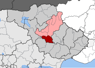
Skoutari is a village and a former municipality in the Serres regional unit, Greece. Since the 2011 local government reform it is part of the municipality Serres, of which it is a municipal unit. The municipal unit has an area of 90.159 km2. Population 4,666 (2021). The first villagers arrived from Minor Asia as refugees in October 1922. On 15 August 1924, the day of The Assumption of Mary into Heaven, refugees from Skoutari from Northern Thrace began, and finally settled in the region of today's village. That way the village took its name.

Pavliani is a village on Mount Oeta, and a former community in Phthiotis, Greece. It is divided into two settlements, Pavliani proper or Ano Pavliani and Nea Pavliani or Kato Pavliani.
Moira is a village located southeast of Patras, Greece. Moira had a population of 65 in 2011. Moira was part of the municipality of Patras between 1845 and 1912, and again after 1997. Between 1912 and 1997, it was an independent community.
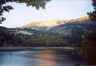
Tsivlos is a small mountain village in the municipality of Akrata, Achaea, Greece. It is part of the community Platanos. In 2011, it had a population of 9. It is built on the slopes of Mount Chelmos (Aroania), above the river Krathis, at about 750 m elevation. Lake Tsivlos, north of the village, was formed by a landslide in 1912. Tsivlos is located 12 km southwest of Akrata, 12 km northeast of Kalavryta and 11 km south of Platanos.
Alalkomenes is a village and a community in the municipality of Livadeia, Boeotia, central Greece. It is situated in a wide plain, 6 km northeast of Koroneia, 10 km east of Livadeia and 30 km west of Thebes. The community Alalkomenes consists of the villages Alalkomenes and Agios Athanasios. The population of the community was 116 in 2021.

Moschopotamos is a village and a community of the Katerini municipality. Before the 2011 local government reform it was part of the municipality of Elafina, of which it was a municipal district. The community of Moschopotamos covers an area of 13,606 km (8,454 mi).
Velvina is a village and a community in the municipal unit of Nafpaktos in Nafpaktia, Aetolia-Acarnania, Greece. According to the 2021 census, it had 43 inhabitants.
Galatas is a village and a community in western Chalkeia, Nafpaktia, Aetolia-Acarnania, Greece located at 14 m above sea level. The community includes the village Kryoneri.
Lakkomata is a mountain village and community in the municipality of Erymanthos in Achaea, Greece. According to the 2021 census, it had 61 inhabitants. In 2011 the village had 113 inhabitants and the community, which also includes the settlement Tsapournia, 133 inhabitants.


