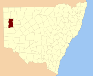
Langawirra is a remote civil parish of Mootwingee County in far North West New South Wales. [1]

Langawirra is a remote civil parish of Mootwingee County in far North West New South Wales. [1]

The geography of the parish is mostly a flat, arid landscape, although ephemeral lakes are found in the parish. The parish has a Köppen climate classification of BWh (Hot desert). [2] The nearest town is Broken Hill to the south and Whitecliffs to the east.
The Parish is on the traditional lands of the Bandjigali [3] Aboriginal peoples. [4]
Langawirra is located at 31°21′25″S 142°06′18″E.

Mount Blackwood, New South Wales located at 29°48′37″S 141°31′10″E, is a remote rural locality and civil parish of Evelyn County in far northwest New South Wales. located at 30°04′42″S 142°45′50″E, east of the Silver City Highway . The geography of the parish is mostly the flat, arid landscape of the Channel Country. The parish has a Köppen climate classification of BWh.
Whitty is a remote rural locality and civil parish of Evelyn County in far northwest New South Wales. located at 30°12′34″S 141°05′06″E.
Quintyambi is a remote rural locality and civil parish of Evelyn County in far northwest New South Wales. located at 30°18′40″S 141°05′05″E.
Teltawongee is a remote civil parish located at 30.673056°S 141.952778°E in Mootwingee County western New South Wales.

Bengoro located at 31°02′54″S 142°08′20″ is a remote civil parish of Mootwingee County in far North West New South Wales.
Bimpia located at 30°47′21″S 142°03′46E is a remote civil parish of Mootwingee County in far North West New South Wales.

Booraboonara located at 31°25′02″S 141°44′53″E is a remote civil parish of Mootwingee County in far North West New South Wales.

Bomgadah located at 31°25′02″S 141°44′53″ is a remote civil parish of Mootwingee County in far North West New South Wales.
Boorla located at 30.968333°S 141.859167°E is a remote civil parish of Mootwingee County in far North West New South Wales.

Coyurunda located at 30°46′51″S 141°47′19″ is a remote civil parish of Mootwingee County in far North West New South Wales.

Kayrunnera located at 30.680278°S 142.401389°E is a remote civil parish of Mootwingee County in far North West New South Wales.
Noonthorangee located at 30°57′50″S 142°17′53″ is a remote civil parish of Mootwingee County in far North West New South Wales.

Maropinna, New South Wales is a remote civil parish of Mootwingee County in far North West New South Wales.

Morden located at 30°29′53″S 142°24′08″ is a remote civil parish of Mootwingee County in far North West New South Wales.

Kara Parish is a remote civil parish of Mootwingee County in far North West New South Wales. The parish is on Mutawintji Road outside Mutawintji National Park and has mostly a flat, arid landscape. The parish has a Köppen climate classification of BWh.
Gooruba, New South Wales, located at 30°23′56″S 142°11′53″E, is a remote civil parish of Mootwingee County in far North West New South Wales.

Tucinyah is a remote civil parish of Mootwingee County in far North West New South Wales.

Rosstrevor, New South Wales in Central Darling Shire is a remote rural locality and civil parish of Yungnulgra County in far North West New South Wales.
Wonominta, New South Wales is a remote rural locality and civil parish of Evelyn County in far northwest New South Wales. located at 30°18′40″S 141°05′05″E.
Parish of Kooltoo, New South Wales is a remote civil parish of Yantara County in far North West New South Wales. The geography of the parish is mostly the flat, arid landscape of the Channel Country. The parish has a Köppen climate classification of BWh.