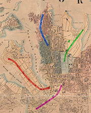
The Rocks is an urban locality, tourist precinct and historic area of Sydney's city centre, in the state of New South Wales, Australia. It is located on the southern shore of Sydney Harbour, immediately north-west of the Sydney central business district.

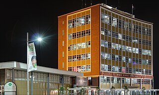
Ryde is a suburb of Sydney, New South Wales, Australia. Ryde is located 13 km north-west of the Sydney Central Business District and 8 km east of Parramatta. Ryde is the administrative centre of the local government area of the City of Ryde and part of the Northern Sydney region. It lies on the north bank of the Parramatta River.

Kirribilli is a suburb of Sydney, in the state of New South Wales, Australia. One of the city's most established and affluent neighbourhoods, it is located three kilometres north of the Sydney central business district, in the local government area administered by North Sydney Council. Kirribilli is a harbourside suburb, sitting on the Lower North Shore of Sydney Harbour. Kirribilli House is one of the two official residences of the Prime Minister of Australia.

Hunters Hill is a suburb on the Lower North Shore of Sydney, in the state of New South Wales, Australia. Hunters Hill is located 9 kilometres (5.6 mi) north-west of the Sydney central business district and is the administrative centre for the local government area of the Municipality of Hunter's Hill.

Randwick is a suburb in the Eastern Suburbs of Sydney, in the state of New South Wales, Australia. Randwick is located 6 kilometres south-east of the Sydney central business district and is the administrative centre for the local government area of the City of Randwick. Randwick is part of the Eastern Suburbs region. The postcode is 2031.

Museum railway station is a heritage-listed underground commuter rail station that is located on the City Circle route at the southern end of Hyde Park in the Sydney central business district of New South Wales, Australia. The station is served by Sydney Trains T2 Inner West & Leppington and T3 Bankstown T8 Airport & South lines. The station is named after the nearby Australian Museum. It was added to the New South Wales State Heritage Register on 2 April 1999.

The Domain is a heritage-listed 34-hectare (84-acre) area of open space located on the eastern fringe of the Sydney central business district, in the City of Sydney local government area of New South Wales, Australia. Separating the central business district from Woolloomooloo, The Domain adjoins the Royal Botanic Gardens and is managed by the Royal Botanic Gardens Trust, a division of the NSW Office of Environment and Heritage, an agency of the Government of New South Wales. The Domain is a popular venue for outdoor concerts, open-air events, large political gatherings and rallies and is used daily by the people of Sydney for exercise and relaxation. Along with the Royal Botanic Gardens, The Domain was added to the New South Wales State Heritage Register on 2 April 1999.

Macquarie Street is a street in the central business district of Sydney in New South Wales, Australia. Macquarie Street extends from Hyde Park at its southern end to the Sydney Opera House at its northern end. Apart from connecting these two major landmarks, the key government institutions of the state of New South Wales are all located on this street.

Cremorne is a suburb on the Lower North Shore of Sydney, New South Wales, Australia, located 6 kilometres north-east of the Sydney central business district, in the local government area of North Sydney Council.

St James' Church, commonly known as St James', King Street, is an Australian heritage-listed Anglican parish church located at 173 King Street, in the Sydney central business district of the City of Sydney local government area of New South Wales. Consecrated in February 1824 and named in honour of St James the Great, it became a parish church in 1835. Designed in the style of a Georgian town church by the transported convict architect Francis Greenway during the governorship of Lachlan Macquarie, St James' is part of the historical precinct of Macquarie Street which includes other early colonial era buildings such as the World Heritage listed Hyde Park Barracks.

The Sydney Central Business District (CBD) is the historical centre and the main commercial centre of Sydney, located on iconic Sydney Harbour. The Sydney CBD is Sydney's city centre, or Sydney City, and the two terms are used interchangeably. The CBD or city centre is often referred to simply as "Town" or "the City". The Sydney city centre extends southwards for about 3 km (2 mi) from Sydney Cove, the point of first European settlement in which the Sydney region was initially established. Due to its pivotal role in Australia's early history, it is one of the oldest established areas in the country.

Alexandria is an inner-city suburb of Sydney, New South Wales, Australia. Alexandria is located 4 kilometres south of the Sydney central business district and is part of the local government area of the City of Sydney. The postcode is 2015.

Phillip Street is a street in the central business district of Sydney in New South Wales, Australia. While the street runs from King Street in the south to Circular Quay in the north, the present street is effectively in two sections, separated by Chifley Square. Other cross streets include Martin Place, Bridge Street, and Bent Street. It is the hotspot of Sydney's legal elite.

St Lawrence Parish is one of the 57 parishes of Cumberland County, New South Wales, Australia, a cadastral unit for use on land titles. It is one of the four small parishes in the Sydney city area. Unlike the other three parishes, St Lawrence was not named after a church, but instead due to confusion over the naming, the parish gave its name to the Christ Church St Laurence. This had been controversial in the 19th century, as it was mistakenly thought that the Anglican church had been given a Catholic saint's name.

St Andrew Parish, Cumberland is one of the 57 parishes of Cumberland County, New South Wales, a cadastral unit for use on land titles. It is one of the four small parishes in the Sydney city area, and is named after the church of St Andrew's. The parish was named while the church was still in the planning stages. The parish includes Pyrmont and the Darling Harbour area. It is bounded by Wattle Street in the south west, George Street in the south and east, and King Street in the north-east. It includes Town Hall railway station, which is on the eastern end of the parish.

St Philip Parish is one of the 57 parishes of Cumberland County, New South Wales, a cadastral unit for use on land titles. It is located on the western part of the original colony at Sydney Cove, which was to the west of the Tank Stream. It is one of the four small parishes in the Sydney city area and is named after the church of St Philip's. It includes the southern end of the Sydney Harbour Bridge, The Rocks, Dawes Point and Millers Point. It is bounded by Sydney Harbour in the north, King Street in the south, George Street in the south-east, and what was once the Tank Stream in the east. The northern end of Darling Harbour is the boundary in the west. It includes Wynyard railway station.

St Luke Parish is one of the 57 parishes of Cumberland County, New South Wales, a cadastral unit for use on land titles. It is bounded by Prospect Creek in the north-east, Georges River in the south-east, and Cowpasture Road in the west. It was named after the Anglican church of St Lukes in Liverpool, which was completed in 1819. The parish is mentioned in various legislation dealing with property law for the city of Liverpool.

Queen's Square is a public square in central Sydney, Australia. The square is located at the junction of King Street with Phillip Street and Macquarie Street. It is bounded on the south by St James Road and Prince Albert Road.

St John's Cathedral is a heritage-listed, Anglican cathedral in Parramatta, City of Parramatta, Sydney, New South Wales, Australia. St John's was given the status of provisional cathedral of the Anglican Diocese of Sydney in 1969, and designated a Regional Cathedral in 2011 for the Western Region. It was added to the New South Wales State Heritage Register on 5 March 2010.

The following outline is provided as an overview of and topical guide to Sydney:


